Random
Random
Random
Random
100
A southern oscillation index of 15 indicates what phase of ENSO?
La Nina
100
Which of these natural factors is LEAST likely to cause flooding?
A) Heavy and prolonged rainfall
B) Strong winds from a cyclone
C) A high-pressure system over the region
D) Snowmelt from mountain ranges
C) A high-pressure system over the region
200
When is your Humanities exam? (Week and Day)
Week 9 - Monday
200
Name two natural causes of floods.
Heavy rainfall, storm surges, snowmelt, tsunamis etc
200
Which of these long-term effects of flooding is most likely to affect the economy?
A) Water contamination leading to increased disease
B) Loss of agricultural land due to waterlogging
C) Closure of schools for a period of time
B) Loss of agricultural land due to waterlogging
300
Describe how ocean temperatures near Eastern Australia change during El Niño and La Niña.
(El Niño = cooler-than-average ocean temps ; La Niña = warmer-than-average ocean temps)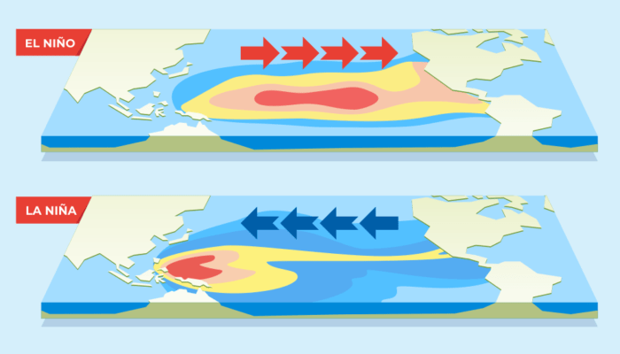
300
Draw an annotated diagram to explain how urbanisation contributes to flooding.
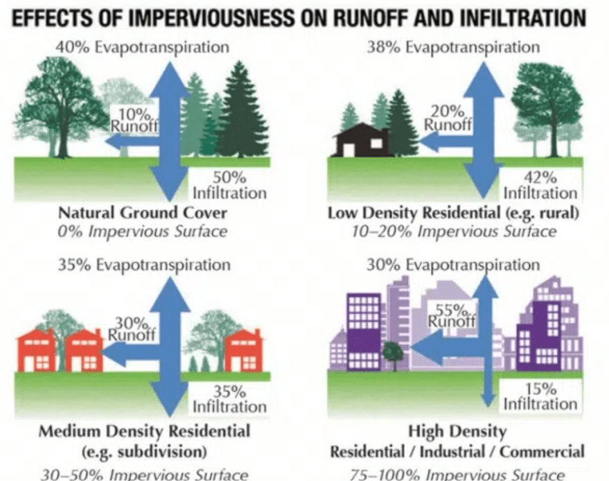
300
What is a catchment?
A catchment is an area of land where water from rain and melting snow collects and drains into a common body of water, such as a river, lake, or ocean. 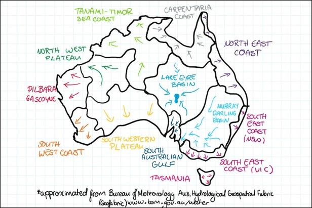
400
It takes only _______ cm of water to move a small car.
15cm
400
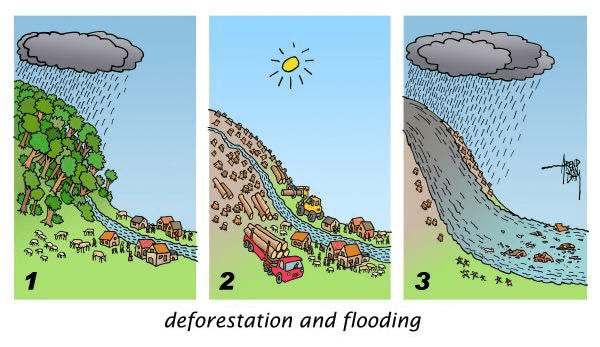
Draw an annotated diagram to explain how deforestation can worsen flood impacts.
400
What is the magic number of atmospheric pressure we often to use to determine if the system is a 'high' or a 'low'? Must include unit of measurement.
1013 hPa
400
What would be 2 industries in either Australia or North/South America that are particularly interested/follow the ENSO cycle as it has implications for them? (other than agriculture)
1. Water management (dams, reservoirs)
2. Fishing (ENSO affects ocean temperatures and nutrient levels, changing fish migration and stocks)
3. Emergency services and disaster management (ie. bushfire risk increases during El Niño due to drier conditions)4. Tourism (weather dependent industries, ski)
500
What does 'ENSO' stand for?
El Niño-Southern Oscillation
500
a) Name the 5 flood mitigation strategies.
b) For 3 strategies, state a location that has implemented this strategy.
Dams (Wivenhoe - Brisbane), levees (Goondiwindi), permeable pavement (Brisbane City Botanic Gardens, Sydney's Olympic Park), town relocation (Grantham), detention basin (Toowoomba - Garnett Lehman Park)
500
What is the wind speed AND direction you would be experiencing if you were standing at the red dot?
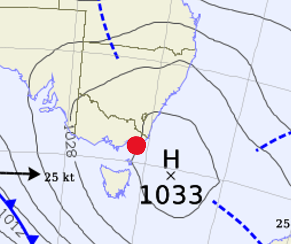
I will accept:
Weak or moderate northerly
Weak or moderate north-easterly
500
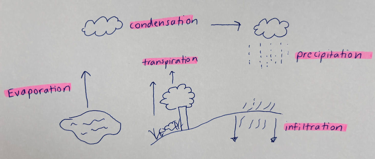
Draw the water cycle with our 5 key stages we looked at. You must use sophisticated terminology.
Evaporation > Condensation > Precipitation > Infiltration (and Transpiration)