Continents
Oceans
Notes 1.1/hemispheres
Notes 1.2
Notes 1.3
100
The continent in orange

North America
100
Ocean C
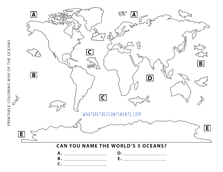
Atlantic ocean
100
The points give the cardinal directions
Compass rose
100
All flat maps have some type of
Distortion
100
0 degrees latitude
Equator
200
The continent in dark red
Africa
200
Ocean B
Pacific ocean
200
Explains what the different colors and symbols on a map mean
Map key/map legend
200
If you wanted to look at the whole world and wanted the correct sizes, shapes and distances.
A globe
200
180 degrees longitude
International date line
300
The continent in pink
Europe
300
Ocean A
Artic Ocean
300
A ruler for a map, it tells us how much distance on the map is in real life
Map scale
300
Map A is an example of
Interruption map
300
0 degrees longitude
Prime Meridian
400
The continent in green
South America
400
Ocean E
Southern Ocean
400
Continents in the Western Hemisphere
North and South America
400
Map B is an example of
Mercator map
400
(30* N, 115* W) and 171 Burgess Rd Harrisonburg VA
Absolute locations
500
The continent in purple
Asia
500
Ocean D
Indian ocean
500
Continents in the Southern Hemisphere
Australia and Antartica
500
Map C in an example of
Robinson map
500
40 miles west of Harrisonburg and next to the McDonald's
Relative locations