Land Between the Rivers
From the Hills to Sumer
Controlling the Water
From Villages to City-States
Map Skills
100
What two rivers flowed through Mesopotamia?
The Tigris and Euphrates rivers
100
Where did the early farmers live before moving onto the plains of Sumer?
The Zagros foothills
100
What is a system that supplies farmland with water called?
Irrigation
100
What fine soil carried by river water clogged Sumerian canals?
Silt
100
What two Sumerian city-states are labeled on this map?
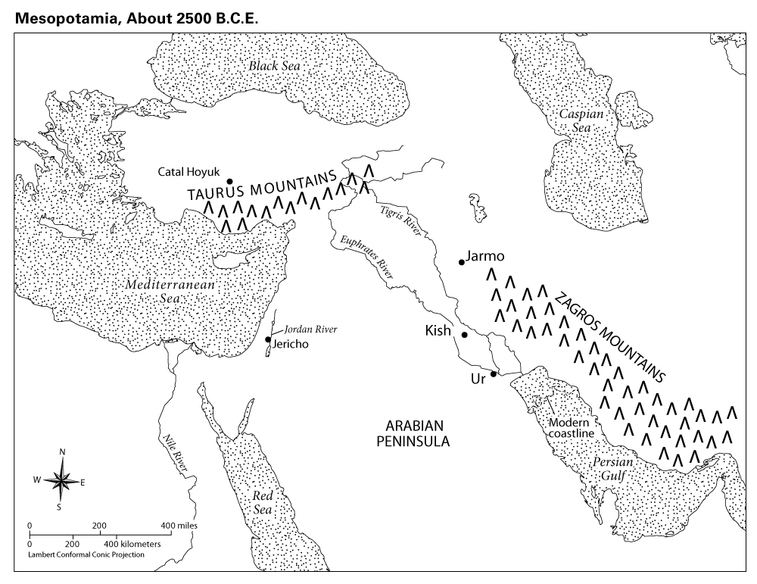
Kish and Ur
200
Mesopotamia was located mainly in what present-day country?
Iraq
200
What made the Zagros foothills a good place to farm?
Plentiful rain and mild weather
200
What raised wall of earth helped prevent rivers from flooding?
A levee
200
Why did Sumerian villages need to cooperate?
To maintain their connected irrigation systems
200
Which labeled city-state is farther south and closer to the Persian Gulf?
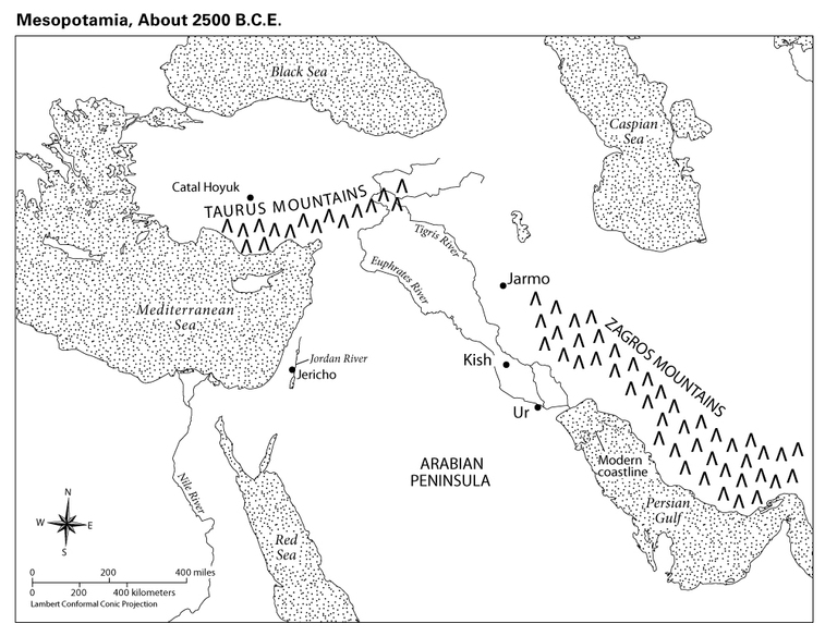
Ur
300
What does the name Mesopotamia mean?
Land between the rivers
300
What change caused food shortages in the foothills?
What change caused food shortages in the foothills?
300
What human-made waterway carried river water to fields?
An irrigtion canal
300
What happened as villages cooperated and became more dependent on one another?
They grew into towns and cities.
300
Into what body of water do the Tigris and Euphrates rivers flow?
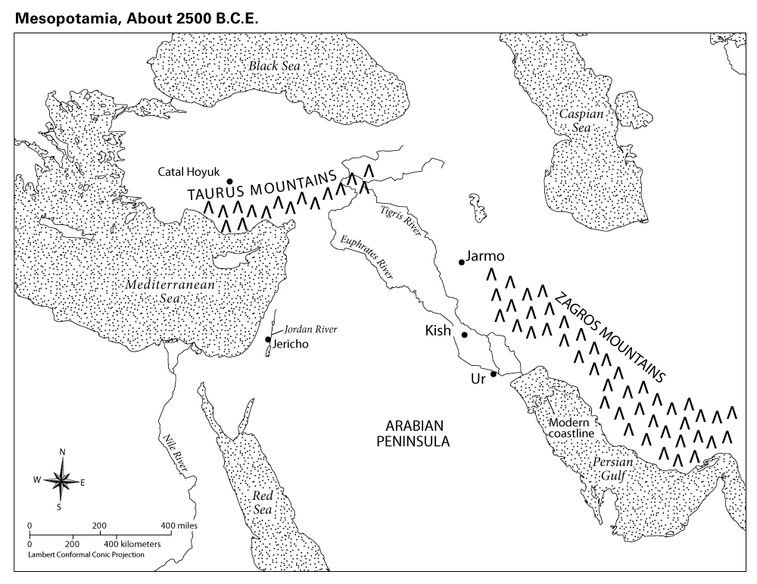
The Persian Gulf
400
What mountain range was located northeast of Sumer?
The Zagros Mountains
400
How did people respond when there was not enough farmland in the foothills?
They moved south to the river plains.
400
What structure or place allowed Sumerians to collect water for later use?
A reservoir
400
What two features did Sumerians build to defend their cities?
Walls and moats
400
Traveling south from the Caspian Sea toward the Persian Gulf, what mountain range would you cross?
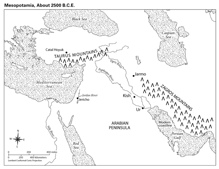
The Zagros Mountains
500
In what general direction did the Tigris and lower Euphrates rivers flow toward the Persian Gulf?
Southeast
500
What was the southern region where these people settled called?
Sumer
500
What two opposite water problems made farming difficult in Sumer?
Flooding and drought
500
What was a Sumerian city and its surrounding farmland that had its own ruler called?
A city-state
500
Use the map scale to estimate the straight-line distance between Kish and Ur.
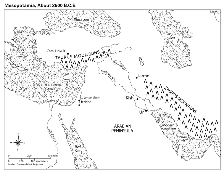
Answer: About 150 miles
Accept: Approximately 100–200 miles