MAP TYPES
FINDING PLACES
LAND & HEIGHT
LAND MASS
On the map
100
This type of map shows countries, states, and borders.
Political map
100
These directions are North, South, East, and West.
Cardinal points
100
Lines on a map that connect places of the same height.
Contour lines
100
Large land masses on Earth, such as Asia, Africa, and Australia.
Continents
100

Spain
200
This type of map shows landforms like mountains and rivers.
Physical map
200
The symbol on a map that shows directions.
Compass rose
200
The difference in height between contour lines.
Contour interval
200
The icy ocean region around the North Pole with no large land mass in the center.
The Arctic
200

Venezuela
300
This type of map shows roads, highways, and routes.
Road map
300
A system of letters and numbers used to find locations on a map.
Grid reference
300
The shape and height of the land shown on a map.
Relief
300
The continent where wild tigers mainly live.
Asia
300
Egypt
400
This type of map shows buildings and natural features using real images from space.
Satellite map
400
This helps you know the real distance between places on a map.
Scale
400
This is what contour lines help represent on a map.
Height
400
The supercontinent that existed millions of years ago, before the continents separated.
Pangaea
400
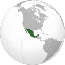
Mexico
500
This type of map shows information about farming, minerals, and natural resources.
Data & resource map
500
A location-finding system that uses four numbers.
4-figure grid reference
500
A map that shows land height and shape using contour lines.
Topographic map
500
The continent known for its outback
Australia
500
A country known for being very flat, with some land actually below sea level, and protected by dikes and canals to keep the sea out.
The Netherlands
600
This map projection keeps direction correct for sailors, but the country/continent sizes are not correct.
Mercator projection
600
A tool used to find direction.
Compass
600
A raised area of land that is smaller than a mountain.
Hill
600
A country that touches both the Pacific Ocean and the Atlantic Ocean.
Panama
600
A country that is famous for the Eiffel Tower and is one of the most visited tourist destinations in the world.
France
700
This map projection shows countries closer to their true size.
Gall-Peters projection
700
The study and making of maps is called this.
Cartography
700
A low area of land between hills or mountains.
Valley
700
A very large country that stretches across 11 time zones
Russia
700
A country with more pyramids in the world
Sudan