Vocabulary
Map Skills
Types of Maps
Vocabulary 2
Globe Skills
100
What is the study of the Earth's surfaces?
Geography
100
What are the Cardinal Directions on a Compass Rose going clockwise?
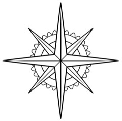
North, East, South, West
100
Which type of map helps you navigate between places?
Road Map
100
What is the largest continent on earth?
Asia
100
What is the number 1 on the globe depicting?
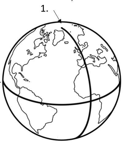
A) Prime Meridian
200
What is the world's largest area of land called?
Continents
200
What are the Intermediate Directions on the Compass Rose going clockwise?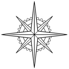
Northeast, Southeast, Southwest, Northeast
200
Which type of map shows where mountains and plains are?
Physical Map
200
What is the smallest continent on earth?
Australia
200
What is the number 2 on the globe depicting?
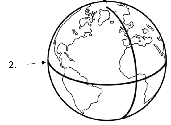
D) Equator
300
The change in the shape and size of an object:
Distortion
300
What symbol represents where people would go to
camp?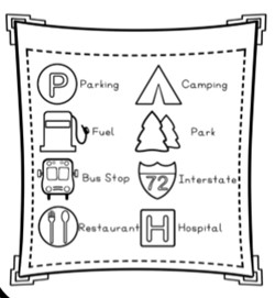
The park symbol
300
DAILY DOUBLE
Which type of map shows borders between countries, states, or cities?
Political
300
Why do maps need a scale?
to show how distances on the map compare to distances in real life
300
What continents are numbers 1-7 depicting?
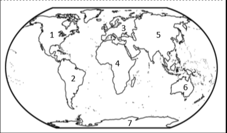
1) North America 2) South America 3) Europe
4) Africa 5) Asia 6) Australia 7) Antarctica
400
DAILY DOUBLE
Half of the globe:
Hemisphere
400
If someone was needing transportation, what symbol would be helpful?
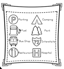
The bus stop symbol
400
Which type of map shows natural resources?
Resource map
400
Why is a globe a useful model?
shows the whole earth, no distortion
400
DAILY DOUBLE
What is the globe depicting below?
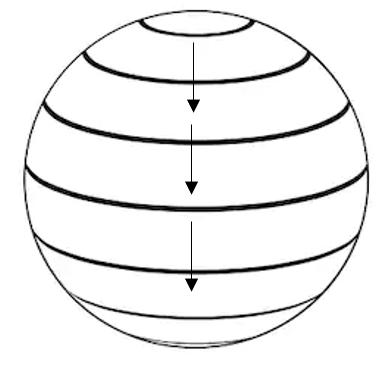
Latitude
500
The pictures used on a map:
Symbols
500
What direction is the campfire of the sleeping tents?
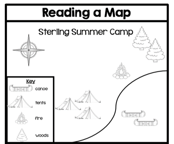
Northeast
500
Which type of map shows weather over a period of time?
Climate map
500
Why is a globe not a good model?
Can only see part of the earth at one time, can only show big objects, not much details, hard to carry around
500
What is the globe depicting below?
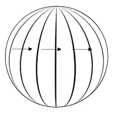
longitude