Latitude/Longitude
Map Symbols
Types of Maps
Map Projections
Continents/Oceans
100
Runs horizontally and known as parallels
Latitude lines
100

Compass Rose
100

Physical Map
100
The serious problem that occurs when a globe is tranferred onto a flat map?
What is Distortion
100
The continent you live on
North America
200
Runs vertically and known as meridians
Longitude
200
This is usually located at the top of the map and tells you what the map is about
Title
200
This map shows basic boundaries and man-made divisions between states, countries, etc.
Political Map
200
This map projection is popular for textbooks.
What is Robinson's?
200
This is the continent we will spend most of our time learning about in this class
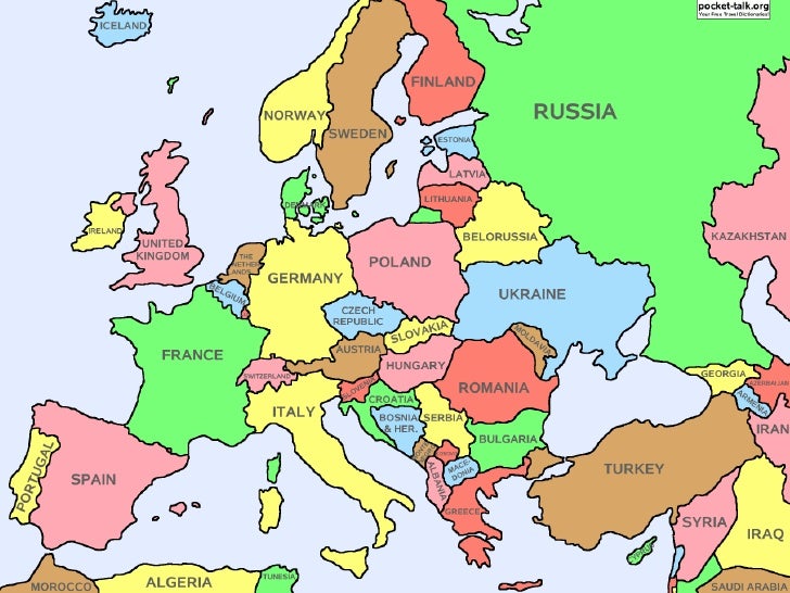
Europe
300
This line runs through the middle of the Earth horizontally and separates Latitude lines
Equator
300
This shows what all of the symbols and colors on a map represent
Map legend/key
300

Climate Map
300
What is someone called that draws up or produces maps?
What is a Cartographer?
300
Name all 7 continents
North America, South America, Asia, Australia, Antarctica, Europe, Africa
400
This lines runs through the middle of the earth vertically and separates longitude lines
Prime Meridian
400
This is a feature on a map that shows the actual distance of one place to another place in real life
Scale
400
This type of map shows resources, crops, and things that involve people making money
Economic Map
400
One type of map projection that was devoloped to solve the problem of distortion?
What is Cylindrical, Azimuthal or Conic?
400
The 3 countries that make up North America
United States, Mexico, Canada
500
The name of the city that the International Date Line runs through in England where time zones start
Greenwich
500
What does the star on a political map (like the one below) usually represent?
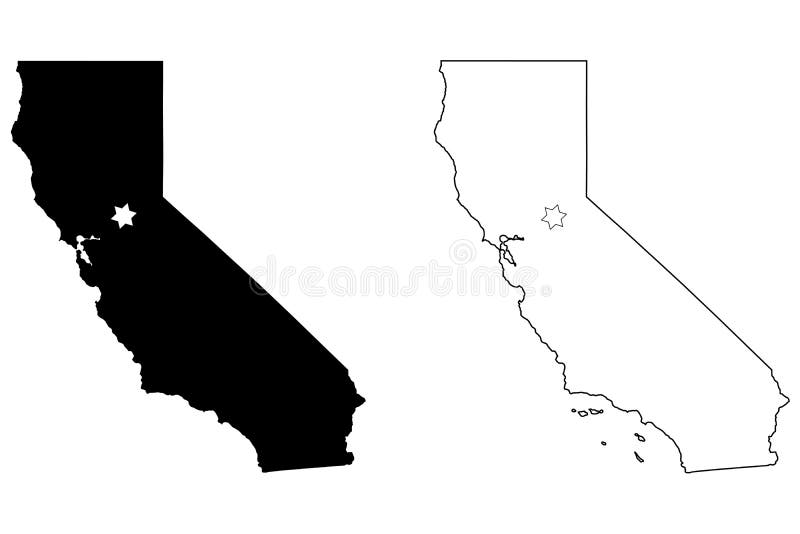
A capital city
500
This type of map shows things that involve human activity such as migration, battle sites, etc.
Special Purpose or Thematic
500
Name two of the four features of a globe that map projections try to avoid distorting?
What is area, shape, distance and direction?
500
Name all 5 oceans
Arctic, Pacific, Indian, Atlantic, Southern