Map Basics
Map Elements
Coordinates
Maps & Jamaica
GIS
100
What is a map?
A visual representation of all or part of the Earth's surface.
100
This map element shows the relationship between a distance measured on the map and the actual distance on the Earth's surface.
Scale
100
What are latitude lines?
Imaginary lines that run east–west and measure distance north or south of the Equator.
100
What is the capital city of Jamaica?
Kingston
100
What is GIS?
GIS is a club that specializes in the study of the earth and its people, along with mapping technology, to understand the world and solve real-life problems.
200
What is the purpose of a map? why do we need them?
The primary purpose of a map is to provide a visual, scaled representation of a specific area, helping us understand spatial relationships and find our way from one place to another.
200
This map element helps you determine the direction of features on a map, such as north, south, east and west.
Compass Rose or North Compass
200
What are longitude lines?
Imaginary lines that run from the North Pole to the South Pole and measure distance east or west of the Prime Meridian.
200
Which parish is Kingston located in?
Kingston
(Kingston is the capital of the parish Kingston)
200
Which Jamaican government agency is responsible for surveying and mapping Jamaica's land and property boundaries?
The National Land Agency (NLA).
300
Name 2 types of maps?
Political maps, Physical maps, Topographic map, Road maps, Climate maps, Population maps, Economic maps,
300
This map element explains what the different symbols, colours and patterns on a map represent.
Legend or Key
300
What are the Equator and Prime Meridian?( what are they and what are their degrees)
The Equator is 0° latitude, while the Prime Meridian is 0° longitude.
400
300
Name two parishes located on Jamaica's southern coast.
Clarendon, Manchester, St. Elizabeth, Westmoreland, St. Catherine and Kingston.
300
What is spatial data?
Data that contains information about where something is located on Earth's surface.

400
What is the difference between a physical and political map?
A physical map shows natural features such as mountains and rivers, while a political map shows boundaries such as countries, parishes or states.
400
This map element consists of lines that intersect across a map that help you locate specific places using coordinates.
Grid
400
What is the other name for the Prime Meridian, and why is it called that?
It is also called the Greenwich Meridian because it passes through the Royal Observatory in Greenwich, London. It is the 0° longitude line used as the reference point for measuring longitude east and west.
400
Which Jamaican parish is the largest by area?
St. Ann
400
Name two GIS technology
Satellites, underwater drones, GPS (Global Positioning System), GIS aircraft
500
A map has a scale of 1:50,000. What does this mean?
1 unit on the map represents 50,000 units on the ground.
For example, 1 cm on the map represents 50,000 cm (500 m) on the ground.
500
This map element tells the reader what the map is about and usually identifies the area or subject being represented.
Title
500
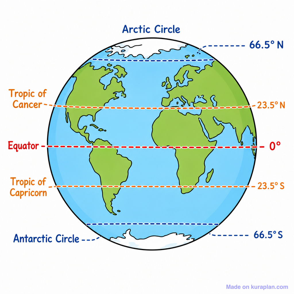
Name the five major lines of latitude found on Earth.
Equator 0°, Tropic of Cancer 23.5° N, Tropic of Capricorn 23.5° S, Arctic Circle 66.5° N, Antarctic Circle 66.5° S
500
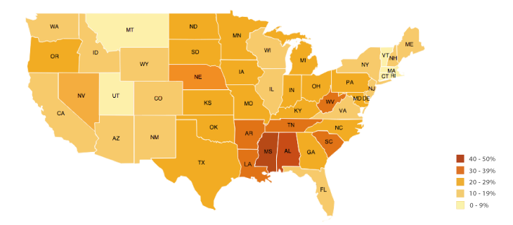
Jamaica is divided into 14 parishes. If you wanted to create a GIS map showing population density by parish, what type of map would be especially appropriate?
A choropleth map
500
What does GPS stand for, and what is it used for?
Global Positioning System: it is used to determine the location of a person, place, or object on Earth.