Types of Maps
Types of Location
Regions of the U.S.
Primary Sources & Secondary Sources
200
The types of maps we use to study geography are
What are:
Political Map
Physical Map
Population Density Map
Climate Map
200
The two types of location we use to understand Geography are
Absolute and Relative Location!
200
The U.S recognizes [blank] amount of regions
Five!
200
A source created at the time an event happens
A source created after the event occurs
Primary Source
Secondary Source
400
The following map is an example of a :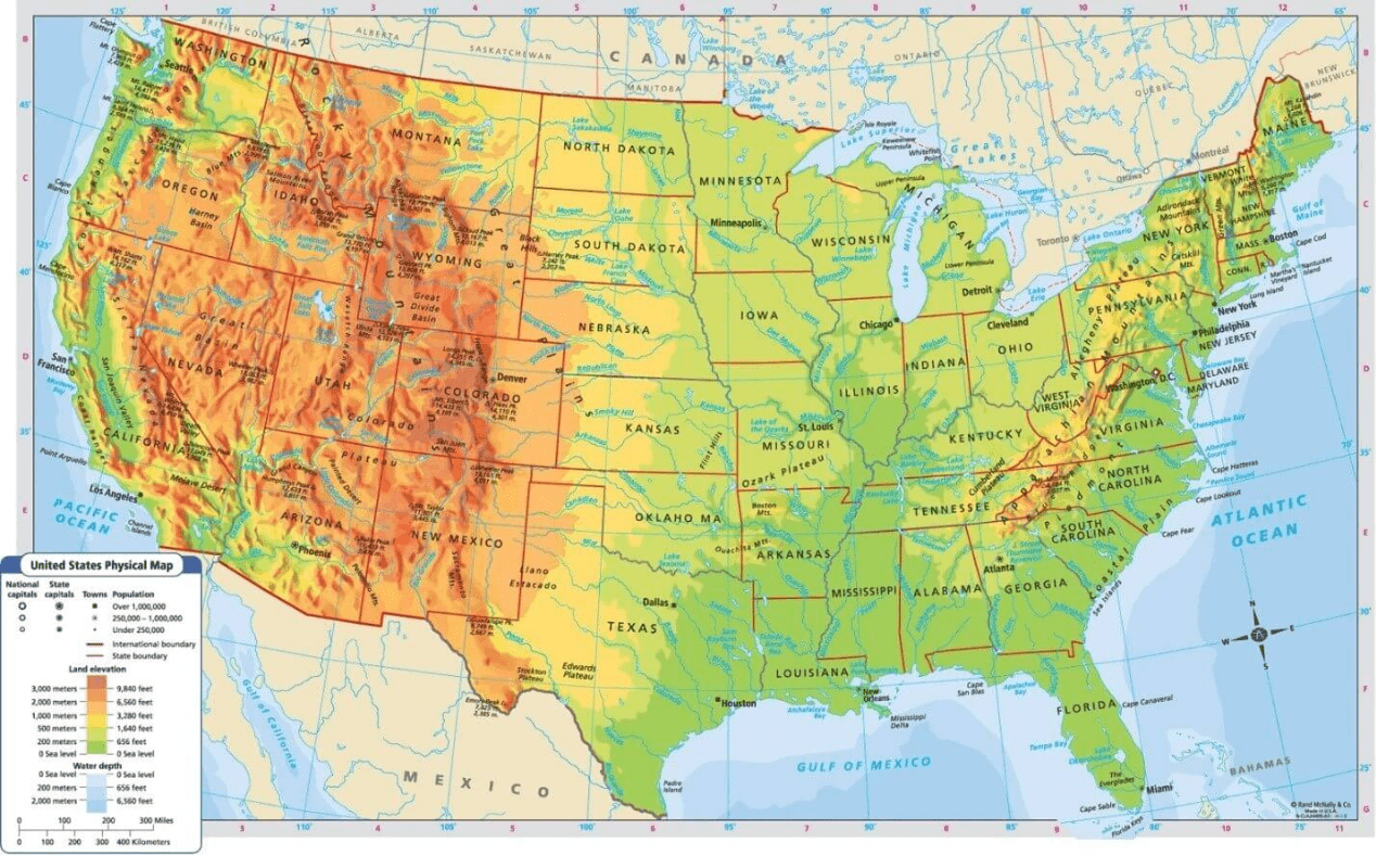
What is a Physical Map?
400
This map shows and example of a specific type of location that can be described as:
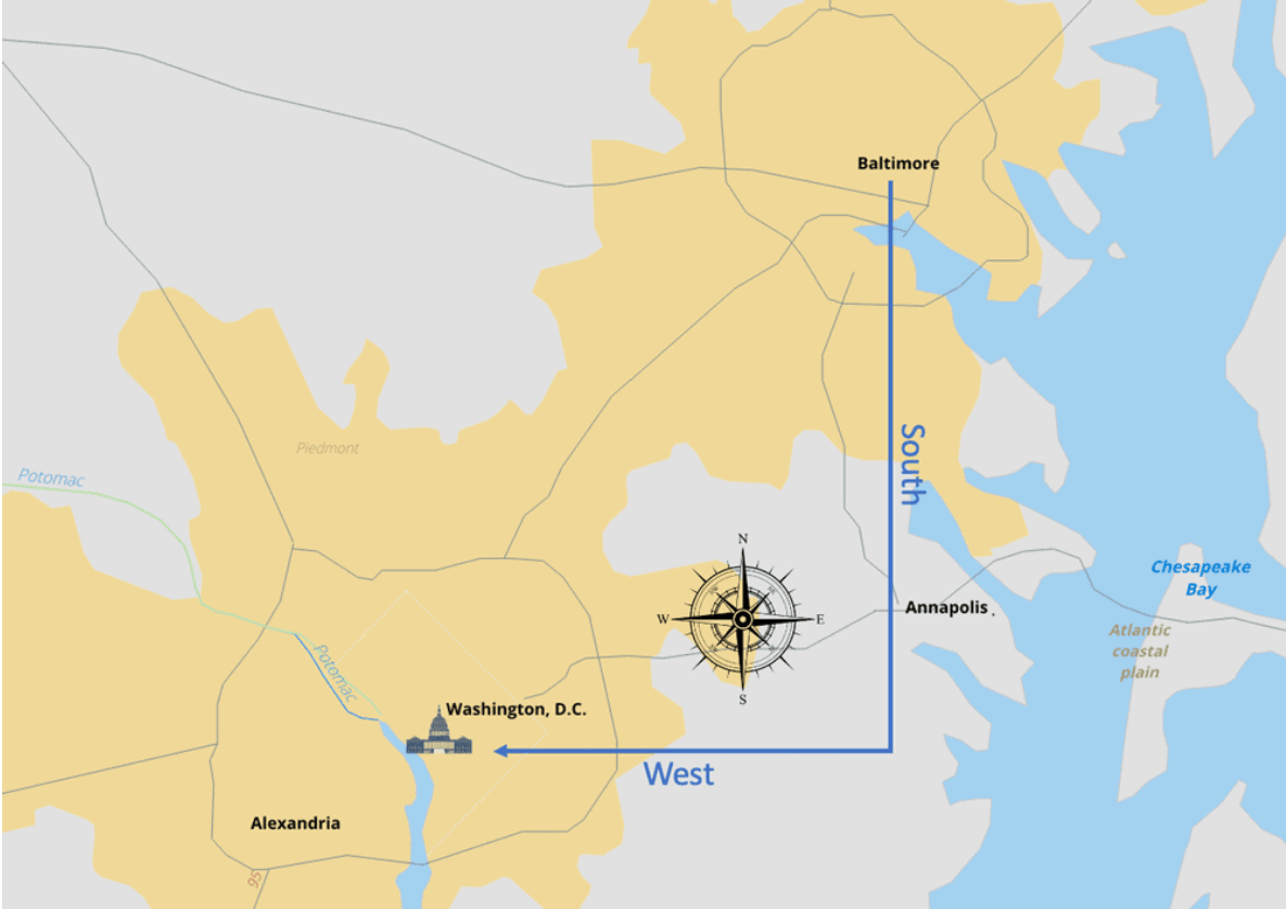
Realitive Location! Washington D.C. is Southwest of Baltimore or Baltimore is Northeast of Washington D.C.
400
The names of the five regions of the U.S. are
Northeast, Southwest, Southeast, Midwest and West
400
A photograph is an example of a [blank] source
Primary Source
600
A person who is looking to know where they have to cross the border to get from Germany to France would use a:
What is a Political Map?
600
Give an example of an absolute and a relative location!
Answers may vary!
600
This region of the U.S. has mountains, oceans, forests and deserts!
This region of the U.S. has the biggest influence of Mexican and Native American cultures!
The West!
The Southwest!
600
People should only read primary sources about historical events, never secondary sources. [True or False]
False!
800
This type of map shows the weather patterns of locations on Earth. Mapmakers will often use different colors to symbolize different temperatures and zones around the world. 
What is a Climate Map?
800
The address 387 Urban St is the address of [blank]!
This is a [which type of location].
Persistence Prep Charter!! It is an absolute location.
800
This map shows the [blank] region of the U.S. 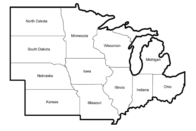
Midwest!
800
This picture is an example of a [blank] source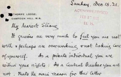
What is a Primary Source?
1000
In your own words, identify the four types of maps and why we use each map!
What is:
Political Map- To understand the borders between countries, cities, staes, counties and more.
Physical Map- To understand landforms, waterway, and other features of the Earth's surface.
Population Density Map- To understand the number of people who live in specific geographic regions.
Climate Map- To show the weather patterns of locations on Earth.
1000
Describe the difference between absolute and realtive location. Create an example of a relative location.
The difference between absolute and relative location is that one give a specific location and the other gives a general direction or area of a place! An example of a relative location would be [an address].
1000
The name of each region in the U.S. in order of 1, 2, 3, 4, 5 is 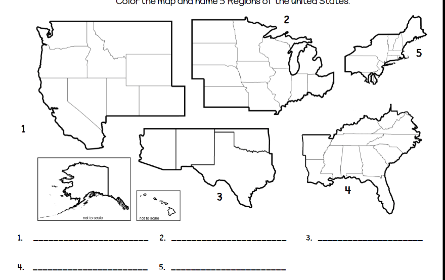
1. West
2. Midwest
3. Southwest
4. Southeast
5. Northeast
1000
When learning about a historical event, why is it important to analyze a wide variety of both primary and secondary sources?
It is important to analyze a wide variety of both primary and secondary sources because it provides different points of view and provides more context about what really happened.