Map Skills
More Map Skills
Climate
Economic Activity/Vegetation/Population
Random Geography
100
What causes the countries on the edge of the map to appear larger than they actually are?
Bonus: Explain why this is.
Map Distortion
Happens when you try to place a 3D globe onto a flat 2D surface (like a map)
100
What is "C" called on the map?

The Compass Rose
100
Which climate zone covers most of the Northeastern United States?

Humid Continental
100
What economic activity is the Middle East known for?
Oil/Petroleum
100
Which country is in both Europe and Asia?
Russia
200
Which line divides the Earth into the Northern and Southern Hemispheres?
Equator
200
What is "D" called on a map?
The Key
200
Which climate zone is Jacksonville in?

Humid Subtropical
200
Which continent has the lowest population density in the world?
Antarctica
200
Which river runs through Egypt?
The Nile
300
Which line divides the Earth into the Eastern and Western Hemispheres?
Prime Meridian
300
What is "E" called on the map?
The scale
300
Which climate zone covers all of New Zealand?

Marine West Coast (haah haah haaah hahah hahhh)
300
What is the most common land use in Europe? (not including water resources?
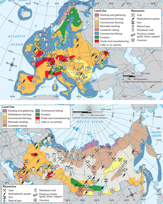
Commercial Farming
300
What do you call a narrow strip of land connecting two larger land masses?
An Isthmus
400
Which two continents are entirely in the Western Hemisphere?
North America and South America
400
What is "B" called on the map?
Map Grid
400
What is the most common climate on the Arabian Peninsula?
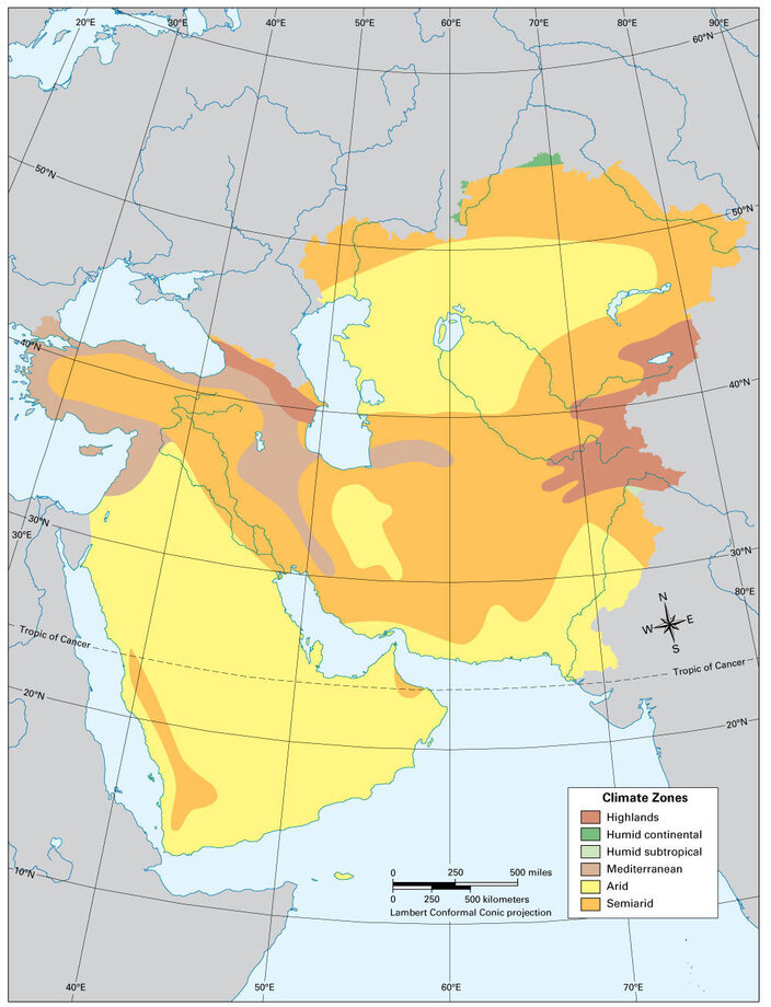
Arid
400
Which vegetation zone exists on the banks of the Nile?

Broadleaf Evergreen Forest
400
Which mountain range runs through the countries of Venezuela, Colombia, Ecuador, Peru, Bolivia, Chile, and Argentina?
Andes Mountains
500
Which continent is in all four hemispheres?
Africa
500
What are the coordinates of #3?

40N, 130W
500
As latitude increases, temperature ______________.
As elevation increases, temperature ______________.
Decreases
Decreases
500
Which Monsoon Asia country has the highest population?
Double: Which Monsoon Asia country has the highest population density?
India
Japan
500
Which body of water separates Europe and Africa?
Mediterranean Sea