Very Easy
Normal
Hard
Harder
Other
10
In which hemisphere does India lie?
Northern Hemisphere
10
In which year Suez Canal opened? You learned In Grade 8 and 9
1869
10
Which is the largest and smallest state of India area wise?
The largest state is Rajasthan and the smallest state is Goa.
10
Name the two water bodies which separate India from Sri Lanka.
The two water bodies that separate India are Palk Strait and the Gulf of Mannar.
10
Name the two states of India which are parts of Indian desert.
Gujarat and Rajasthan are parts of Indian Desert.
20
What are the degrees of the easternmost and westernmost longitude of India?
The longitudinal extent of India is 68°7′ E (westernmost) to 97°25′ E (easternmost) longitude.
20
What is the significance of the Suez Canal?
With the Suez Canal, India’s distance from Europe has been reduced by 7,000 km.
20
Name the states of India which do not have an international border or lie on the coast.
(Minimum =2)
Gujarat, Rajasthan, Punjab and Jammu and Kashmir.
20
Name the country that has common land frontier with the states of Uttarakhand, Uttar Pradesh, Bihar, West Bengal and Sikkim.
Nepal
20
Write the size and extent of India. ( 2 lines needed)
(a) India is the 7th largest country in the world. It has an area of 3.28 million square km. It accounts for 2.4% of the world’s total area.
(b) India has a land frontier of 15,200 km.
(c) India has a coastline of 7516.6 km including the Andaman and Nicobar islands and the Lakshadweep islands.
30
Name the two seas located around India .
The two seas located around India are the Arabian Sea in the west and the Bay of Bengal in the east.
30
Which route connects countries of Europe in the west to the countries of east Asia?
The trans Indian Ocean route
30
Which commodities were exported from India?
The spices, muslin cloth and many other commodities were exported from India.
30
With which country Jammu and Kashmir, Punjab, Rajasthan and Gujarat share international boundary?
Pakistan
30
Identify the state
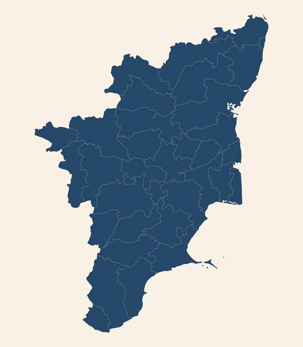 a)Kerala
b)Tamil Nadu
c)Gujarat
d)Madya Pradesh
Tamil Nadu
40
What is the southernmost point of the Union of India?
Southernmost point of the Union of India is Indira Point.
40
What is the total north-south extent of India in km?
(Nearest Number) wins
3,214 km
40
From which regions and styles India got influenced in ancient times?
India got influenced from Greek sculpture, the architectural styles of dome and minarets from west Asia in the ancient times
40
Name the Union Territories of India. ( Minimum = 3)
Each Union territories (5 point)
Delhi, Chandigarh, Andaman and Nicobar, Lakshadweep, Jammu and Kashmir
40
Identify the state 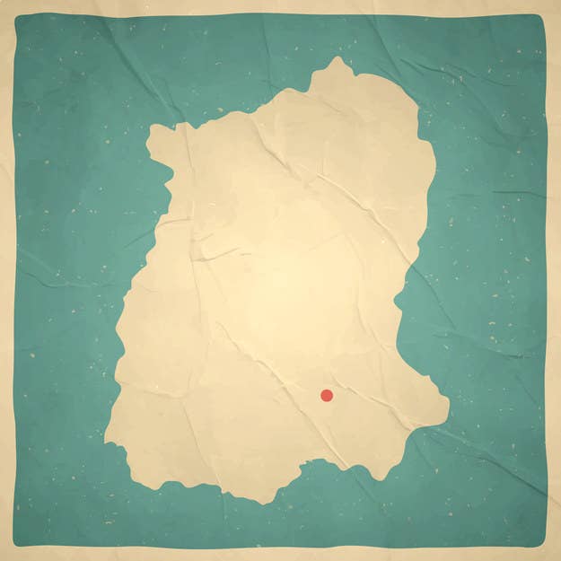
a)Uttar Pradesh
b)Delhi
c)Gujarat
d)Sikkim
Sikkim
50
When did ‘Indira Point’ submerge under water due to tsunami?
2014
If you get this wrong . Please refer the textbook and notebook .
50
What is the total land frontier of India?
(Try to get the Nearest Number )
The total land frontier of India is 15,200 km.
If you got this right . It wasn't given in the textbook. Congrats

50
What is the total east-west extent of India in km? (Nearest Number =250 below or exact number)
2,933 km
50
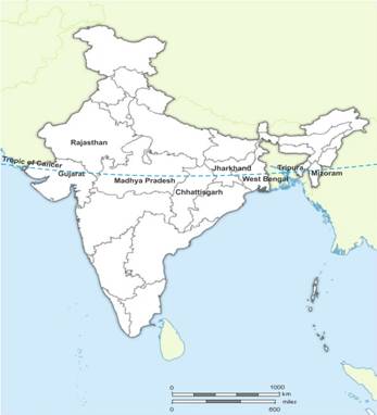
Name the states through which the Tropic of Cancer passes. (Minimum = 5)
Each States which passes through the capricorn (5 points)
Gujarat, Rajasthan, Madhya Pradesh, Chhattisgarh, Jharkhand, West Bengal, Tripura and Mizoram.
50
Guess the states. Maximum ( 3)
1) Green gate
2) Kings coat
3) Snake City
4) Elephant night
5) Large state
6) Mom’s maid
7) Go piece
8) Go and Come
9) Center State
10) Do acting
11) North Piece
12) Roar Village
13) Fall
14) Come in evening

1) Haridwar.
2) Rajkot.
3) Nagpur.
4) Gujarat.
5) Maharashtra.
6) Mumbai.
7) Jharkhand.
8) Goa.
9) Madhya Prasesh.
10) Karnataka.
11) Uttarakhand.
12) Gurgaon.
13) Gir.
14) Assam.