Oceans
Continents
Landforms
Landforms
Maps
100
This ocean is closet to Asia and Africa.
What is the Indian Ocean?
100
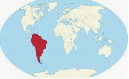
What is South America?
100
A steep area of land that rises more than 1,000 feet.
What is a mountain?
100
A sandy, pebbly, or rocky shore of a body of water.
What is a beach?
100
This map shows roads and highways connecting places.
What is a road map?
200
This ocean is closest to the East coast of the United States.
What is the Atlantic Ocean?
200
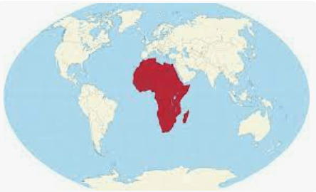
What is Africa?
200
A dry area of land having very little rainfall.
What is a desert?
200
A raised area of land not as high as a mountain.
What is a hill?
200
This map shows average temperature and rainfall.
What is a weather map?
300
This ocean is the largest and covers most of Earth.
What is the Pacific Ocean?
300
This continent is at the Southern most part of Earth.
What is Antarctica?
300
A piece of land that is surrounded by water on 3 sides.
What is a peninsula?
300
A body of land completely surrounded by water.
What is an island?
300
This map shows physical features such as mountains and oceans.
What is a physical map?
400
This ocean is closest to Antarctica.
What is the Southern Ocean?
400
The largest continent on Earth.
What is Asia?
400
A raised, flat area of land that is higher than the surrounding land.
What is a plateau?
400
A body of water completely surrounded by land.
What is a lake?
400
This map shows boundaries between countries and states.
What is a political map?
500
This ocean is at the Northern most part of the Earth.
What is the Arctic Ocean?
500
The only continent that is also considered a country.
What is Australia?
500
Long, low area of land between hills or mountain ranges.
What is valley?
500
A deep, narrow valley usually with steep sides and a river flowing through it.
What is a canyon?
500
This type of map feature helps you with direction.
What is a compass?