Vocabulary
Landforms
Weathering
Maps
Mix
100
The process by which wind,water,ice or gravity transports soil and sediment from one location to another
What is erosion
100
An _____ is a body of land completely surrounded by water.
A. Peninsula
B. Island
C. Continent
B. What is an Island
100
This is the breakdown of rock material by physical and chemical processes.
What is weathering?
100
The line that runs 0° Latitude, cutting the earth in half.
Equator
100
The line that runs 0° Longitude, cutting the earth in half.
prime meridian
200
the process of scraping or wearing away.
What is abrasion
200
A _______ is a deep Valley with very steep sides. These are often formed by Erosion from a River Water over a Long, Long Period of Time, taking Millions of Years.
A. Gorges
B. Trench
C. Canyon
C. What is a Canyon
200
Temperature changes, pressure changes, plant and animal actions, water, wind, and gravity are all agents of this.
What is physical weathering?
200
What box has symbols use on a map?
Map Key (or Legend)
200
What does a political map show?
country/state borders, city boundaries and names
300
A mound of wind deposited sand that moves as a result of the Acton of wind
What is dune
300
A _____ is a Landform surrounded by Water on Three Sides and is connected to a Main Landform such as a Continent.
A. Trench
B. Delta
C. Island
D. Peninsula
D. What is a Peninsula
300
This is the breakdown of rocks by this type of reaction. Agents of this include oxygen in the air and acids. This results in a change of color for the rock.
What is chemical weathering?
300
What is this called? 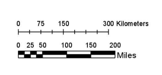
A scale
300
lines that measure east or west of prime meridian
lines of longitude
400
The slow downhill movement of weathered rock material
What is creep
400
Huge, flat areas of land that are higher than the surrounding land.
A. Peninsula
B. Plateau
C. Island
B. What is a Plateau
400
What are the factors that control the rate the rock weathers?
Temperature, climate, water, time
400
What does a scale measure on a map?
Distance
400
Lines of latitude are also called
Parallels
500
A mass of material deposited in a triangular of fan shape at the mouth of a river or stream
What is Delta
500
An _____ is a narrow strip of land, with water on either side, which connects two land masses.
A. Fjord
B. Isthmus
C. Island
B. What is an ISTHMUS
500
Solid material moved by wind and water, that settles on the surface of land or the bottom of a body of water
What's deposition
500
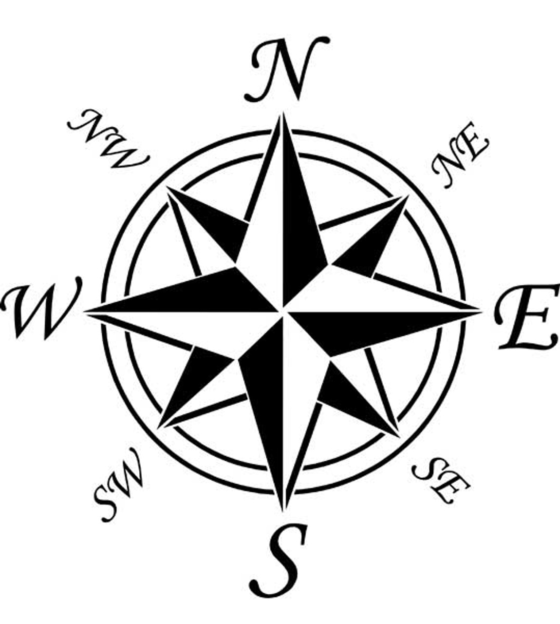 What is this image called?
Compass Rose
500
Which two lines divide the Earth into the four hemispheres?
Equator & Prime Meridian