Theories
Vocab
Map analysis
100
Theory describing the functional relationships between countries in the world economy categorizes countries consisting of the core, periphery, and semi periphery
What is Wallerstein's World System Theory?
100
The process by which a cultural trait spreads from one place to another over time
What is diffusion?
100
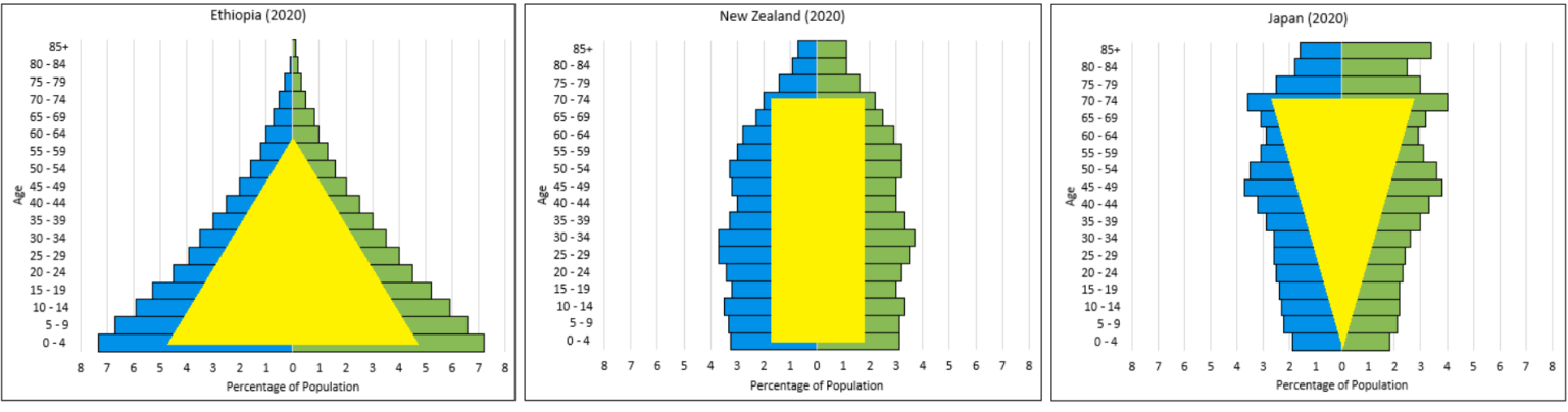 what is shown in these images and what are they saying
What is population pyramids and 1=rapid growth 2= zero growth 3=negative growth?
200
Theory used to describe the relationship between cities and their surrounding areas
What is Central Place Theory?
200
The established limit by the government on the #of immigrants who can enter a country each year
What is quotas?
200
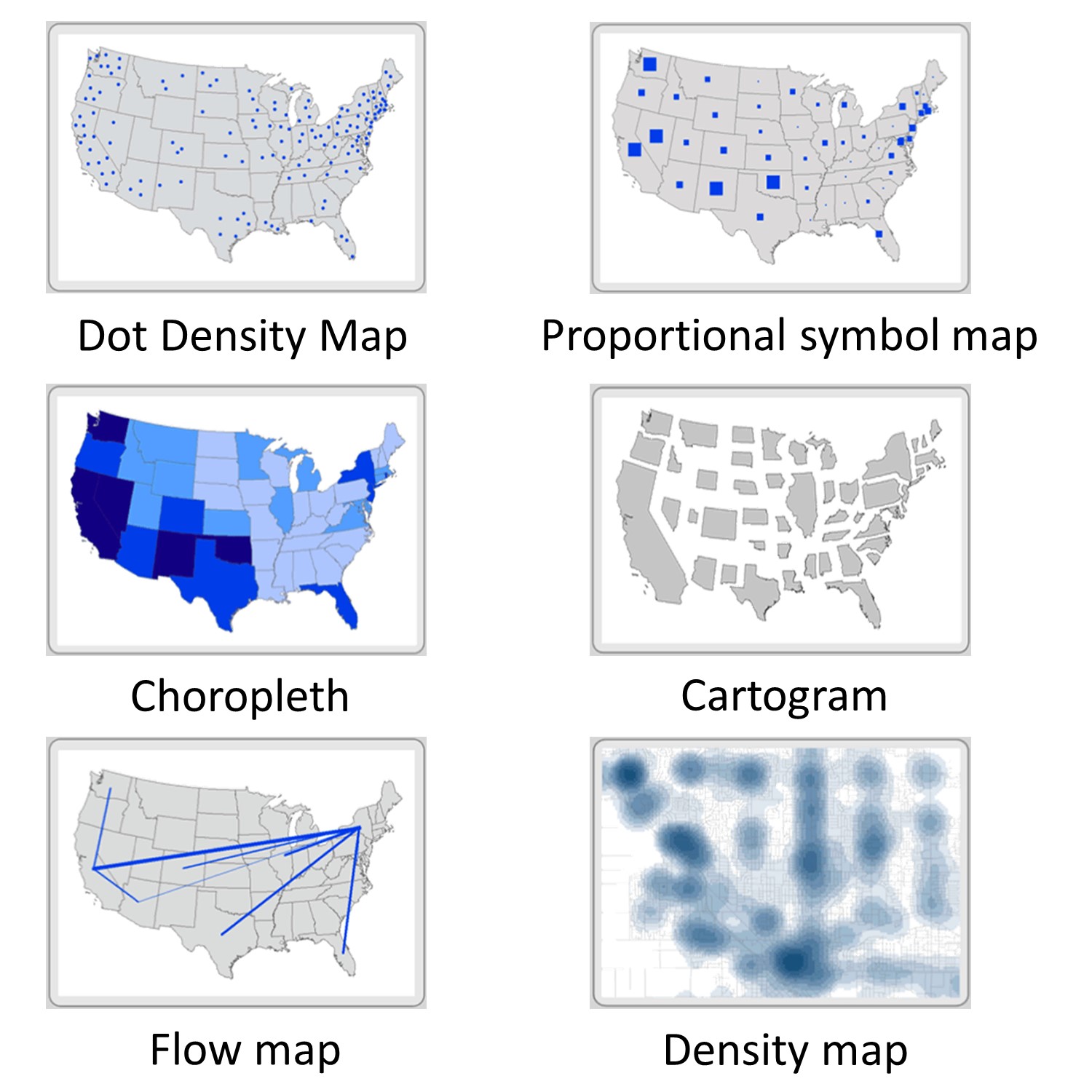 What category do all these maps fall under
What is thematic map?
300
a model that suggests that perishability of the product and transport costs to the market influences the location of agricultural land use and activity
What is Von Thunen Model?
300
Satellite based system for showing the absolute location of places or geographic features
What is GPS?
300
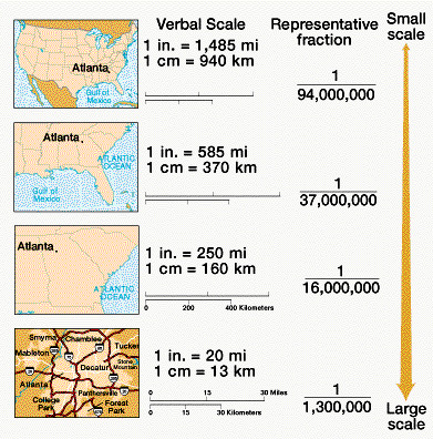 What are the different kinds of map scales shown
What is global, regional, national, and local?
400
a model that suggests that countries can be categorized on a from traditional to modern and to become modern, countries need to pass different stages
What is Rostow’s Stages of Growth?
400
The total value of the goods and services produced by a country’s citizens and companies within the country in a year
The total value of the goods and services produced by a country’s citizens and companies both domestically and internationally
What is GDP and GNP?
400
What are the different types of map projection
What is Mercator, Gall-Peters, Robinson, and Azimuthal projections?
500
The theory describe trends in migration that show economic conditions population size, and distance affect whether people move and where they move to
What is Ravenstein’s Laws of Migration?
500
Sectors that ranges from harvesting raw materials from the earth to turning those raw materials into goods to transporting, storage, marketing, and selling of goods or services to activities that require workers to process and handle information to the involvement of very top leaders
What is the 5 economic sectors?
500
What are the limitations and advantages of the map projections
what is Mercator = Shows true direction, good for navigation purposes but distorts area increasingly near the poles
Gall-peters = shows true direction, area is relatively precise, but distorts shape and continents appear elongated
Robinson= A globe-like appearance, distorts size and shape, but not too much, but has imprecise measurements and extreme distortion at the poles
Azimuthal= Preserves direction, when used from the point of the North Pole no country is seen as center, but distorts shape and area and only shows one half of earth?