Thinking Geographically
Geographic Data and Spatial Concepts
Scales/Scales of Analysis
Regional Analysis
Vocabulary
100
 Identify the type of map
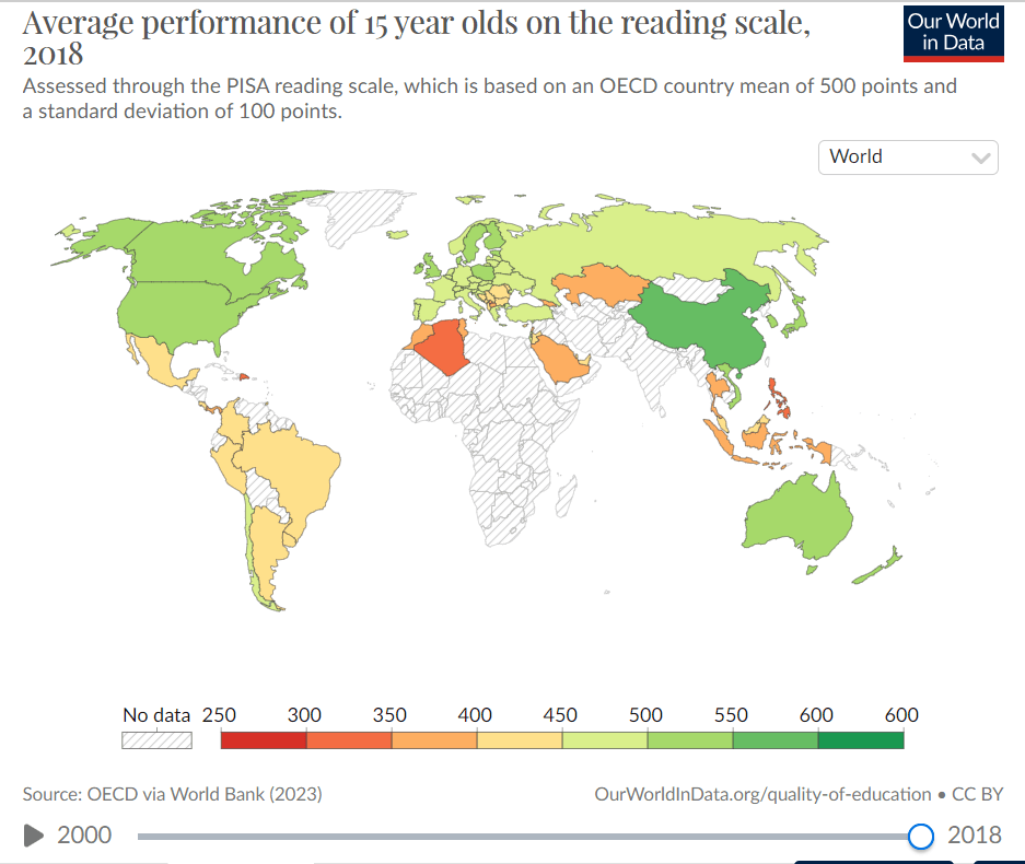
What is choropleth
100

Is this map large, medium, or small scale?
Small scale
100
a 2D model of the earth or a portion of its surface
What is a map?
200
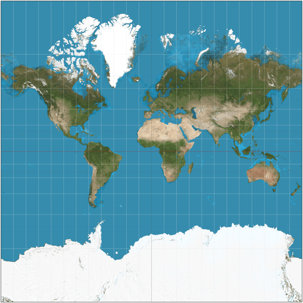
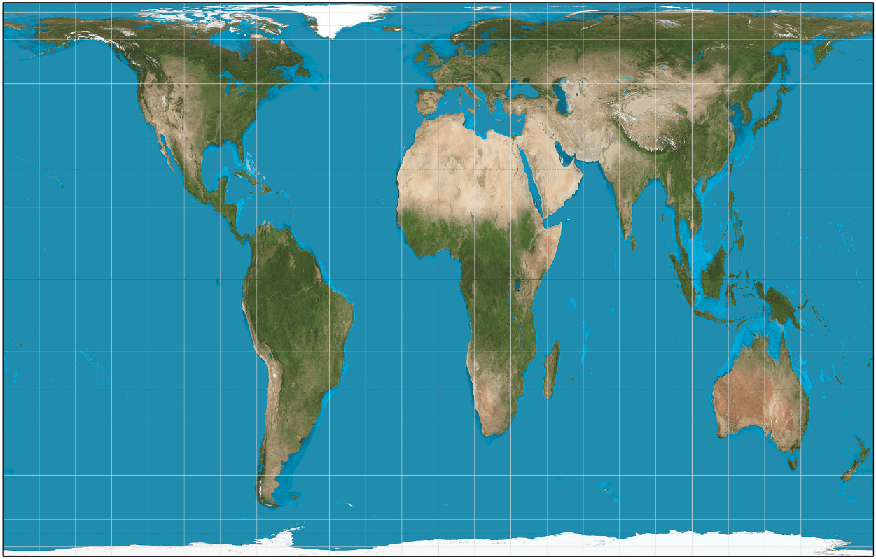 Identify the type of map projection shown.
What is the Gall-Peters Projection
200
This satellite-based global navigation system provides precise positioning, navigation, and timing information to users all over the world.
What is GPS?
200
 The map is (large or small) scale
What is small scale (the entire globe is shown- small scale=small detail)
200
DOUBLE JEOPARDY
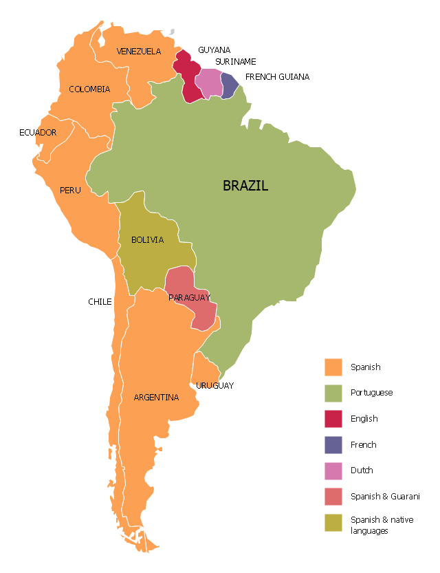
 This map is an example of which type of region.
What is perceptual/vernacular
200
Name the cardinal directions
North, East, South, and West
300
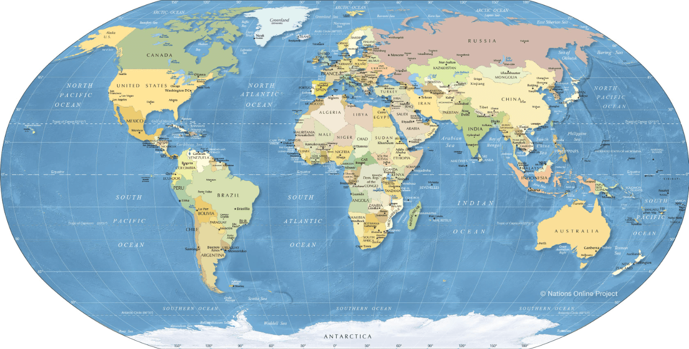
What is the mercator map?
300
DOUBLE JEOPARDY
A computer system that stores location information in layers.
What is Geographic Information System (GIS)
300
DOUBLE JEOPARDY
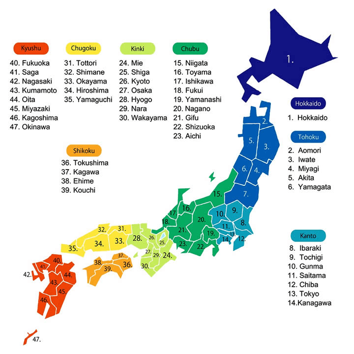
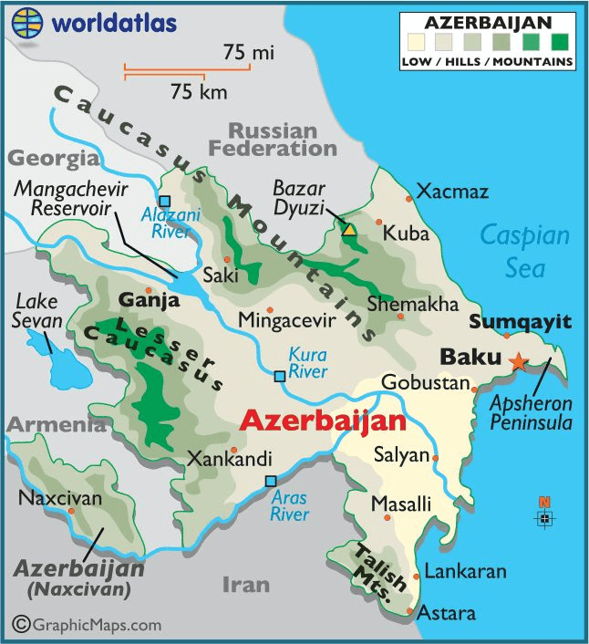 Identify the scale of the map shown
What is national (we only see one country)
300
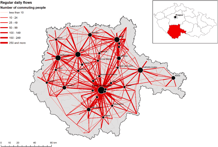 This map is an example of which type of region
What is a functional region
300
DOUBLE JEOPARDY
The earth's surface is curved while a map's surface is flat. This causes map projections to experience some level of...
What is distortion
400
DOUBLE JEOPARDY
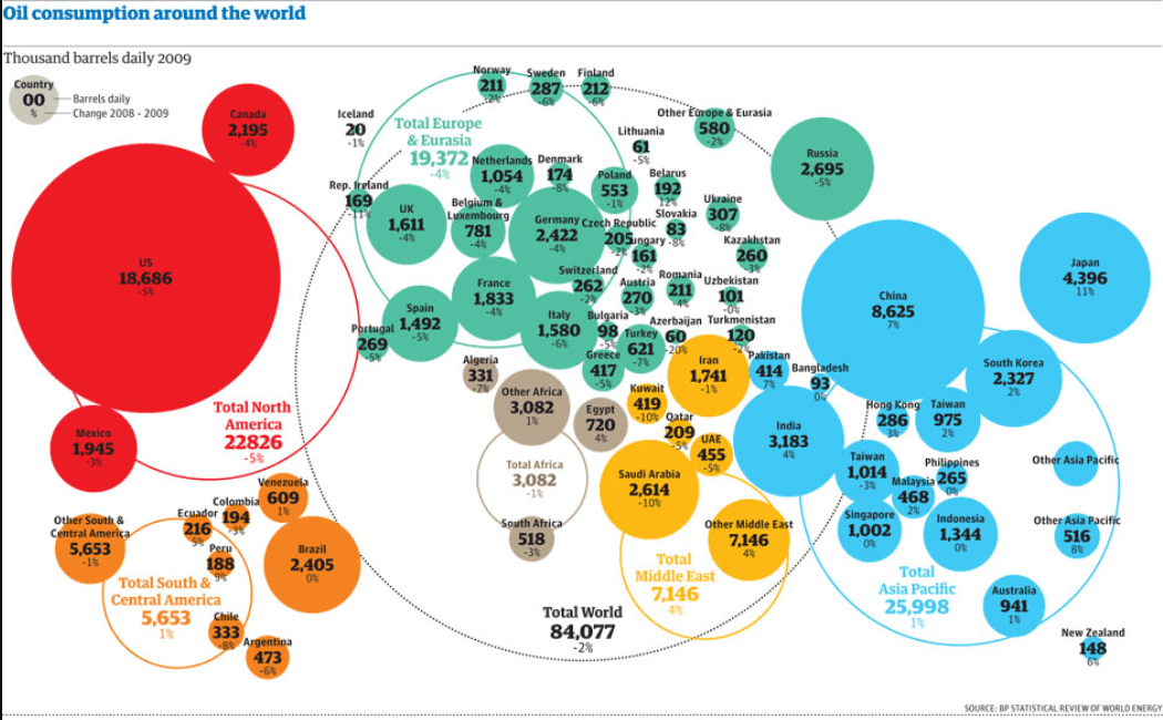 Identify the type of map shown.
What is a cartogram (each country is a different size based on their statistical value)
400
This method involves capturing information about the Earth's surface from a distance, typically using satellites or aircraft. What is it called
What is remote sensing?
400
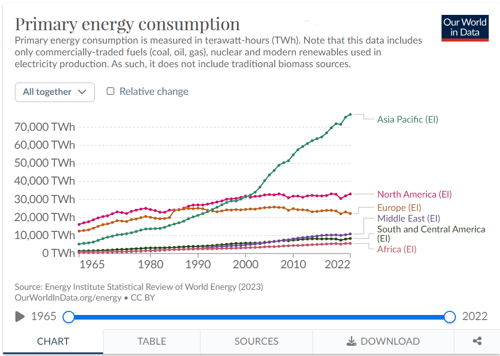 Identify the scale of analysis.
What is regional (the data presented has countries grouped together in regions)
400
This map is an example of which type of region
What is a formal region
400
This type of map uses continuous lines that join points of the same value
Isoline Map
500

Authograph Map
500
The precise spot where something is according to some system.
What is absolute location
500
Scale- National (only one country is shown)
500
A geographic area characterized by the interactions and interconnectedness of various locations or nodes within it.
What is a functional region