Map It Out
Spatial Patterns
Tech & Data
Thinking Geographically
Regional Retionale
100
This type of thematic map visualizes data by using different colors to represent specific information, such as political party votes
What is a Choropleth map?
100
This term describes how phenomena are spread out across an area, specifically when they are close together
What is clustering (or clustered)?
100
This software is used to manipulate geospatial data to find answers to research-based problems, like where to build a new store

What is GIS (Geographic Information System)?
100
This 19th-century theory argued that the physical environment completely determined how a people's culture developed
What is environmental determinism?
100
This type of region is defined by shared traits like language, religion, or economic prosperity
What is a formal region?
200
This map feature explains how distance on a map relates to distance in the real world, often represented as a ratio like 1:1,000
What is scale?
200
Unlike absolute distance, this is a measure of social, cultural, or political differences between two locations

What is relative distance?
200
This type of data is descriptive and language-based, often focusing on how a community "feels" about an issue
What is qualitative data?
200
This modern theory argues that humans are the driving force in shaping their own culture, regardless of their environment
What is possibilism?
200
This type of region, also called a nodal region, is organized around a central point or node that defines the activity
What is a functional region?
300
This specific map projection is criticized for being "eurocentric" because it distorts landmasses further from the equator to make Europe look grander
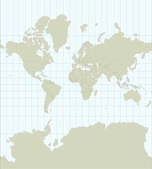
What is the Mercator projection?
300
This geographic concept states that the further apart two things are, the less connected they will be
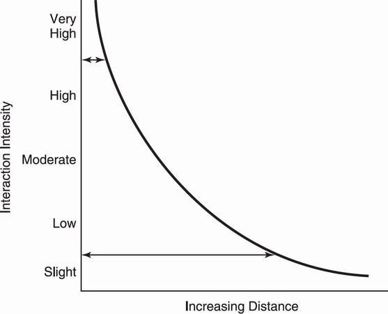
What is distance decay?
300
This technology gathers information about geographic locations through satellite imagery or aerial photography

What is remote sensing?
300
This concept refers to the decreased time or cost it takes to travel between places due to technological advancements like airplanes
What is time-space compression?
300
These regions, such as "The American South," are defined by shared beliefs and feelings and often have vague borders
What is a perceptual region?
400
This type of map serves as a "blueprint" to display specific geographic locations, such as roads, mountains, or political boundaries
What is a reference map?
400
This describes the precise geographical coordinates of a place on Earth, determined by latitude and longitude
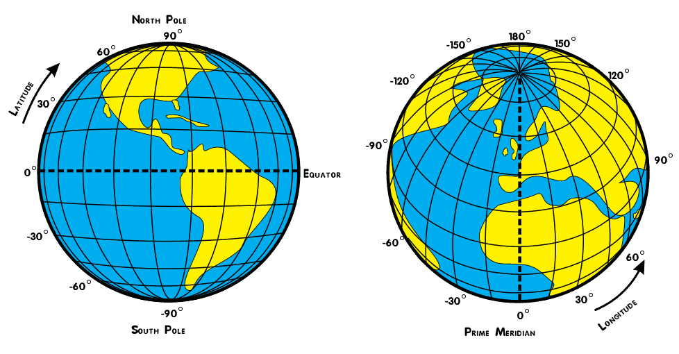
What is absolute location?
400
This method of data collection involves a researcher physically visiting a location and making written observations
What is field observation?
400
This is the study of how humans interact with their environment, which includes the use of natural resources and land modification
What is human-environmental interaction?
400
This occurs when the borders between regions are not a hard line and can be the subject of disputes
What are transitional or contested boundaries?
500
This thematic map distorts the size of geographic shapes to display differences in data, such as making India appear larger than Russia due to population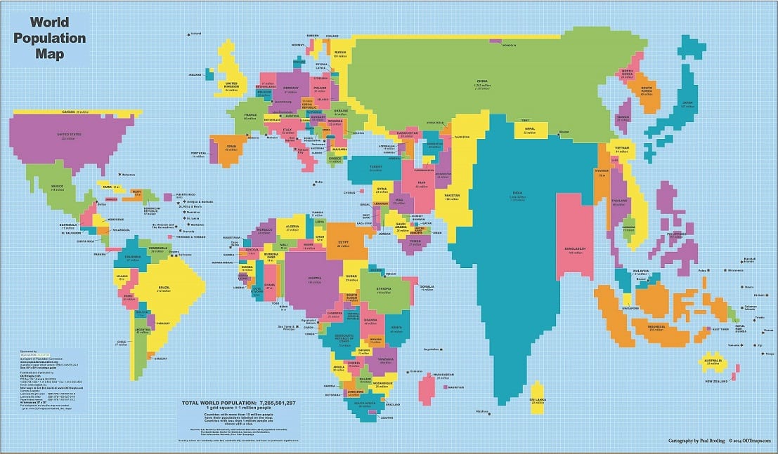
What is a cartogram?
500
This pattern indicates that objects under study, such as houses, are arranged in a straight line along a road
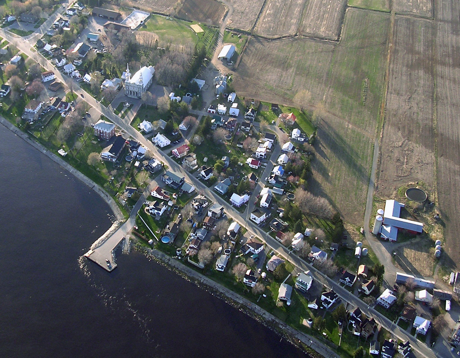
What is a linear pattern?
500
Every 10 years, this U.S. organization collects quantitative data on residents to determine representation in the House of Representatives
What is the Census Bureau?
500
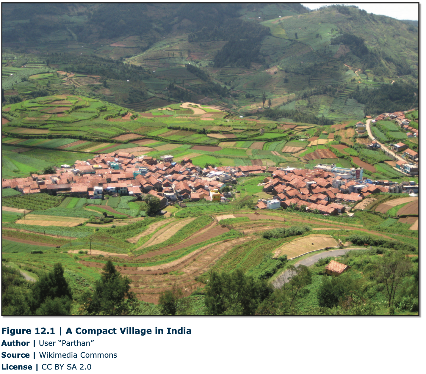
This refers to the built environment that reflects the specific values and culture of the people who created it
What is the cultural landscape?
500
In AP Human Geography, this counter-intuitive rule states that the further you zoom in on a map, the "larger" this becomes
What is the scale of analysis (large scale)?