Scale of Analysis
Types of Maps
Regions
Environment
Vocab
100
This is the smallest scale of analysis
Census tract
100
This is a thematic map that uses dots to indicate a feature or occurrence
Dot-density map
100
The four scales to which geographers apply regional analysis
Global, regional, national, local
100
This is the study of how humans interact or adapt to the environment.
Cultural ecology
100
This happens when objects form a group.
Clustering
200
A small scale map shows this size area
large
200
This type of map is used to show landforms and/or places.
Reference map
200
The South is a region with a perceived identity. This is an example of what type of region?
Perceptual/vernacular region
200
This is the belief that climate and landforms are the most powerful forces shaping human culture.
Environmental determinism
200
This type of data uses field observations
qualitative data
300
The scale of analysis presented in this map. 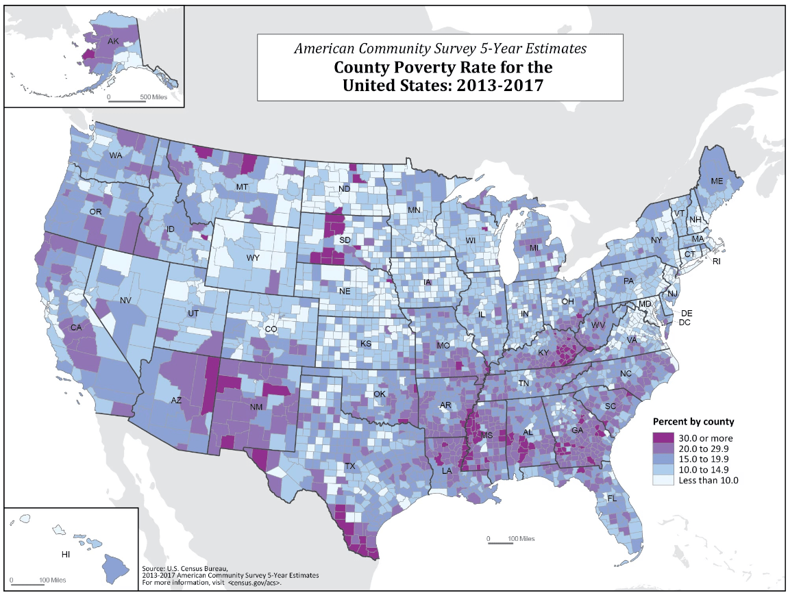
Local: county
300
This type of reference map shows political boundaries.
Political map
300
"I think Texas is not part of the South" is an example of this kind of analysis.
Regional
300
This is the belief that humans can modify and respond to the environment to better fit their needs
environmental possibilism
300
This is a system of satellites that orbit Earth and provide absolute distance and direction.
GPS
400
The map scale presented in the image. 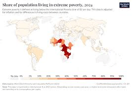
Global
400
This thematic map shows statistical data by transforming space.
Cartogram
400
A pizza delivery zone is an example of THIS type of region, and the Rocky Mountains are an example of THIS type of region.
Functional, Formal
400
These are physical artifacts that humans create that make up the landscape
Cultural landscape/built environment
400
This is a region that exists as an idea.
Vernacular/Perceptual region
500
The scale of analysis presented in this graph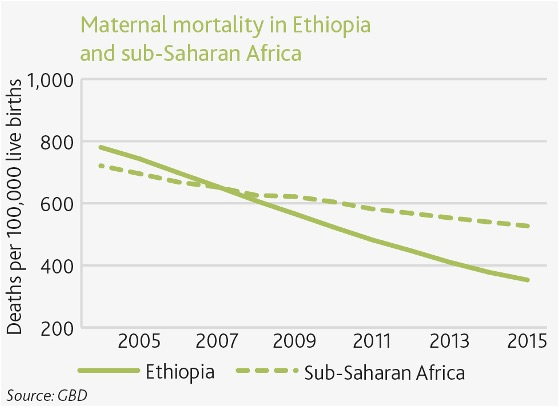
Regional
500
This map is created by a computer that can combine layers of spatial data.
GIS (geographic information system)
500
These are the three types of regions
Functional
Formal
Vernacular/perceptual
500
Environmental features of a location
Physical landscape
500
The term that describes the sense of bringing people closer together while the distances remain the same?
Time-space compression