Map Types and Spatial Analysis
Map Scale and Scale of Analysis
WORDS...LOTS OF WORDS...
Land usage and considerations
Other stuff...
100
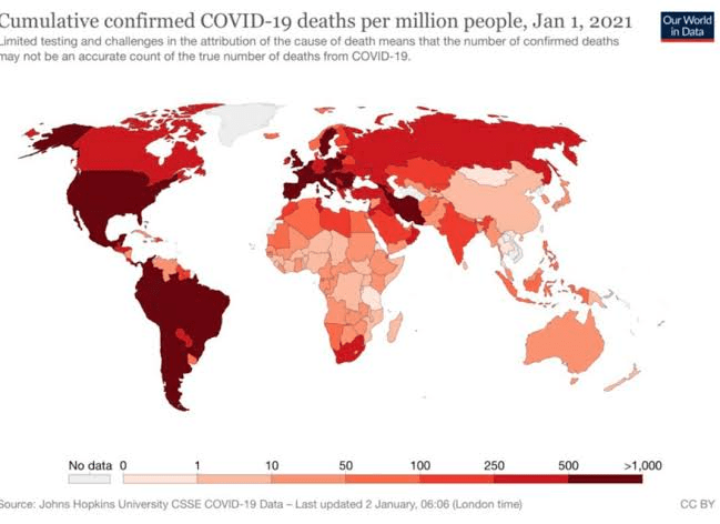
Identify the type of thematic map shown above.
What is choropleth?
100
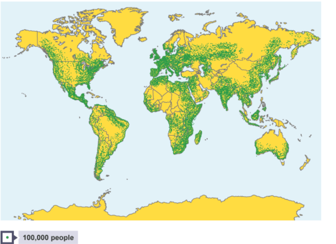
Identify the scale of analysis of the map.
What is global scale?
100
The geographic concept that implies humans have agency and can adapt to their environment and create thriving places to live is known as this.
What is possibilism?
100
This type of land use is most likely to be kept farthest away from residential communities.
What is industrial?
100
This type of qualitative data collection for geographers can give the most nuanced and in depth account of a location.
What is field obervation?
200
This type of map projection is most useful for navigation and direction on a global scale.
What is a Mercator projection?
200
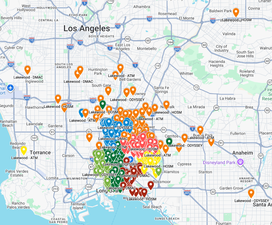 Identify the scale of analysis on the map above.
What is local?
200
This term refers to the exact physical characteristics and literal ground of a specific place.
What is site?
200
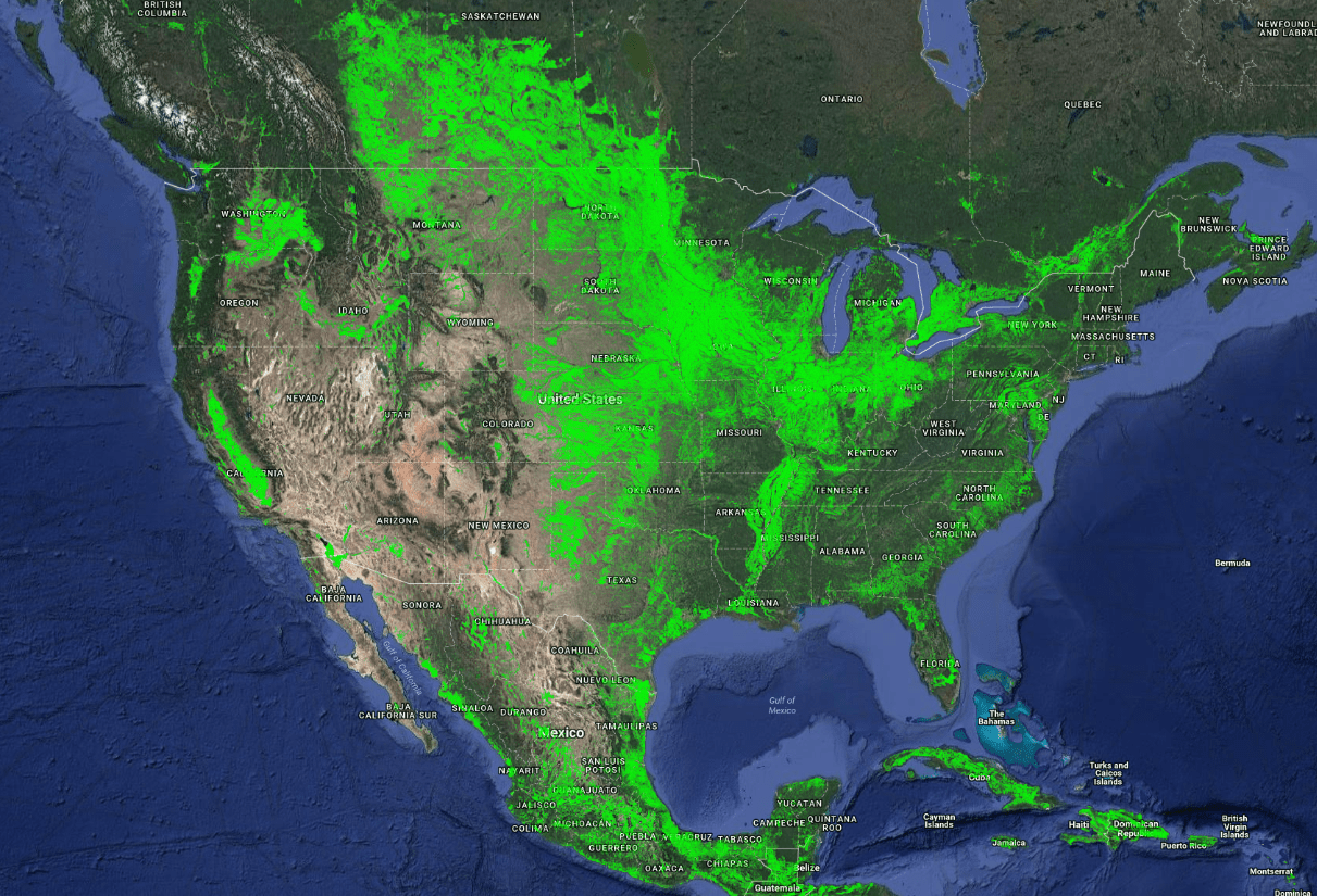
This GIS graphic is most likely displaying this type of land use data.
What is agricultural?
200
Identify the term that best matches with the area that the New York transit system services?
What is functional region?
300
This type of map projection is a good compromise map that distorts features equally for all regions.
What is a Gall-Peters projection?
300
A map that shows the details of a small, local area including street and school names would be considered this scale: large or small.
What is large scale?
300
What type of region is synonymous with perceptual regions?
What are vernacular regions?
300
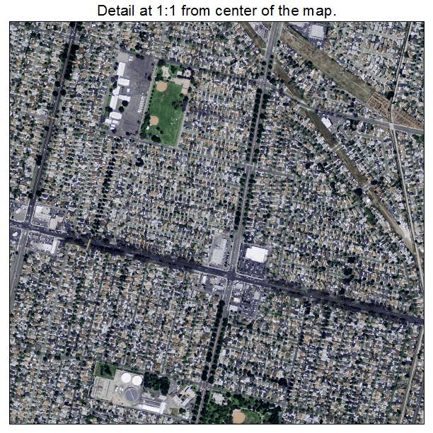 This Landsat image is showing mostly this type of land use.
What is residential?
300
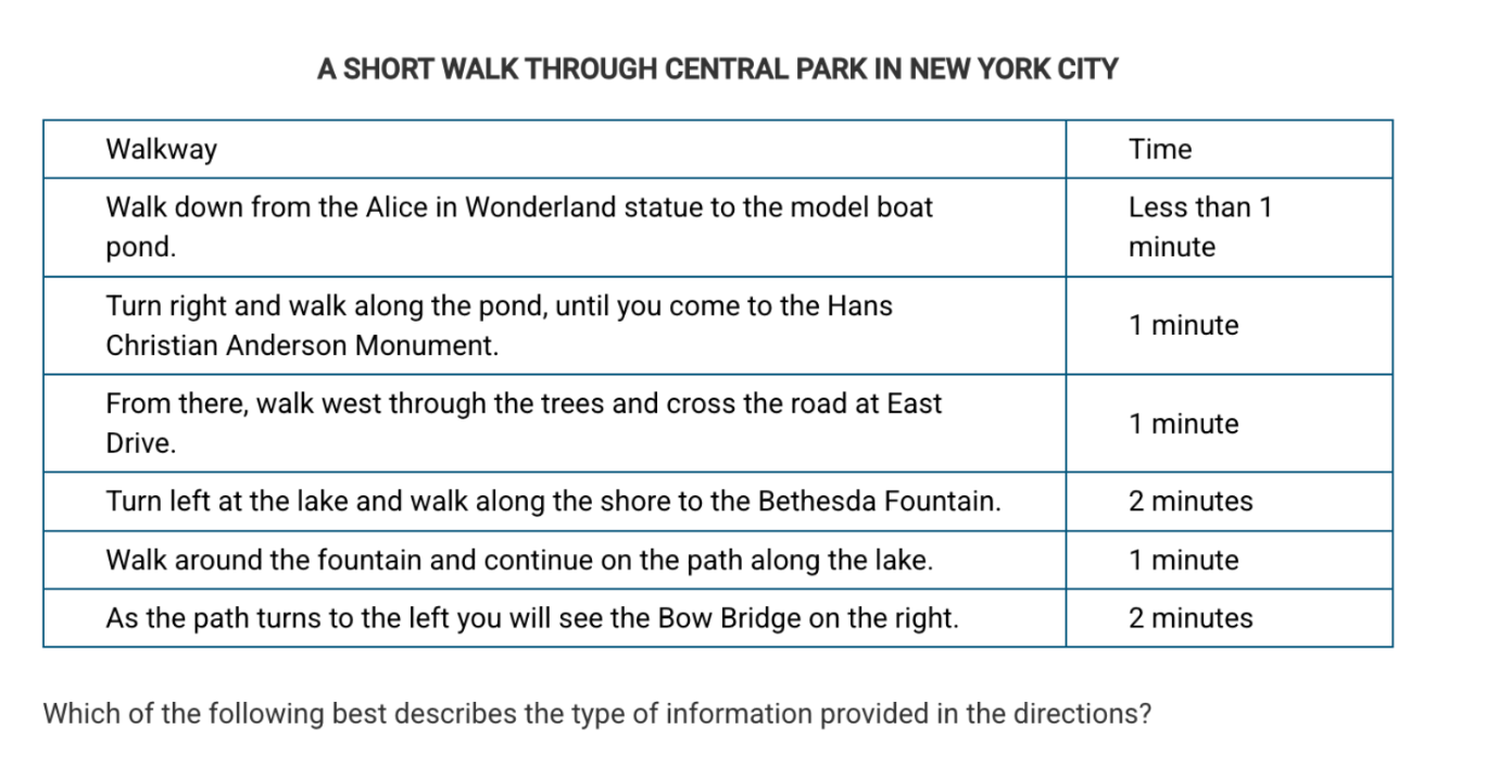
This type of geographic data is provided in the table.
What is relative distance?
400
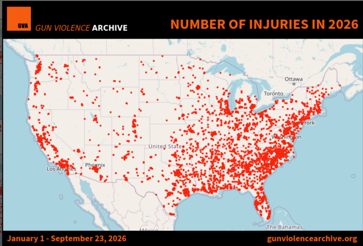 Describe the spatial analysis pattern in injuries by gun in the U.S.
There is a cluster of injuries in the Southeastern part of the U.S., there is a cluster of injuries in the southern states, excluding western Texas. There is a cluster of injuries due to guns in Southern California, specifically in Los Angeles, ... There are dispersed incidents of gun injuries in Nevada, the Dakotas, and other Great Plains states.
400
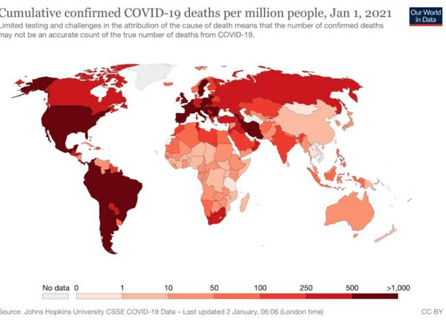
Identify the scale of analysis in the map above (how is data being presented?)
What is national scale?
400
This type of region is defined as having one uniform trait in physical or human characteristics
What is a formal region?
400
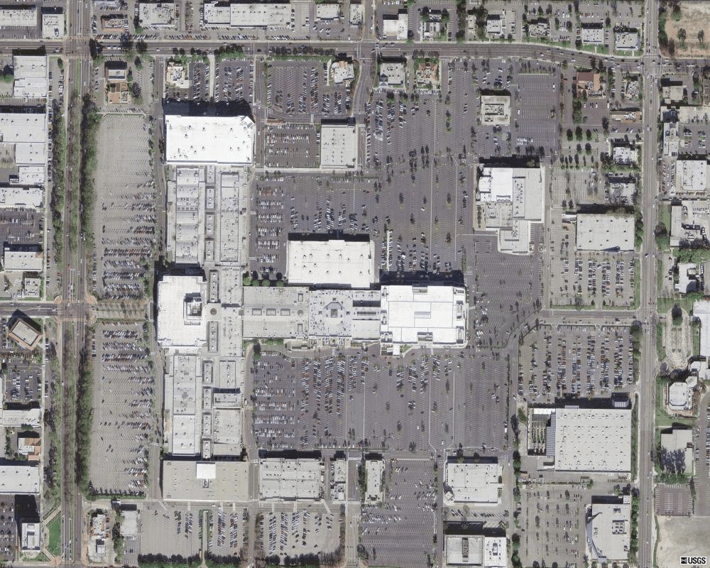
The above image is showing a satellite image of this type of land use.
What is commercial?
400
These three things contribute to distance decay and are known as causing friction on distance.
What are time, effort, and cost?
500
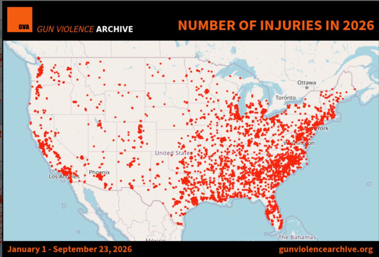
Identify the type of map above AND what other scale of analysis would be helpful to conduct - include what might be learned from using a different scale.
What is dot-distribution, local to determine what is happening in various regions within the U.S. or even at the state level (which is also local, or by town) many answers could be acceptable....
500
A state department official examines relationships between the U.S. and Iran.
What is National?
500
A progressive decline or reduction in trade, cultural exchange, or interaction between different places as the physical or relative distance between them increases is known as
What is distance decay?
500
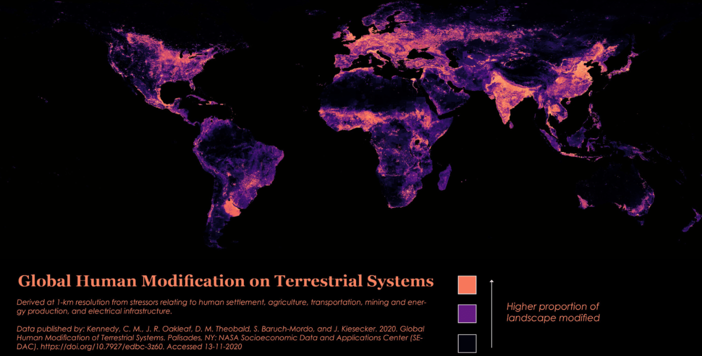
What key concept from unit 1 connects most to the image above, which shows human impact on the environment.
What is sustainability?
500
The geographic concept describing how advances in transportation and communication technologies make the world feel smaller is known as this.
What is the time space compression?