COLONIAL ECONOMY
AGRICULTURAL REGIONS
ROMAN EMPIRE
LEGEND & SYMBOLS
MAP INFERENCES
100
Which product is shown in both Virginia and North Carolina?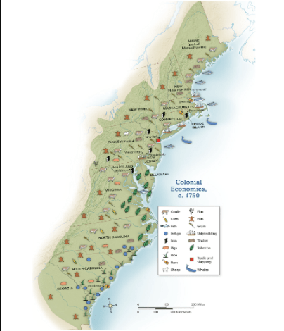
Tobacco
100
Which agricultural region is concentrated around the Great Lakes and Midwest?
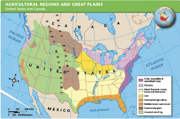
Corn
100
Rome is located near the center of which peninsula?
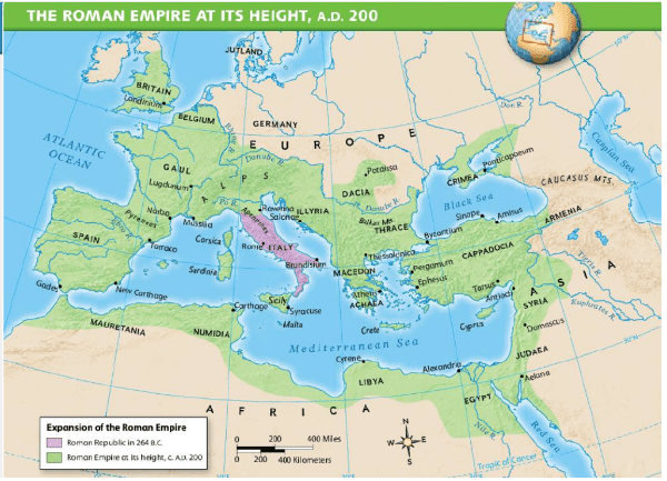
The Italian Peninsula
100
What does the red square symbol represent on the colonial map?
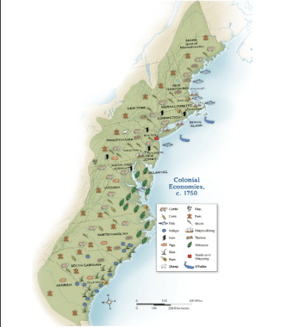
Trade and shipping
100
Why are fishing and shipbuilding symbols concentrated along the coast?
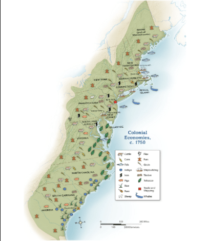
Those activities depended on access to the ocean.
200
Which activity is clustered near New England ports such as Boston and Portsmouth?
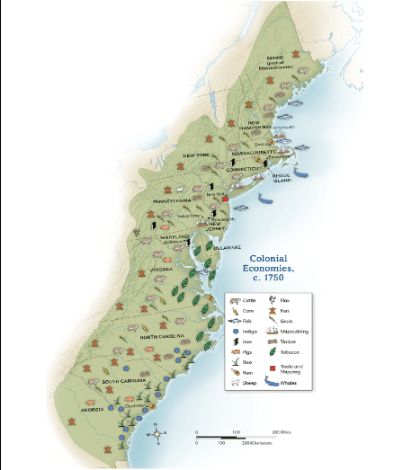
Shipbuilding
200
Which land use covers the largest area of the western United States?
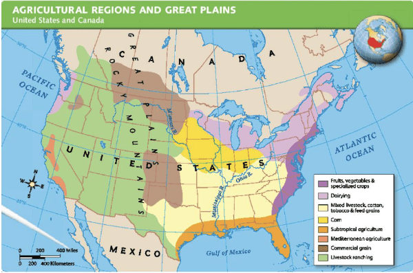
Livestock ranching
200
According to the legend, where was the Roman Republic in 264 B.C. mainly centered?
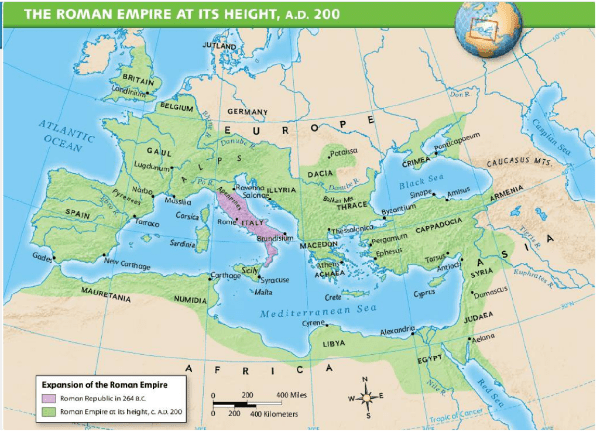
Italy and nearby Mediterranean islands
200
What product is represented by the green leaf symbol?
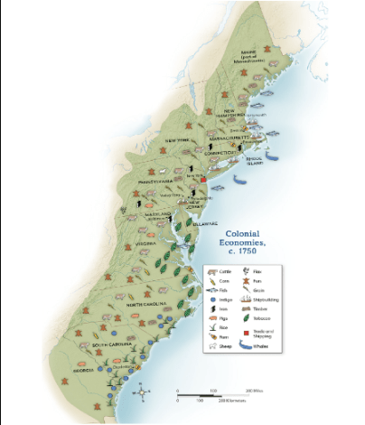
Tobacco
200
What does the large ranching region suggest about much of the western land?
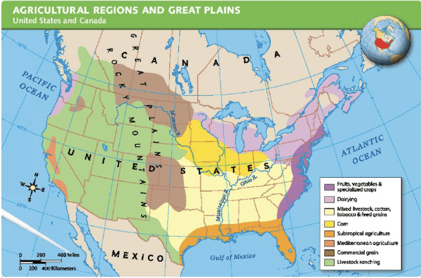
It is better suited to grazing animals than intensive crop farming.
300
Which two cash crops appear along the coast of South Carolina and Georgia
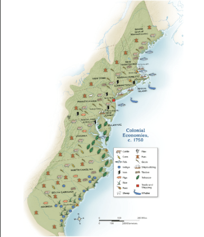
Rice and indigo
300
Which agricultural region stretches along much of the Gulf Coast?
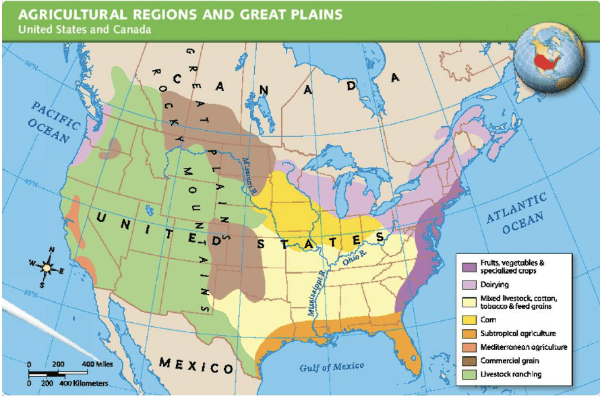
Subtropical agriculture
300
Which sea was nearly surrounded by the Roman Empire at its height
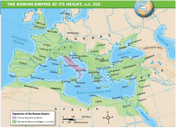
The Mediterranean Sea
300
What does the light-green shading represent on the agricultural map?
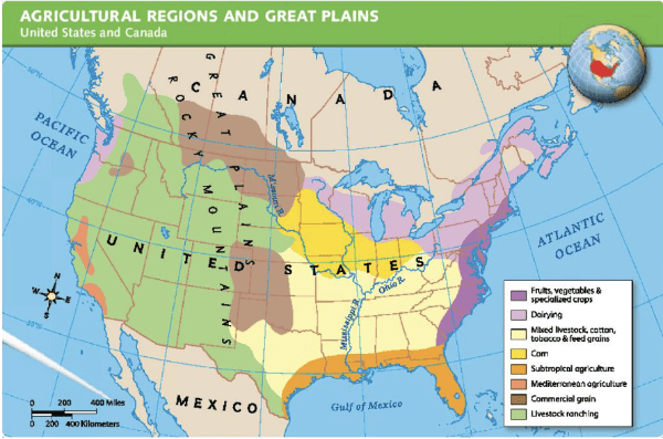
Livestock ranching
300
What does the map show about Roman expansion between 264 B.C. and A.D. 200?
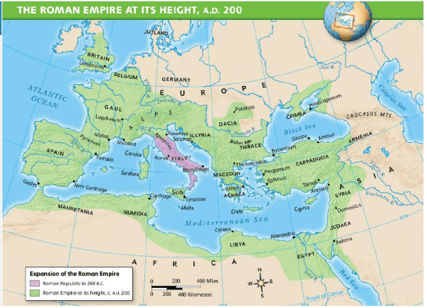
Rome expanded far beyond Italy into Europe, Africa, and Asia.
400
Which colony shows iron, timber, cattle, grain, and furs in its economy?
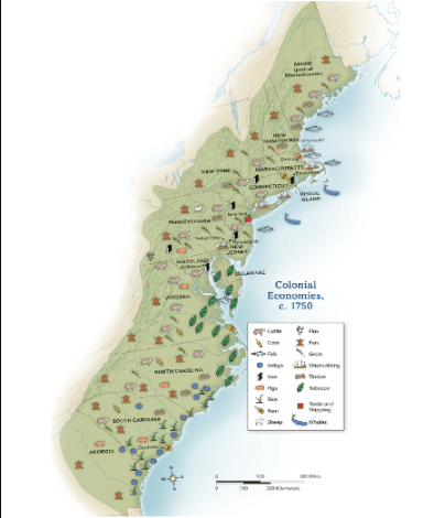
Pennsylvania
400
On which two coasts are fruits, vegetables, and specialized crops shown?
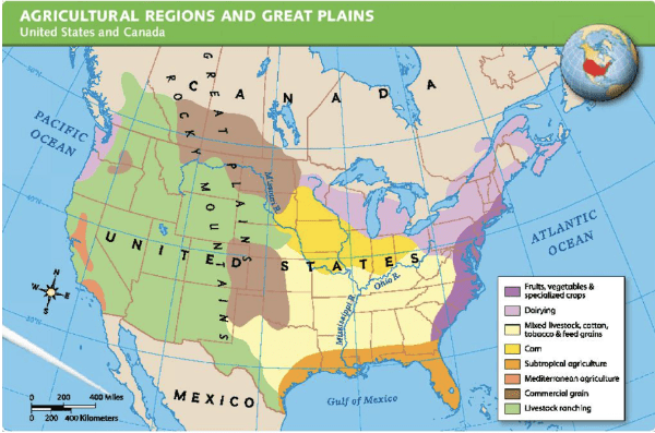
The Atlantic and Pacific coasts
400
Which labeled city lies in Egypt near the Mediterranean coast?
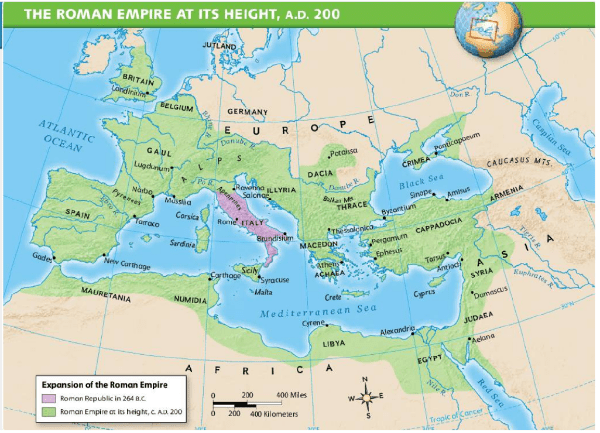
Alexandria
400
What does the green shading show on the Roman map?
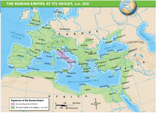
The Roman Empire at its height, around A.D. 200
400
Why might subtropical agriculture appear farther south than dairying?
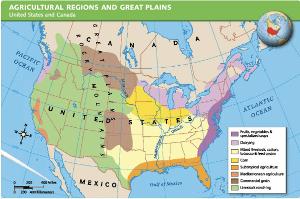
The South has a warmer climate and longer growing season.
500
How did New England’s coastal economy differ from the Southern colonies?
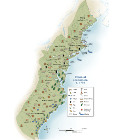
New England relied more on fishing, whaling, trade, and shipbuilding; the South relied more on cash crops.
500
Which activity forms a broad north-south region through the central Great Plains and Canada?
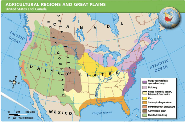
Commercial grain
500
What geographic advantage would controlling land around the Mediterranean give Rome?
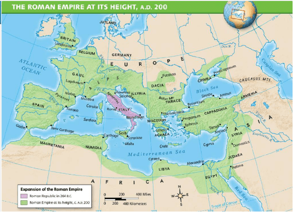
Control of sea travel, trade routes, and movement between regions
500
What map tool helps estimate the distance between Rome and Carthage?
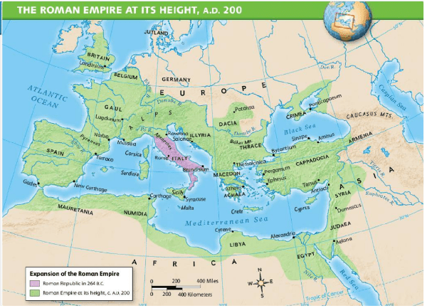
The scale bar
500
Why would the Mediterranean Sea help connect a very large empire?
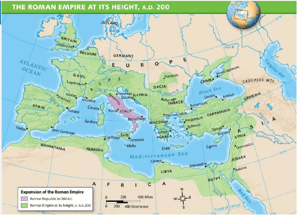
Ships could move people, goods, soldiers, and information between distant regions