extras
Longitude and latitude
Synoptic charts
What are the meaning for each map ?
Maps
100
Which one is the correct definition of an area reference ?
a. A four digit number used to find a general location on a map specifying a specific grid square.
b. what is located per square and the different natural resources place in each grid square.
a. 😁😁😁😁
100
Draw the lines of longitude and latitude ?


100
What is a synoptic chart ?
a. a synoptic chart records data and trends of the local relief
b. a synoptic chart records and picks up frequency
c. a synoptic chart is a weather map that uses symbols for different weather conditions
c. 😎
100
What is the right definition of a road map ?
a. shows the boarder of states and countries
b. shows goods produced or found in a area
c. shows the highways, streets, and landmarks
c 😆
100
What type of map is this ?
a. resource map
b. political map
c. weather map
d. road map
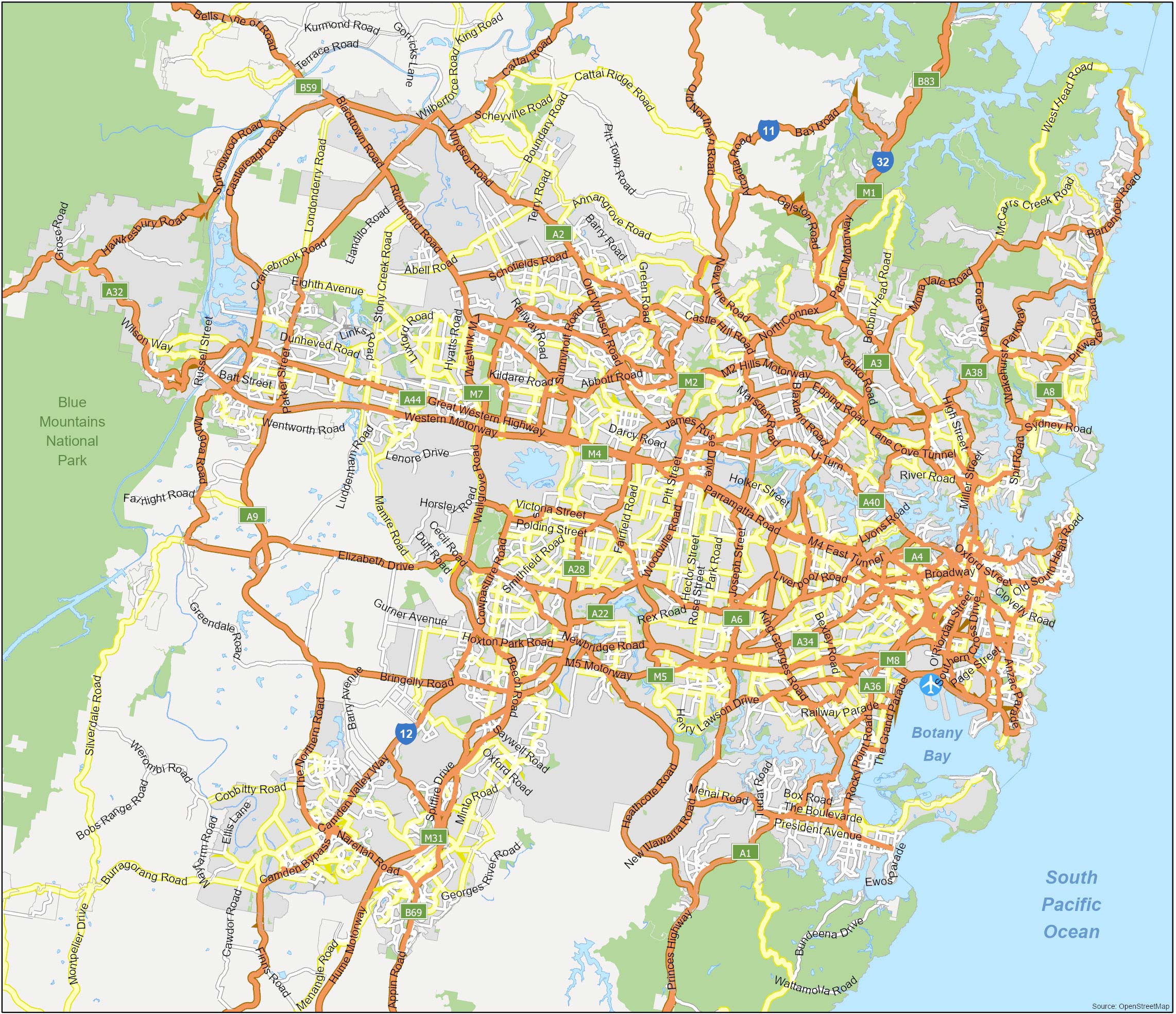
d. road map
200
What is the definition of a grid reference ?
a. Each per grid square applies a different value depending on the line of the y and x axis
b. A map reference indicating a location in terms of series vertical and horizontal grid line identified by numbers or letters.
b. 😅 This was a hard one
200
What is the definition of longitude ?
a. Longitude is how far the north and south of the equator is. The measurement is between 0 degrees at the equator and 90 degrees either north or south of the equator. It runs for east to west on a map.
b. Longtidude is measure how far east or west of prime meridian a location is. The prime meridian is a an imaginary line at 0 degrees that runs from the north pole to the south pole passing through Greenwich, a suburb of London. The measurement is 0 degrees of the prime meridian and 180 degrees of the international date line. There lines run from north to south on a map.
c. Runs diagonally and horizontally across the map locating the prime meridian and the equator.
b. This was a hard one 😅
200
Which one is a synoptic chart ?
a. 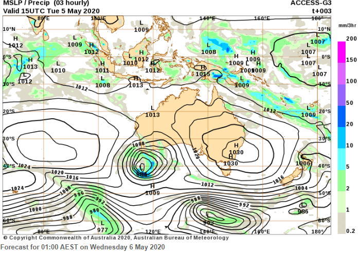
b. 
c. 
a and c did i get you on this one 🤣😂
200
What is the right definition of a topographic map ?
a. shows the land features such as water or mountains
b. shows the natural elevation of the land
c. shows the boarders of the states and countries
b😁
200
What type of map is this ?
a. political map
b. resource map
c. legend
d. physical map
b. resource map
300
Is the equator is the line of latitude that runs through the center of the Earth ? True or false ?
True the equator is a a primary line of latitude.
😏
300
What are the four hemispheres ?
Northern and southern
Eastern and western
This was an easy one 🤦♀️😅
300
How do you read a synoptic chart ?
a. interpret the lines and symbols to understand the weather system
b. understanding the legend, and identify symbols etc..
c. use the title, legend and compass to understand the directions
a. hope you got this one right 😒😂😁
300
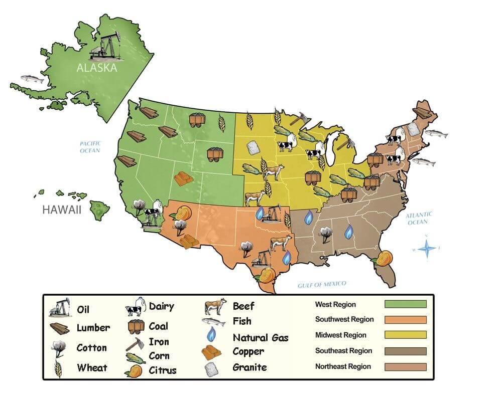
What is the right definition of a resource map ?
a. shows highways, streets, and countries
b. shows goods produced or found in an area
c. shows land features such as water or mountains
b 👌
300
What type of map is this ?
a. physical map
b. political map
c. resource map
d. country map
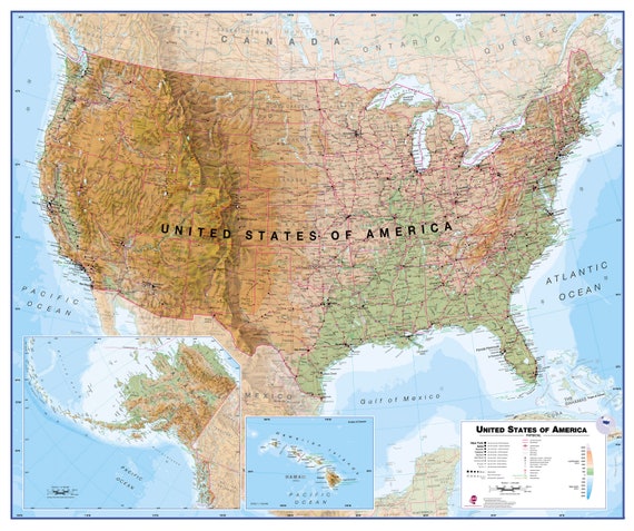
a. physical map
400
The prime meridian is the line of latitude at 0 degrees ? True or false
False 😒
400
The international date line is located 0 degrees of longitude ? True or false ?
False 😅😏
400
Is a climate graph similar to a synoptic chart ?
a. true
b. false
b. false I got you on this one right 😂😒😀😅😆
400
What is the right definition of a physical map ?
a. shows land features such as water or mountains
b. shows the borders of states and countries
c. shows the natural elevation of the land
a ☺️
400
What type of map is this ?
a. physical map
b. political map
c. resource map
d. flag map
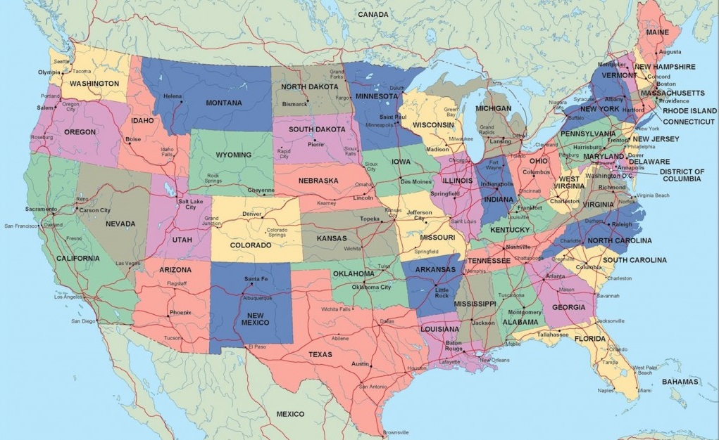
b. political map
500
What is the acronym for BOLTS ?
a) Biodiversity, Orientation, Length, Topographic, Scale
b) Border, Orientation, Legend, Title, Scale
c) Border, Orientation, Length, Title, Scale
B) ☺️😁🥰
500
Look at the answer
I just want you to know that even if you get a bad mark it will be ok yr 7 is when you can improve and learn from those mistakes 😆🥰☺️
500
What word matches this weather symbol ?
A) Warm front
B)Isobar
C)Cold front
C)😁
500
What is the right definition of a political map ?
a. shows the flag and culture of the country
b. shows the borders of states and countries
c. shows the highways, streets, and landmarks
b 😍
500
What type of Map is this
a. Road map
b. Weather map
c. Topographic map
d. contour map
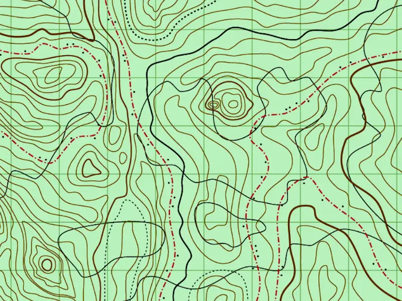
b. Topographic map