The basics
Our 3D world
Projections and GIS
Types of Maps
100
What kind of maps do sailors use?
Charts
100
Where do cartographers get the points for their map projections?
A 3D sphere
100
What does GIS stand for?
Geographic Information System
100

What type of map is this?
Thematic
200
Why don't we use maps with an oblique view anymore?
They distort the distance between images
200
What is the starting point of latitude?
Equator
200
Who makes maps?
Cartographer
200

What type of map is this?
Topographic
300
A degree is about how many nautical miles
60 nautical miles
300
Daily Double!
What do we use to map the ocean floor?
Acoustic sensing
300
What areas of the world are conic projections most used for?
The middle of the earth
300
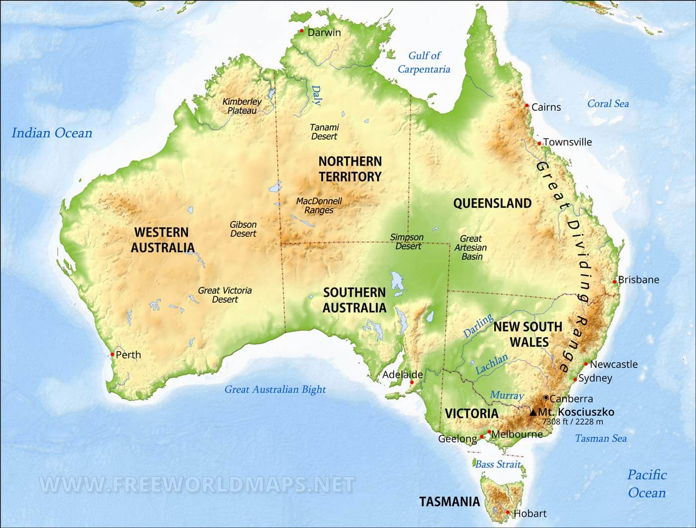
What type of map is this?
Geographic
400
At least how many satellites does a gps receiver need to get an accurate location?
Three
400
How do topographic maps show elevation?
Contour lines
400
What are the three ways that we can collect data for GIS?
Surveying
Remote Sensing
Acoustic Sensing
400

What type of map is this?
Political
500
What are the four standard map features?
Some kind of scale information
Map legend
A title, copyright, etc.
North is at the top of the map
500
What are the three evidences that tells us that the earth is a sphere?
Ships far out on sea slowly disappear below the horizon.
Some stars can only be seen from certain parts of the earth at the same time.
During a lunar eclipse, earth's shadow on the moon is always round
500
Where do gnomonic projections start from and what areas are they used to map?
Starts from the earth's center
Used for maps of the polar regions
500
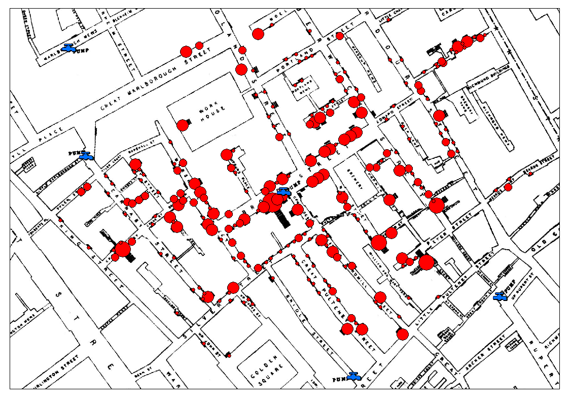
This is John Snow's cholera map. What type of map is this?
Thematic