Maps
Topo Maps
Weather Maps
Geologic Maps
Solar System
100
The type of map projection that has lines of longitude parallel to each other as well as lines of latitude parallel to each other. Good for navigation but the land near the poles is distorted in size.
What is Mercator (projection)?
100
Lines of equal elevation on a topographic map.
What are contour (isoelevation) lines?
100

The type of weather front represented by this symbol.
What is cold front?
100

The natural resource found in Virginia that is used in the production of electricity.
What is coal?
200
Lines that measure east or west of the prime meridian.
What are longitude lines?
200
Marks on topographic contour lines that indicate a depression.

What are hachure marks?
200
Lines of equal pressure on a weather map.
What are isobars?
300

The latitude and longitude of point D.
What is 30°N, 90°W?
300
The change in elevation between two adjacent contour lines.
What is the contour interval?
300
The type of weather Virginia should experience in the next 24 hours based on the map.
What is cooler, cloudier, chance of rain.
400
With a map ratio of 1:25,000 this is the real distance represented by 1 cm on the map.
What is 25,000 cm?
400

The elevation of point B on the topographic map in feet.
What is 165 feet?
400
Stormy weather is most likely located there.
What is around the L (low pressure)?
500

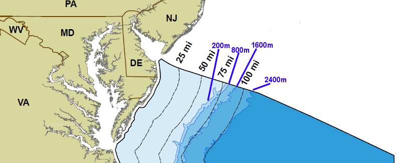
The approximate distance from shore where the 200 m depth is shown on the continental shelf.
What is 62 miles?
500
Daily Double

Match the profiles to their topographic maps.
What is 1B, 2E, 3D, 4C, 5F, 6A?
500

The wind speed & direction and the sky cover (clouds) at some weather station.
What is 20 Knots NNE direction 100% clouds (8/8). (It is also raining.)
500

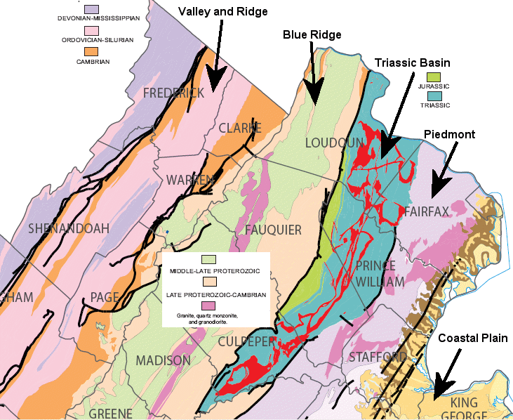
The age of the rocks found in the Blue Ridges.
What is middle to late proterozoic?