Name that Depositional Feature
Poorly Sorted Questions
Deposits left behind by agents of Erosion
Weathering
Cry Me a River
100
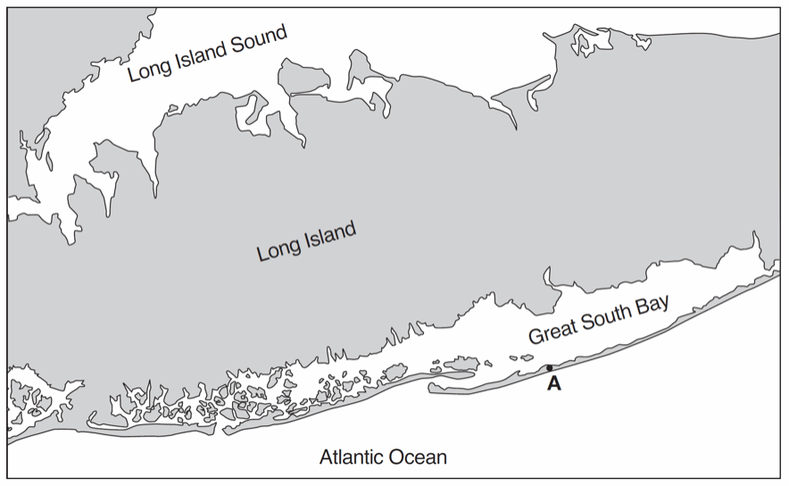 On which landscape feature is point A located?
a) Moraine
b) Delta
c) Barrier Island
d) Floodplain
c) Barrier Island
100
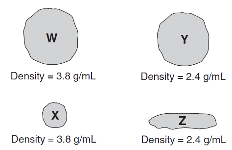 Which particle will most likely settle to the bottom first as the velocity of this stream decreases?
a) W
b) X
c) Y
d) Z
a) W
100
The sediment deposited by a landslide is usually
a) sorted and layered
b) sorted and non-layered
c) unsorted and layered
d) unsorted and non-layered
d) unsorted and non-layered
100
As a quartz people is transported by a stream, the pebble will become more rounded as a result of
a) dissolving as water is running over the rock
b) abrasion by colliding with other rocks
c) deposition in well-sorted layers
d) resistance to weathering and erosion
b) abrasion by colliding with other rocks
100
What is the minimum water velocity necessary to maintain movement of 0.1-centimeter-diameter particles in a stream?
A) 0.02 cm/s
B) 0.5 cm/s
C) 5.0 cm/s
D) 20.0 cm/s
C) 5.0 cm/s
200
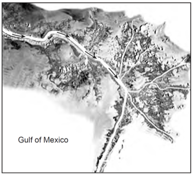
This depositional feature in the Gulf of Mexico is best identified as
a) a delta
b) a sandbar
c) a barrier island
d) an outwash plain
a) a delta
200
How does the shape of a valley eroded by a glacier differ from the shape of a river valley?
A glacier froms a U-shaped valley
200
A large, scratched boulder is found in a mixture of unsorted, smaller sediments forming a hill in central New Jersey. Which agents of erosion most likely transported and then deposited this boulder?
a) wind
b) a glacier
c) ocean waves
d) running water
b) a glacier
200
Which characteristic would most likely remain constant when a limestone cobble is subjected to extensive abrasion?
A) Shape
B) Mass
C) Volume
D) Composition
D) Composition
200
A river's current carries sediments into the ocean. Which sediment size will most likely be deposited in deeper water farthest from the shore?
A) pebble
B) Sand
C) Silt
D) Clay
D) Clay
300
The photograph below shows an elongated hill that was originally deposited by a glacier.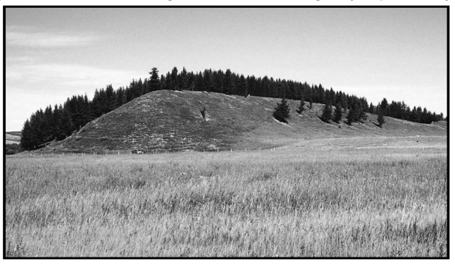 This landscape feature is identified as a
A) dune
B) terminal moraine
C) drumlin
D) outwash plain
c) drumlin
300
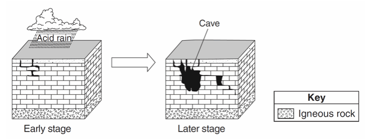
Which types of weathering and erosion are primarily responsible for the formation of caves?
A) chemical weathering and groundwater flow
B) chemical weathering and runoff
C) physical weathering and groundwater flow
D) physical weathering and runoff
A) chemical weathering and groundwater flow
300
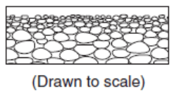
The pattern of sediment size shown indicates that these sediments were most likely deposited within a
A) landslide
B) drumlin
C) moraine
D) delta
D) delta
300
Which type of climate has the greatest amount of rock weathering caused by frost action?
A) a wet climate in which temperatures remain below freezing
B) a wet climate in which temperatures alternate from below freezing to above freezing
C) a dry climate in which temperatures remain below freezing
D) a dry climate in which temperatures alternate from below freezing to above freezing
B) a wet climate in which temperatures alternate from below freezing to above freezing
300
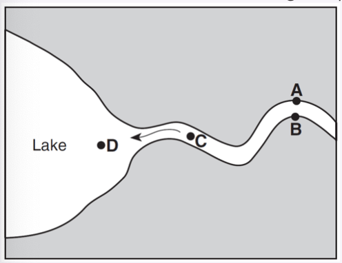
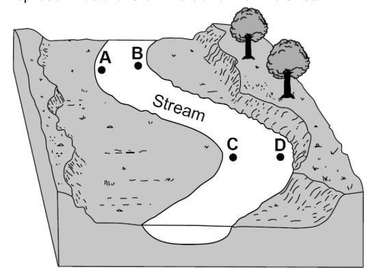 At which two locations would the stream most likely be the deepest?
A and D
400
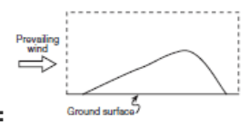
Draw a sketch showing the general sideview of a sand dune formed by wind blowing in the direction indicated. Your sketch should clearly show any variations in the slope of the sides of the dune.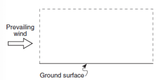
400
A stream's velocity decreases from 100 cm/s to 5cm/s. Which size sediment particles will still be transported by the stream?
A) pebbles, sand, silt, and clay
B) sand, silt, and clay, only
C) silt and clay, only
D) clay, only
B) sand, silt, and clay, only
400
The diagram represents an erosional-depositional system in an arid environment, and indicates the process occurring at various locations within the atmosphere and on the land surface. The box labeled X identifies one sand dune. Arrows represent the movement of particles.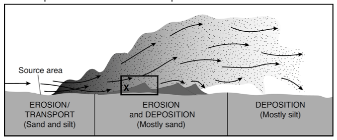
The total range of particle sizes indicated in this system is
a) less than 0.0004 cm
b) 0.0004 to 0.006 cm, only
c) 0.006 to 0.2 cm, only
d) 0.0004 to 0.2 cm
d) 0.0004 to 0.2 cm
400
Which long-term atmospheric changes would increase the rate of chemical weathering of surface bedrock?
A) decreasing temperature and decreasing precipitation
B) decreasing temperature and increasing precipitation
C) increasing temperature and decreasing precipitation
D) increasing temperature and increasing precipitation
D) increasing temperature and increasing precipitation
400
Sediment is deposited in a river delta because the
A) velocity of the river decreases
B) force of gravity decreases
C) volume of the river increases
D) gradient of the river increases
A) velocity of the river decreases
500
Points A and B are locations at the edge of a stream. The data table gives the depth of the water and distance from point A, in feet, along line AB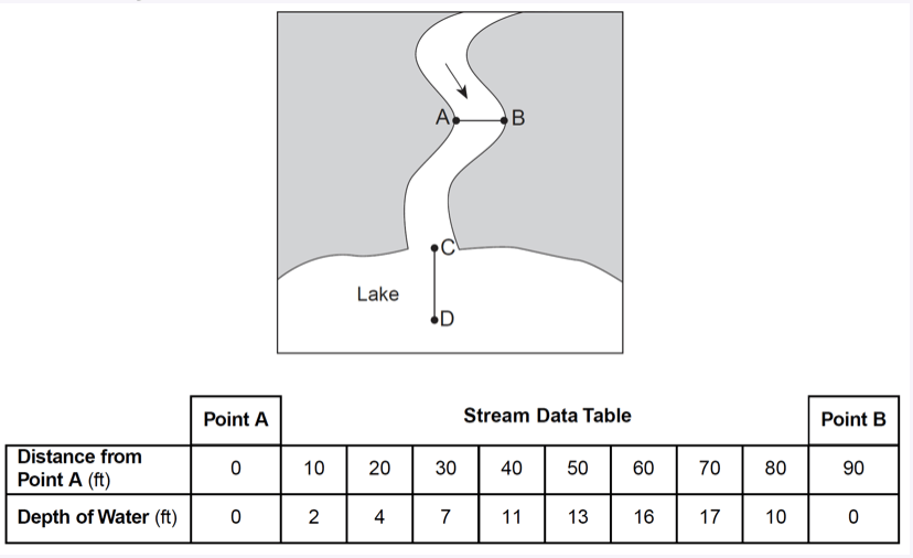 Using the map and the data table, explain why the depth of water 20 feet from point A is different from the depth of water 20 feet from point B.
-More deposition occurred on the inside of the meander
-Stream water moves slower on the inside curve
-More erosion occurs on the outside of a bend
500
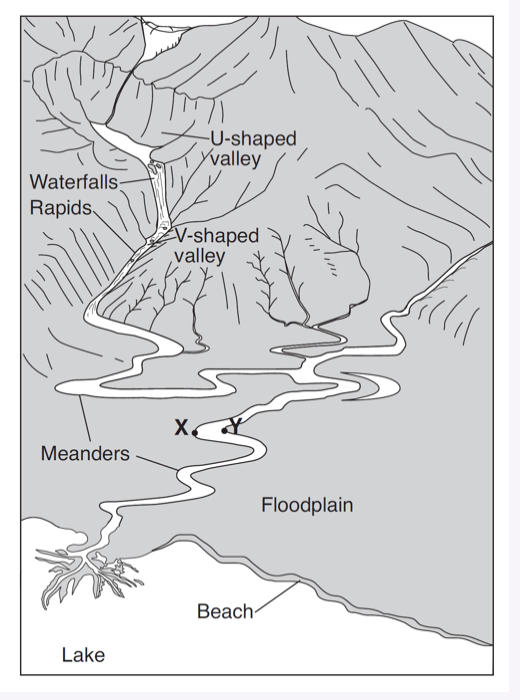 Explain why the stream meanders on the floodplain, but not in the mountains.
— The stream began to flow over a nearly flat landscape.
— Stream velocity decreased.
— Gradient decreases from the mountains to the floodplain.
— The stream flows more slowly on the floodplain.
500
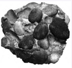 Describe the evidence from the photograph that supports the inference that the particles in this rock were most likely transported by running water.
The particles are smooth and have round shapes.
500
Which rock will weather at the fastest rate when exposed to acid rain?
a) granite
b) limestone
c) gneiss
d) quartzite
b) limestone
500
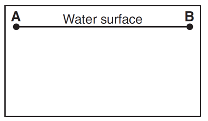
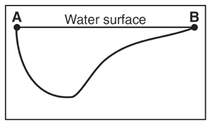
In the box below, draw a cross-sectional view of the general shape of the stream bottom between points A and B. The water surface line has already been drawn.