Topographic Maps
Random
Map Terms
GPS/GIS
Latitude/Longitude
100
The change in elevation between any two contour lines is called the contour __________________
Interval
100
This land feature has low relief and low elevation
Plains
100
A model shaped like a sphere that represents Earth's entire surface.
Globe
100
What does GPS stand for?
Global Positioning System
100
This is the name for 0˚ Longitude
Prime Meridian
200
Which of the following will not be shown on a topographic map?
A. Elevation
B. Lakes
C. Temperature
D. Roads
C. Temperature
200
This land feature has high elevation and high relief
Mountain
200
This relates distance on a map to distance on Earth's surface
Scale
200
What latitude line run almost directly through our school?
A. 16˚N
B. 80˚N
C. 40˚N
D. 5˚N
C. 40˚N
200
This is the name for 0˚ Latitude
Equator
300
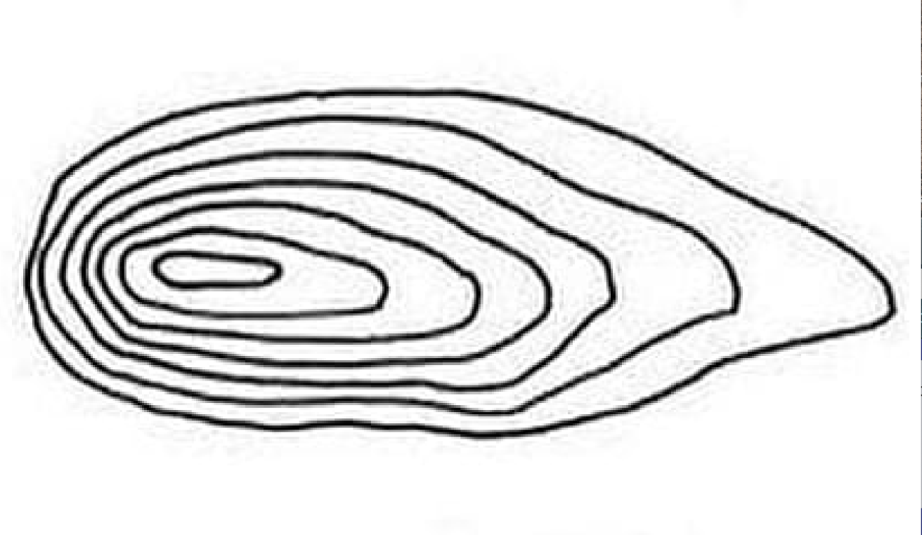
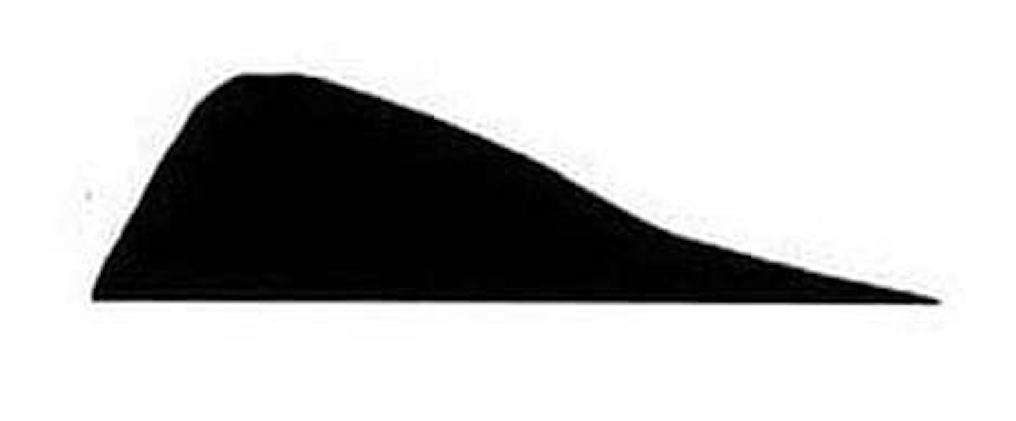
Draw a side view of this land feature.
300
This land feature has high elevation but low relief
Plateau
300
Another name for half of the Earth
Hemisphere
300
How would this GPS position be read? Fill in the blank
24˚ 16' 23.45" S
24 degrees, 16 __________, 23.45 __________ South
minutes
seconds
300
Which state is located at 30˚N, 100˚W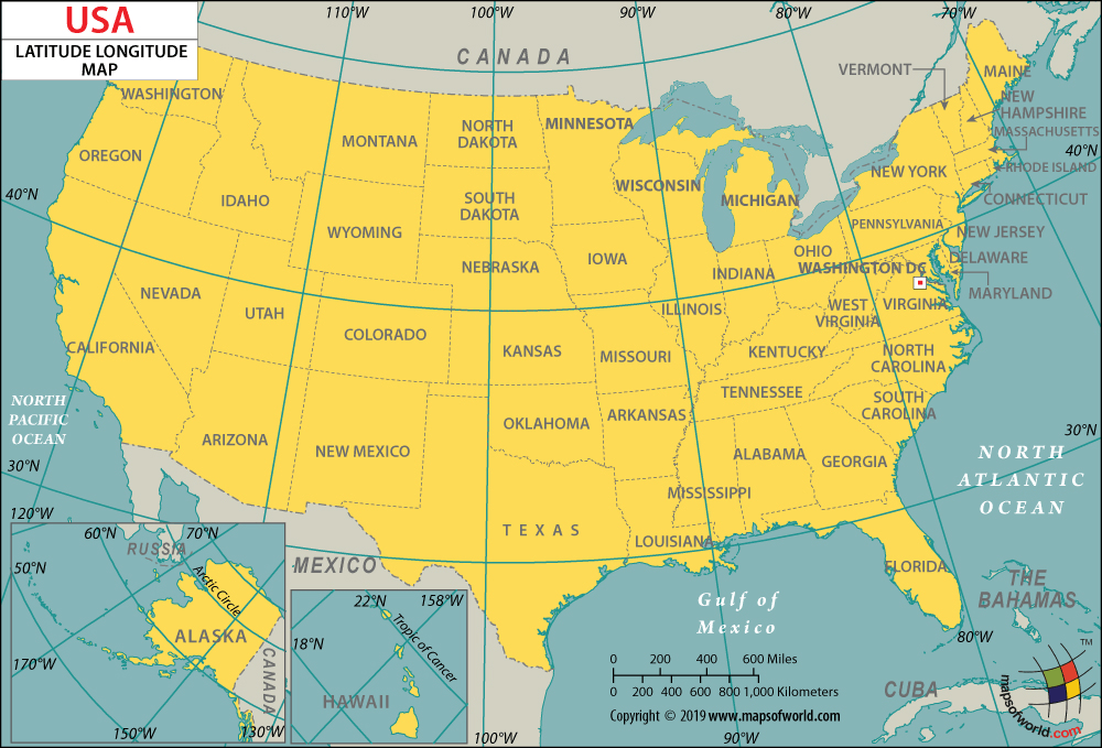
Texas
400
What does the circle on this topographic map represent?
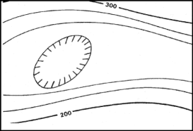
Depression
400
Which would be most likely to have a higher elevation.
Coastal Plains
OR
Interior Plains
Interior Plains
400
This lists all of symbols used on a map with an explanation of their meaning.
Key or Legend
400
What is GIS and what does it stand for?
GIS stands for Geographic Information System and acts as a tool to represent information on a map like rainfall, wind, locations, etc.
400
Which state is located at 40˚N and 110˚W
Utah
500
What is the contour interval on this topographic map?

10 feet
500
What is Remote Sensing?
The process of collecting information about an object or area from far above the surface being studied.
500
Name the map projection most commonly used in schools that shows the correct shape of countries but incorrect sizes closer to the poles.
Mercator Projection
500
What is Sonar?
A system that uses sound waves to detect and measure objects underwater and on the ocean floor.
500
Which Pennsylvania city is closest to 40˚N, 79˚W
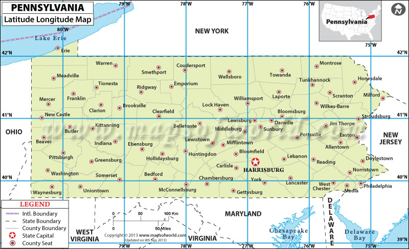
Somerset