What in the World?!
MAPS YOOOO
Get Griddy
Factors Fo'Shizzle
City Livin' Dude
100
What is a Continent?
A Large Mass of Land Containing many Countries
100
What is the "O" in the acronym BOLTSS
Orientation
100
What is Grid Referencing?
The Term for Using a Grid to Locate Things on a Map
100
What are the 5 Factors of Liveability?
Environment, Social, Culture, Economy, Infrastructure
100
Where did we go to for our excursion?
Heritage Forest
200
What is Australia's largest State/Territory?
Western Australia
200
What is this Map Feature:
Legend
200
What are Eastings on a grid?
They are Vertical Lines which increase in value as they move Eastward
200
Name 3 examples of the Culture factor.
Places of worship, community recreational facilities (including sporting clubs), entertainment venues, public libraries, restaurants, licensed clubs, ethnic diversity
200
What is The Most Liveable City in the World this year?
Vienna, Austria
300
What is the Largest Ocean in the World?
Pacific Ocean
300
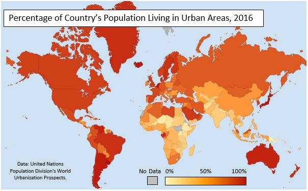
What is "Percentage of Country's Population Living in Urban Areas, 2016" according to BOLTSS?
Title
300
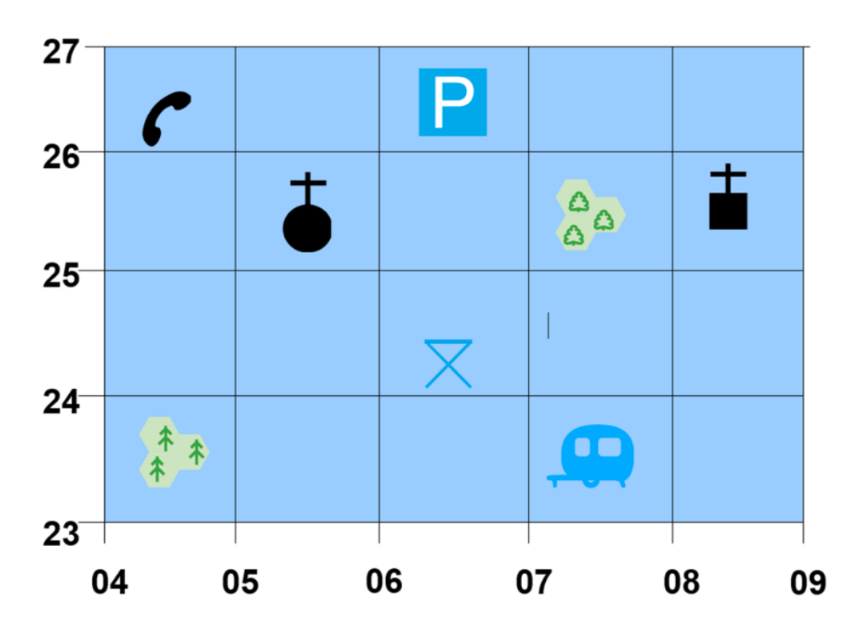
If you looked at a grid referencing map like this, which numbers would you read first, then second?
The number at the bottom first (Eastings), then the number on the side (Northing).
300
Definition of "Place"
Place is the physical location plus the meaning of that place.
300
Name another city/country that was on the Top 10 Liveable Cities in 2024 besides Melbourne and Sydney (Australia).
Copenhagen (Denmark)
Zurich (Switzerland)
Calgary (Canada)
Geneva (Switzerland)
Vancouver (Canada)
Osaka (Japan)
Auckland (New Zealand)
400
Which continent has the lowest population?
Antarctica
400
What is the "imaginary circle" around the middle of Earth?
Equator
400

What is the location of The Pink Shirt Person
(20,42)
400
What factor does employment opportunities and affording housing fall under?
Economy
400
What award did Launceston win in 2022?
2022 Aussie Town of The Year
500

The Continent Labelled 5
South America
500
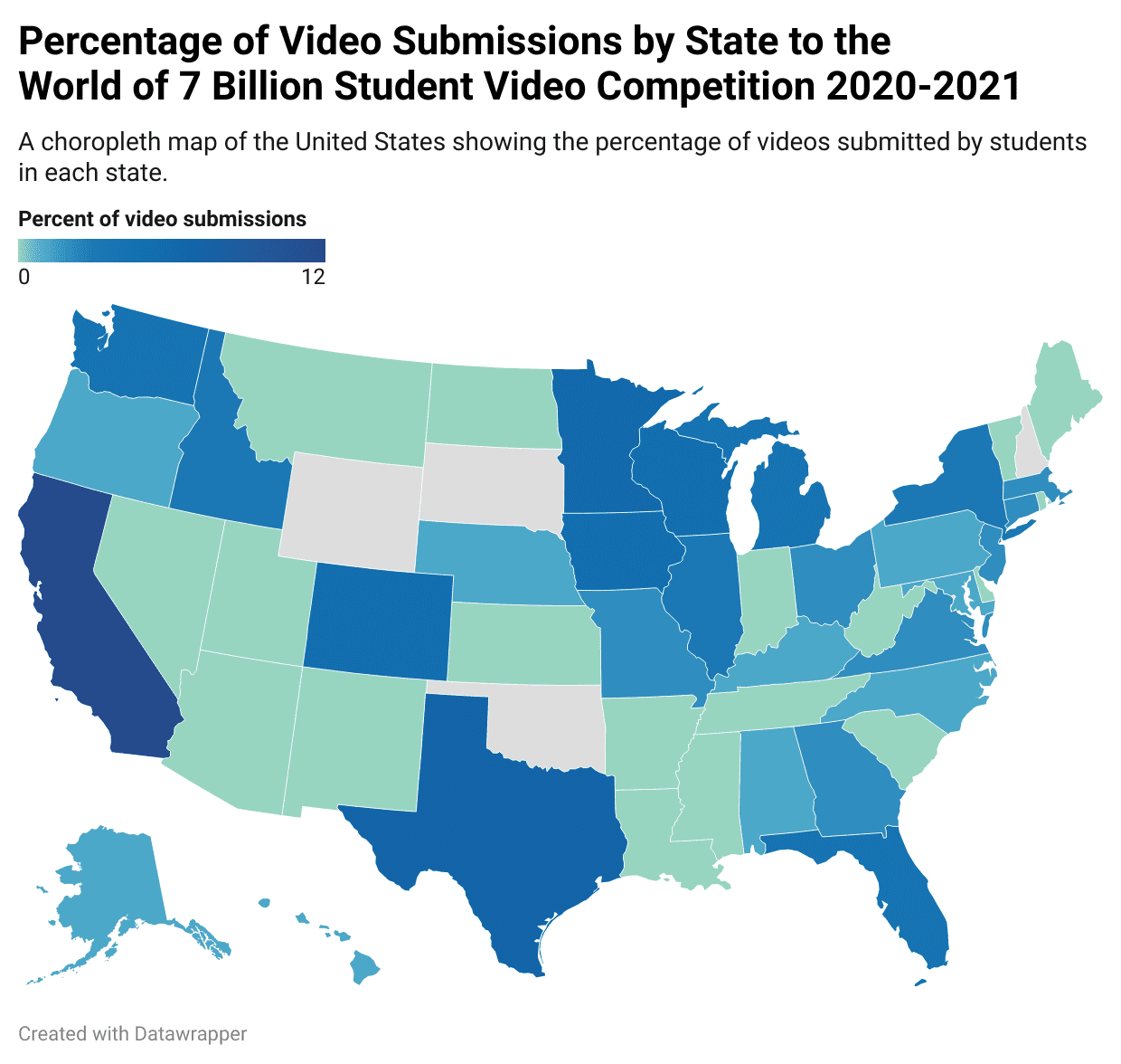
What type of map is displayed above?
Choropleth Map
500
The 6 Figure Grid Reference for the Red 'X'
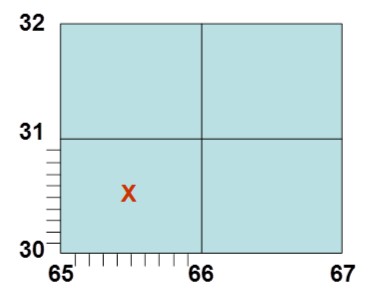
(655,305)
500

What factor would be related to this Picture, and what is a concern related to it?
Factor: Infrastructure
Concern: Safety/danger/overcrowded
500
What is the name of the mapping projection that is commonly used for creating maps?
Mercator Projection