Landforms
Maps
Vocabulary
Continents & Canada
Miscellaneous
100
Which of the following is NOT a landform?
Valley, River, Canal, Isthmus
Canal
100
What is a compass rose?
a small drawing on a map that shows direction
100
What is physical geography?
Features on the earth that are made naturally
100
What continent do we live on?
North America
100
What do we call a mapmaker?
A cartographer
200
What is a hemisphere?
Half of a sphere. Geographers use the equator and the prime meridian to divide the Earth into four sections.
200
Which map element provides the reader with symbols and information about the map?
The KEY!
200
This is an example of a ________ map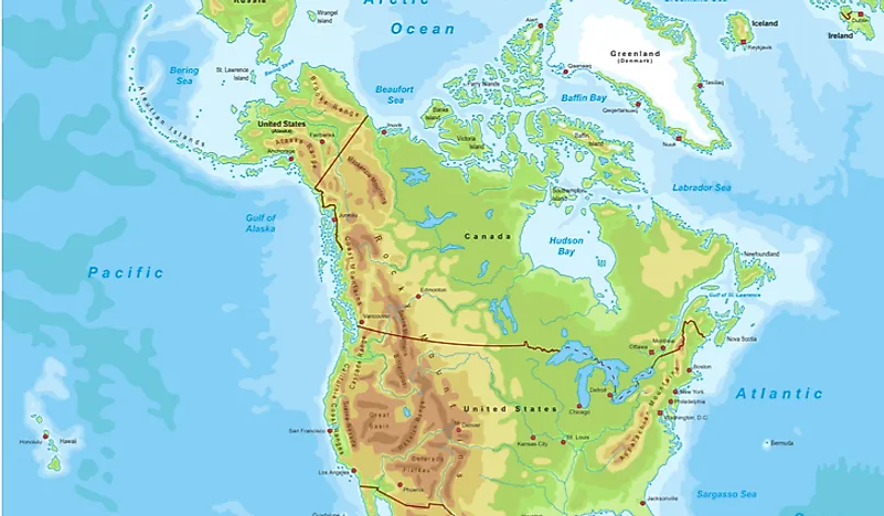
Physical map
200
This continent has no cities and is found at the very south of the earth
Antarctica
200
The average weather conditions in an area over a long period of time.
Climate
300
This landform is made up of a group of islands
archipelago
300
Which map element provides a ratio between actual distance and the distance on a map.
Ex: 1 inch = 10 miles
scale
300
Invisible Line that splits the globe into eastern and western hemispheres
Prime Meridian
300
This large continent is also a country in the Pacific
Australia
300
What is an ecozone?
An area with a specific type of natural environment.
400
Describe a valley
low area between hills or mountains
400
The key contains __________ to represent information.
Symbols
400
These lines run east and west but measure NORTH AND SOUTH
Latitude lines
400
The capital of Canada
Ottawa
400
What is the largest landform region in Canada?
Canadian Shield
500
 What landform is this?
isthmus
500
What are the four main map elements?
Scale, Key, Compass Rose, Title
500
How is physical geography different than human geography?
varied answer.
500
What are the 5 Great Lakes?
Superior, Huron, Michigan, Erie and Ontario
500
How are physical and political maps different?
Political Maps show state and national boundaries and capital and major cities. Physical Maps illustrate the physical features of an area, such as the mountains, rivers and lakes
600
This major landform separates the west coast from the central Great Plains and stretches between the U.S. and Canada
Rocky Mountains
600
Name 3 different types of maps
Political, physical, thematic, general-purpose maps, topographic, etc.
600
What is a general-purpose map?
Shows both natural and human-made features such as coastlines, rivers, lakes, settlements, roads, rail lines etc.
600
This country is located at 33 degrees South and 55 degrees West
Uruguay
600
Give an example of how PHYSICAL GEOGRAPHY affects HUMAN GEOGRAPHY
go ahead...