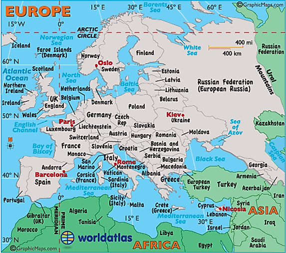
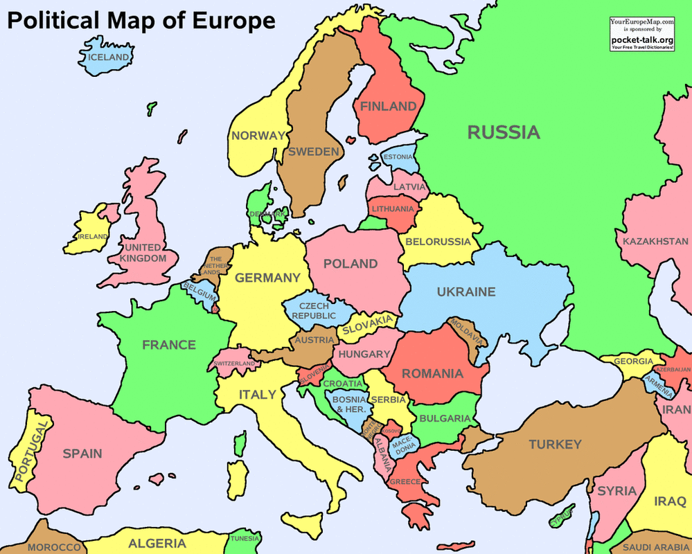
What cardinal direction would you travel when going from the United Kingdom to Russia
East
What mountain range is a natural boundary between Europe and Asia
The Ural
4
What body of water is labeled I?
English Channel
This is a piece of land that is surrounded by water on three sides
Peninsula
Wha  What waterway is located on the 30 degree longitude line?
Mediterranean Sea
What intermediate direction would to go when traveling from Poland to Ukraine?

Southeast
Northwest is what type of direction
Intermediate
What waterway is considered the spine of Europe
The Rhine
This is a large grassland region
Plain
What is this symbol called?

Compass Rose
This mountain range stretches through France, Italy, Switzerland and Austria
The Alps
The imaginary lines that run north and south on a globe or map are called
longitude
This narrow body of water is near a land form that looks like a crown
English Channel
What word that means small is used to describe the Pyrenees Mountains
puny
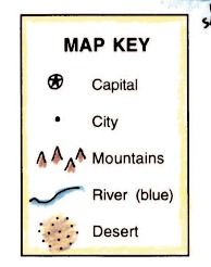
This term tells what symbols on a map mean
key or legend
What peninsula is between Portugal and Spain
Iberian Peninsula
What country lies at 10 degrees longitude and 50 degrees lattitude?
Germany
What large body of water usually connects to the ocean
a sea
This is where most food in Europe is grown, a great place to farm.
The European Plain
This type of map shows characteristics like mountains, plateaus, deserts, rivers, seas, and plains
Physical Map
This land feature forms a natural boundary between countries
mountains
What symbol represents a city capital on this map key?

Star inside a circle
The Mediterranean Sea is between what two continents
Europe and Africa
What word is used to describe land that is good for growing crops/farming?
Arable