Physical Geography
L.A.C.E.M.O.P.S.
Tools of the Geographer
Biomes
Mystery
100
The study of the diverse features of Earth (what is on the Earth and why we care).
Geography
100
________ is the daily, short-term atmospheric conditions, while ________ is the long-term atmospheric conditions.
Weather; climate
100
The equator is a line of __________ and the Prime Meridian is a line of ___________.
Latitude; longitude
100
A cold, treeless biome with very little vegetation
Tundra
100
The ____________ is all of the life that exists on Earth.
Biosphere
200
The theory that all the continents were all connected together and slowly drifted apart over time.
Continental Drift
200
As elevation increases, the air gets _________ and the temperature goes _____.
Thinner; down
200
Places near the equator have 2 seasons. They have a _____ season and a ______ season.
Wet; dry
200
A hot, dry biome with wide temperature fluctuations between day and night.
Desert
200
Which side of the image receives little to no rainfall due to the orographic effect?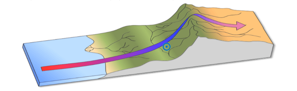
The leeward side
300
The process of breaking rocks, sands, and soils into smaller pieces and carrying them away is called
Erosion
300
Storms occur when hot and cold ____ __________ collide.
Air masses
300
What graph compares precipitation and temperature over a certain period of time?
Climograph
300
A lush and biodiverse biome with lots of precipitation, dense vegetation, and usually 2 seasons: wet and dry
Rainforest
300
__________ location tells me where I am in relation to other things. _________ location tells me my exact coordinates on planet Earth.
Relative; absolute
400
The internal process that creates mountains is called ___________ boundaries.
Convergant
400
Cold ocean currents create _____ conditions on coasts while warm ocean currents create ______ conditions on coasts.
Dry; wet
400
This is an image of a ________ _______.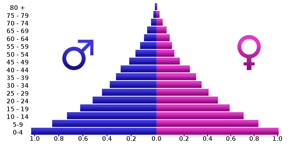
Population pyramid
400
A colder, wooded biome with 2 seasons: long winters and short summers.
Taiga
400
A ________ map shows features such as mountains and landforms. A __________ map shows boundaries between countries.
Physical; political
500
 What adaption is shown in this image?
Terrace farming / terracing
500
Explain what the orographic effect is.
Precipitation near mountain barriers that creates different climates on each side.
500
This image is called a ___________.

Cartogram
500
A woodland-based biome with 4 distinct seasons (hint: a type of forest)
Temperate forest
500
The image below is of a _____ ______ map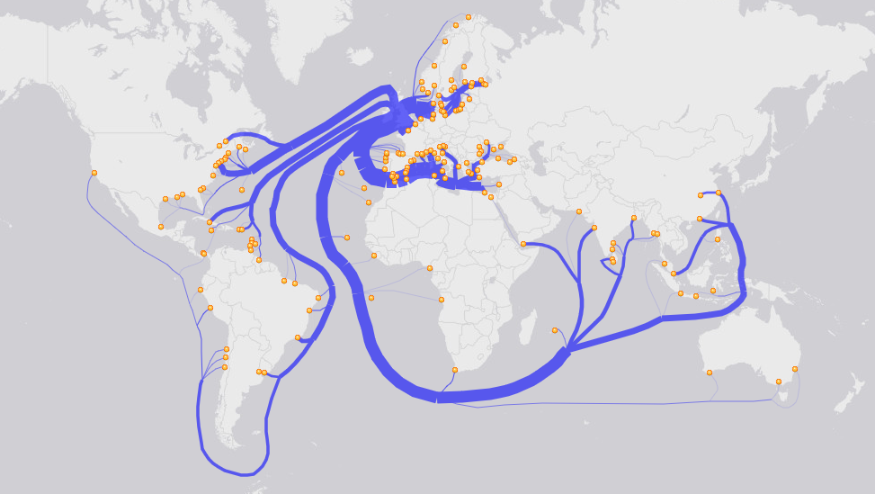
Flow line