Where Are We?
Watch your Latitude!
Hemispheres
Remote Sensing
GIS
100
What does the acronym "GPS" stand for?
Global Positioning System
100
Latitude lines run along the ____ and ____ directions around the Earth.
East and West
100
How many total hemispheres can the Earth be divided into?
Four - Northern, Southern, Eastern, and Western.
100
Name one method (way) that remote sensing images can be taken.
Hot air balloon, satellite, drone, plane, helicopters, etc.
100
The acronym "GIS" stands for what?
Geographic Information Systems
200
GPS uses these objects that float in space to determine the location of someone or something.
Satellites
200
Longitude lines run along the ____ and ____ directions around the Earth.
North and South
200
North America and South America are two continents shown mainly by which hemisphere?
Western
200
Remote Sensing is mainly used to show the ______ of an area on Earth over the course of time.
Change.
200
GIS uses software to build _____ that you can add onto maps by adding them. This has also been referred to as "slices of cheese."
Layers
300
Give one example of an APP or BUSINESS that benefits greatly from using GPS.
Uber, Lyft, DoorDash, Apple Maps, Google Maps, Life360, Restaurants, Amazon, etc.
300
Name three climates that we talked about in class (think about your climate region illustration sheets).
Tropics; Temperate; Subarctic; Arctic; Polar; Tundra; Ice Cap; Mediterranean; Continental.
300
Asia, Europe, Africa, and Australia are all continents that are shown mainly by which hemisphere?
Eastern
300
Look at the image below. Based on these two images, what can you conclude (figure out) that happened over the course of nine days?
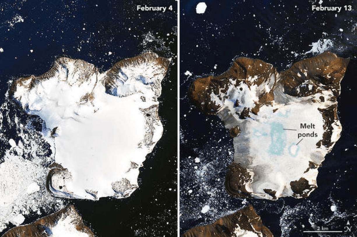
Ice melted (heat wave)
300
GIS can turn a static map into an __________ map that you can change depending on what information you want to see.
Interactive
400
You need to have at least __ satellites in order to accurately determine the location of something or someone.
3 satellites
400
The closer (smaller) latitude lines are, the _______ a climate is.
Hotter; Warmer; more miserable
400
If the Earth was divided into half by the Equator, what hemispheres would be created?
Northern and Southern Hemisphere
400
Lake Chad is a lake in Africa that experienced a tremendous change over the course of two decades. What was this tremendous change that occurred?
The lake's water was drastically used up by the residents from that area.
400
Name two important resources that GIS uses to create layers and other geographic models.
Aerial Images; Satellite Images; Base Maps; GPS
500
GPS is used to find the exact spot where something is located. What is the correct term for the exact spot of something or somewhere in the world?
Absolute Location
500
The further away (larger) latitude lines are, the _____ a climate is.
Colder; Cooler
500
If the Earth was divided into half by the Prime Meridian, what hemispheres would be shown?
Eastern and Western
500
Name two reasons as to why Lake Chad experienced such a drastic change from the images below.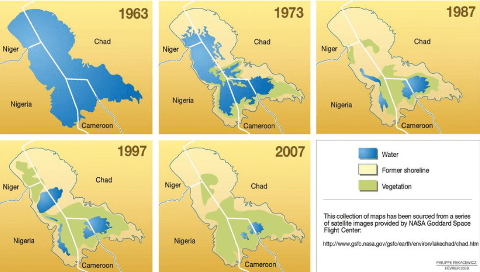
Farming; Dams; Reservoirs, Climate Change
500
This type of map is created by GIS that relies on the input and information of many people including social media, forums, and images.
Crowdsourced Maps or Crowdmapping Maps