1.1 Types of Maps
1.2 & 1.3 Geographic Data
1.4 Spatial Patterns
1.5 Human-Environment Interaction
1.6 Scales of Analysis
1.7 Regional Analysis
Random Sauce
100
All maps distort at least one of these four characteristics (Hint: S.A.D.D.)
Shape, Area (relative size), Distance, and Direction
100
an official count of a population, typically conducted every ten years, to collect demographic information such as age, gender, ethnicity, income, etc.
The Census
100
What are the 5 Themes of Geography?
MR. HELP: Movement, Region, Human Environment Interaction, Location, & Place
100
Which of the following is NOT a natural resource?
Air, fossil fuels (coal, oil, natural gas), minerals, plastics, water
plastics
100
What concept is being described?
The size or extent of something. For example: if you see 1:100,000 on a map, that means every 1 centimeter on the map represents 100,000 centimeters (or 1 kilometer) in the real world.
Scale
100
A geographic area with similar characteristics that set it apart from other areas. (Hint: one of the 5 themes of geography)
Region
100
A map of a large geographic area (e.g. Europe) with very little detail and information would be an example of what kind of scale map?
Small scale map
200
What are the two main categories of maps?
You must also name a kind of map from each category.
Reference & Thematic
Reference maps - Physical, Political, and Road maps
Thematic maps - Cartogram, Choropleth, Dot-Density, Flowline, Isoline, and Proportional Symbol maps
200
What type of geospatial technology is this?
Computer system/software that stores, analyzes, and displays information from multiple digital maps or data sets to help geographers analyze spatial patterns.
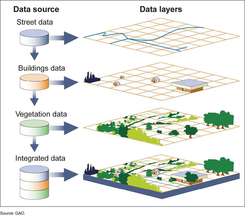
GIS (Geographic Information Systems)
200
What geographic concept is the following an example of?
1100 Sauk St, Lodi, WI 53555
Absolute location
200
Name 3 different kinds of land-use
Examples: Residential, Commercial, Industrial, Recreational, Cultural, Agricultural, etc.
200
What concept is being described?
The level at which something is studied or examined. For example, a geographer studying crime rates between different cities would be examining crime from a city/local ________ __ _________
Scale of Analysis
200
Name the three types of regions
Formal, Functional, Perceptual
200
A map of a local area with lots of detail and information would be an example of what kind of scale map?
Large scale map
300
What type of map is this?
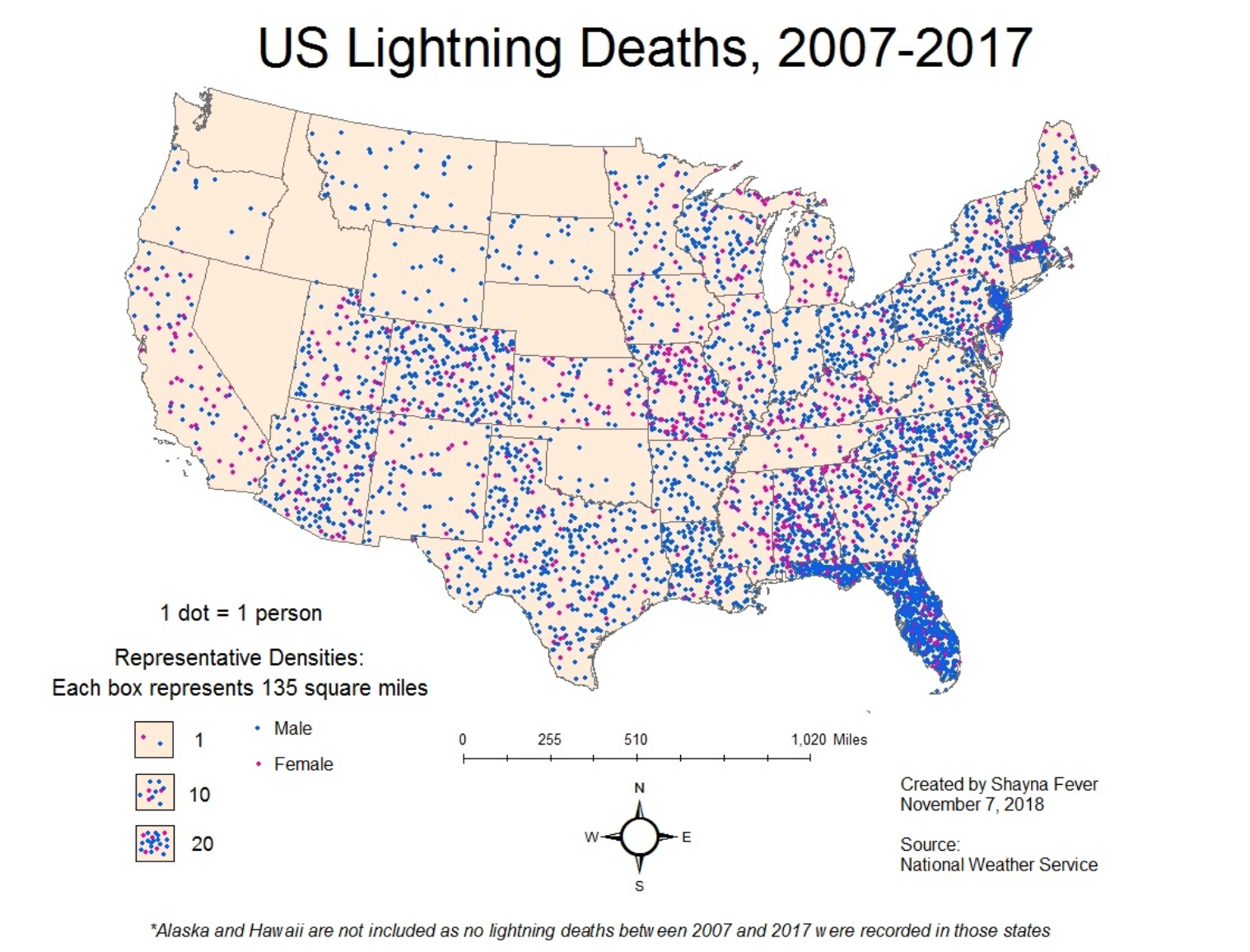
Dot-density map
300
What type of geospatial technology is this?
Satellites orbit the earth and communicate locational information to receivers that locate one's absolute location.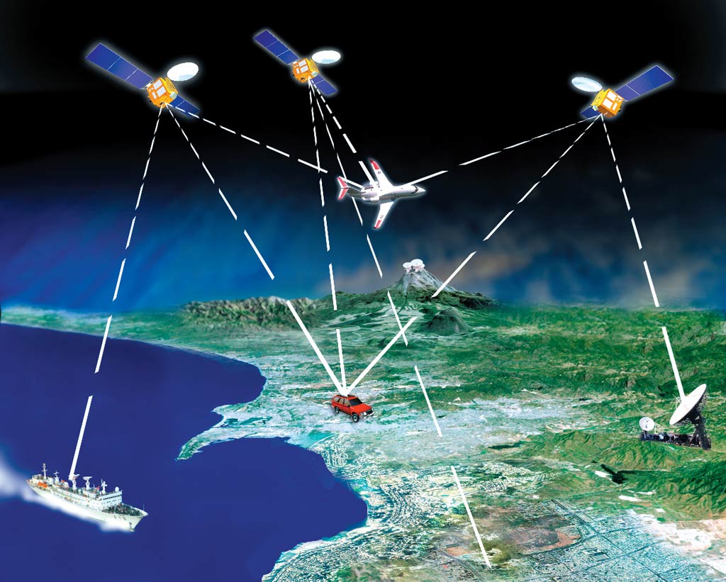
Satellite Navigation System (GPS)
300
What geographic concept is the following an example of?
Our high school is located next to the middle school and across the street from the dentist.
Relative location
300
Define sustainability...
Something close to...
Meeting the needs of the present without compromising the ability of future generations to meet their own needs.
300
Identify the scale and scale of analysis of this map:

Scale: Global
Scale of Analysis: National
300
The image below best describes what kind of region?

Perceptual region
300
What concept is being described below?
The visible human imprint on the landscape (AKA the built landscape)
Ex: Machu Picchu

Cultural landscape
400
What type of map is this?
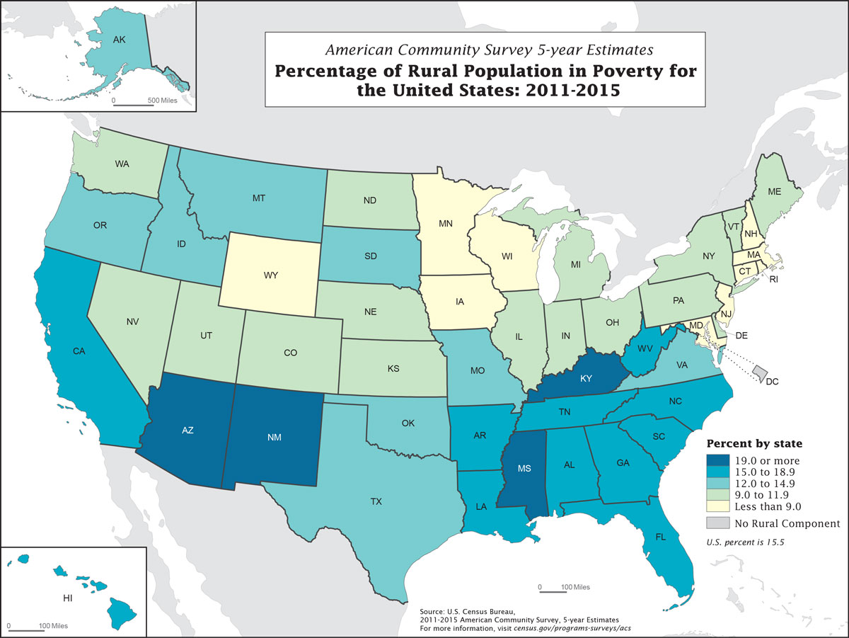
Choropleth map
400
What type of geospatial technology is this?
The use of cameras or other sensors mounted on aircraft or satellites which orbit the earth above the atmosphere to collect digital images of the earth’s surface.
Remote Sensing
400
a feeling/emotion for the features that contribute to the distinctiveness of a particular spot on Earth.
Ex: The Socotra archipelago, part of Yemen, located in the Arabian Sea. It's home to the Socotra dragon tree ; the national tree of Yemen.
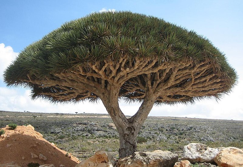
Sense of place
400
What are the two theories used by geographers to describe the relationship between people and their environment?
Also, which one is most accepted today?
Environmental determinism & possibilism
400
Identify the scale and scale of analysis of this map:

Scale: Regional
Scale of Analysis: National
400
The image below best describes what kind of region?
The political boundaries of Europe.
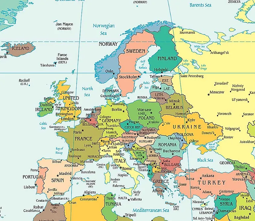
Formal region
400
This geographic concept refers to the physical location of a place, including its natural features, such as climate, landforms, and water resources.
Example: New York City
- Located on a natural harbor at the mouth of the Hudson River
- Has a temperate climate with four distinct seasons
- Relatively flat terrain
- Abundant water resources
Site
500
What type of map is this?

Cartogram map
500
How might an INDIVIDUAL use the following census data?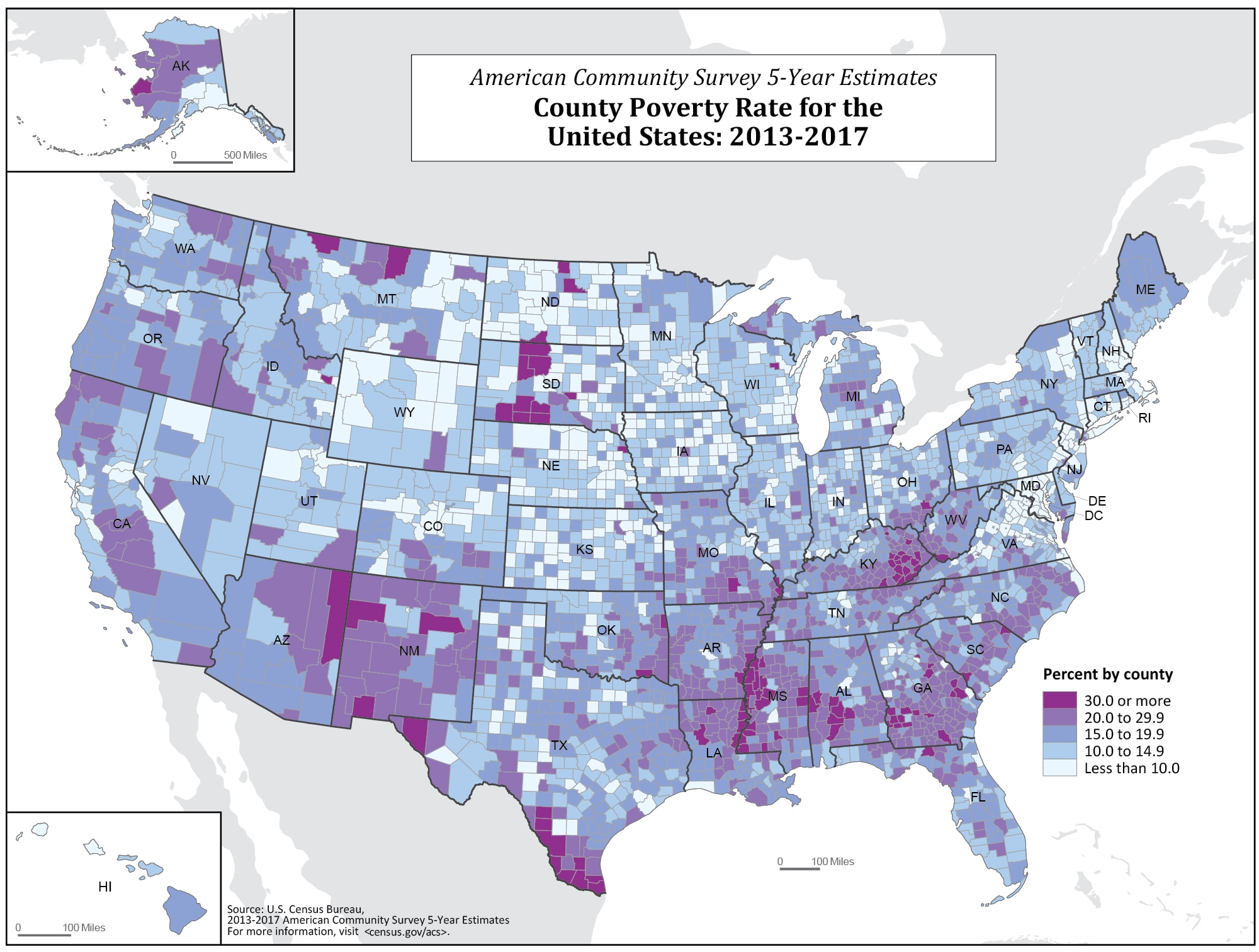
To make decisions about where to live, work, start a business or family, etc.
500
What geographic concept is the following an example of?
Chain restaurants and stores: These businesses often have the same look and feel, regardless of where they are located. This can make it difficult to tell whether you are in a small town or a big city, in the United States or in Europe.

Placelessness
500
Which theory about human-environment interaction is this an example of?
The Dutch have built dams and levees to reclaim land from the sea and create new farmland.
Possibilism
500
Identify the scale and scale of analysis of this map: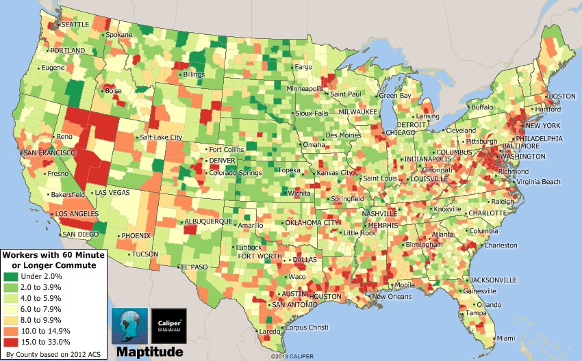
Scale: National
Scale of Analysis: County/Local
500
The image below best describes what kind of region?
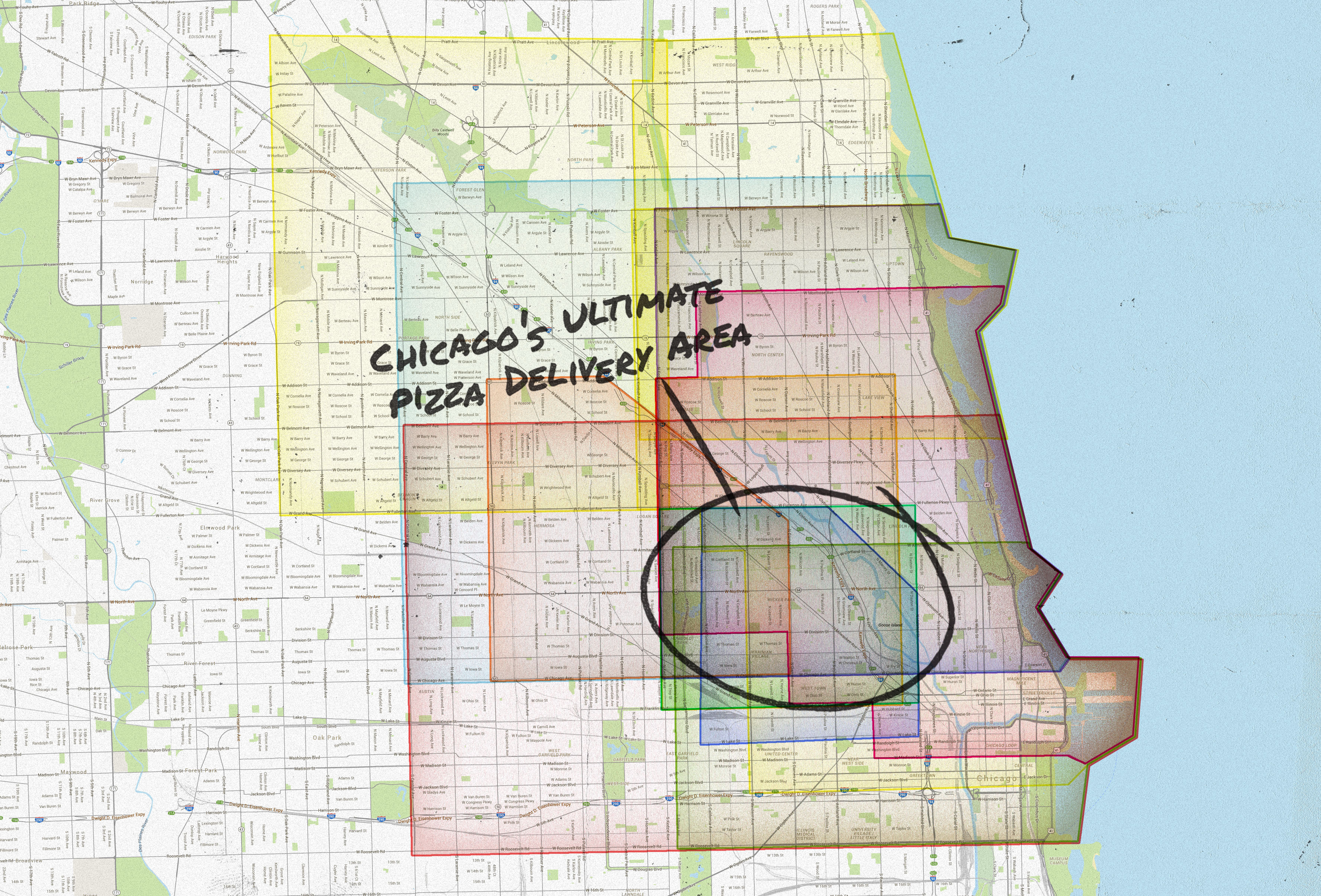
Functional region
500
This geographic concept refers to the relationships between a place and its surrounding area, such as its proximity to other cities, transportation routes, and natural resources.
Example: New York City
- Located in the northeastern United States, near the Atlantic coast
- Proximity to major transportation routes, such as highways, railroads, and airports
- Close to other major cities, such as Boston, Philadelphia, and Washington, D.C.
- Situated in a densely populated region
Situation
600
What type of map?

Proportional symbol map
600
How might a government use the following census data?
To identify areas with high levels of poverty and target them with assistance programs.
To track changes in poverty levels over time.
To develop policies to reduce poverty.
To allocate resources to different counties based on their poverty levels.
To measure the effectiveness of anti-poverty programs.
600
What geographic concept is the following an example of?
Idiotville, Oregon is a ghost town and former logging community northwest of Portland. Most of its former residents worked at a nearby logging camp called Ryan's Camp. Because of the camp’s remote location, locals said that only an idiot would work and live there. They began referring to the surrounding area as Idiotville. The name was eventually borrowed for a nearby stream, Idiot Creek, and officially applied to the community on maps.
Toponym (place name)
600
Which theory about human-environment interaction is this an example of?
Island societies are isolated and underdeveloped because of their location, while people who live in mountainous regions are more independent and self-sufficient because of the difficult terrain.
Environmental determinism
600
Identify the scale and scale of analysis of this map: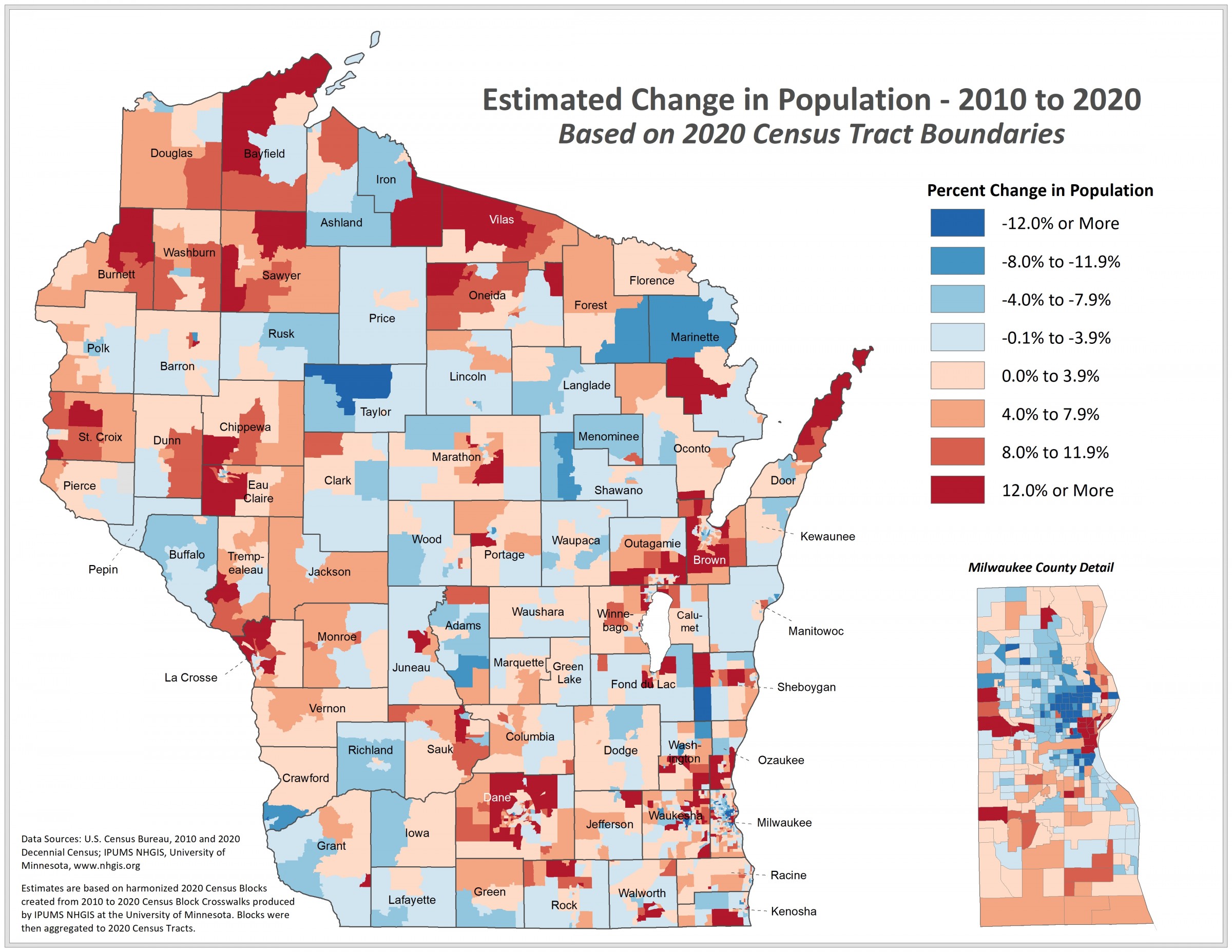
Scale: Substate (US state)
Scale of Analysis: Census tract/local
600
What is the common characteristic that makes all of these countries a region?
Common language: Spanish
600
In the past, people were more likely to marry someone who lived in their village or town. This was because it was difficult and expensive to travel long distances. However, with the development of transportation technology, such as the train and the car, it became possible for people to travel long distances more easily and affordably. This led to an increase in long-distance relationships and marriages.
What geographic concept best describes marriages in the past and what geographic concept describes how technology changed this trend?
Past - Distance decay; Today - Time-space compression