Landforms
Waterbodies
Are you sure?
Landmasses and Waterbodies of the World
Bonus
100

The coloured areas are ________________.
What are continents?
100
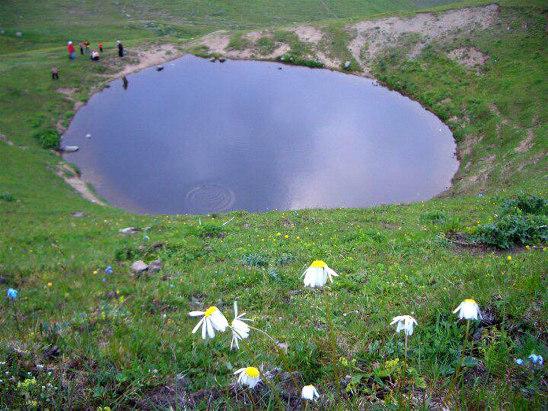
Look at the picture and identify the waterbody.
What is a lake?
100
Areas of fresh or salt water such as lakes, rivers, Sean and oceans.
What are waterbodies?
100
The largest ocean in the world.
What is the Pacific Ocean?
200
An area of large flat land.
What is a plain?
200
At 92.8 km, this is the longest river in Jamaica.
What is the Rio Minho?
200
A river which flows into another river.
What is a tributary?
200
The highest peak in the world is ____________ located in ______________.
What is Mount Everest in Asia?
300

Look at this image and identify the landmass.
What is Africa?
300
![]()
Look at the picture and identify the waterbody.
What is the Pacific Ocean?
300
The beginning of a river.
What is a source?
300
This is the smallest of the seven continents.
What is Australia?
400
A landmass with an elevation between 150m and 600m.
What is a hill?
400
This is the second largest ocean in the world.
What is the Atlantic Ocean?
400
The ground which a river flows on.
What is a river bed?
400
These are small land masses completely surrounded by water.
What are islands?
500
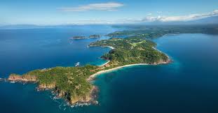
Identify the landform in the picture above.
What is a peninsula?
500

Look at the picture and identify the waterbody.
What is a gulf?
500
A flat area of high land often with steep sides.
What is a plateau?
500
This is the third largest ocean and it is approximately 20% of the water on the Earth's surface.
What is the Indian Ocean?
600

look at the map and identify the white area.
What is the Blue Mountains/Blue Mountain Range?
600

Look at the picture and identify the waterbody located there.
What is the Caribbean Sea?
600
An area of highland above 600m with steep slopes often rising to a peak.
What is a mountain?
600
This sea forms the borders between two continents - Africa and Europe.
What is the Mediterranean Sea?
700
This hill is found in Westmoreland?
What is Negril Hill?
700
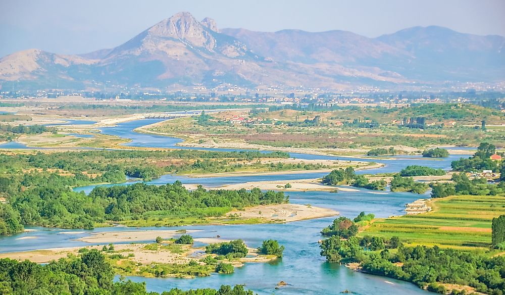
Identify the waterbody in this picture.
What is a river?
700
Physical or relief features such as mountains, valleys and beaches but not rivers.
What are landforms?
700
This sea is connected to the Atlantic Ocean.
What is the Caribbean Sea?
800
Large, continuous areas of land bordered by large bodies of salt water.
What are continents?
800

Identify the waterbody in this picture.
What is a bay?
800
A narrow piece of land which joins two others.
What is an isthmus?
800
This gulf leads into the Caribbean Sea.
What is the Gulf of Mexico?
900
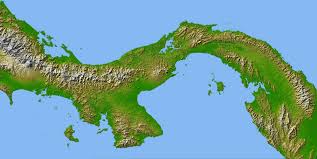
Identify the landform in the picture above.
What is an isthmus?
900
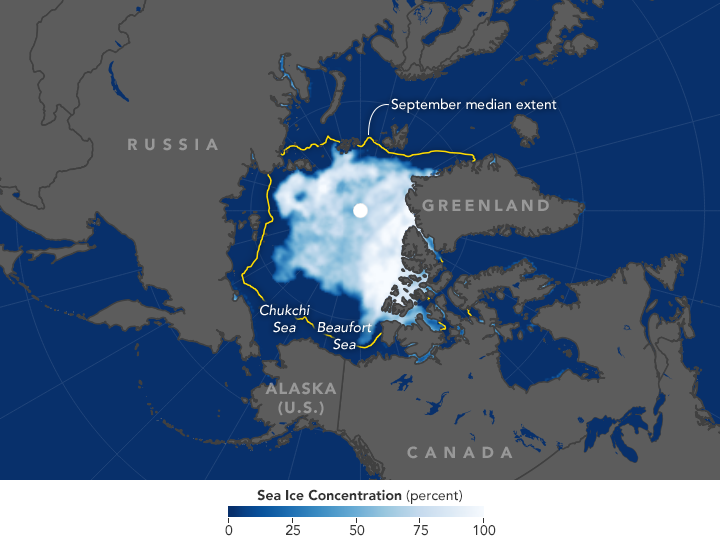
Identify the area encircled in the yellow lines.
What is the Arctic Ocean?
900
A passage for water or other liquids to flow along.
What is a channel?
900
This ocean is east of Africa and west of Australia.
What is the Indian Ocean?
1000

Look at the picture and identify the landmass.
What is North America?
1000
This is the fourth largest ocean in the world and it freezes and melts at different times during the year.
What is the Southern Ocean?
1000
A chain of islands.
What is an archipelago?
1000
This ocean is north of Asia.
What is the Arctic Ocean?
1000
Place the following in the correct categories:
archipelago, gulf, bay, peninsula, sea, lake, isthmus, island, continent, ocean
What are landforms: archipelago, peninsula, isthmus, island, continent. Waterbodies: gulf, bay, lake, ocean, sea