The Geographic Setting
The Tierra Caliente
The Tierra Templada
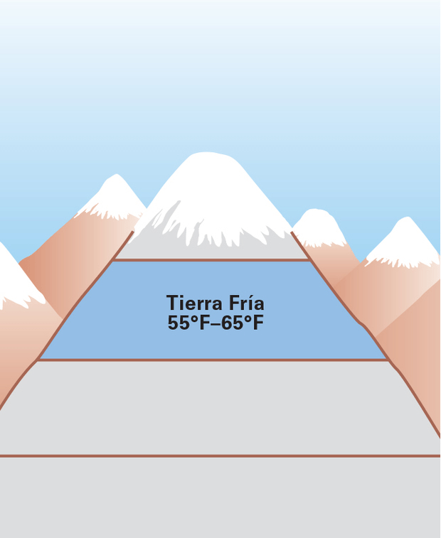
The Tierra Fria
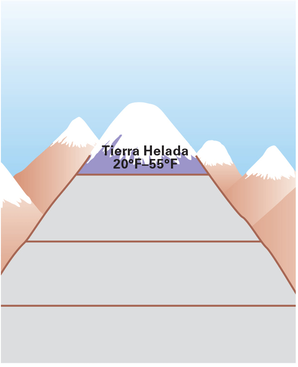
The Tierra Helada
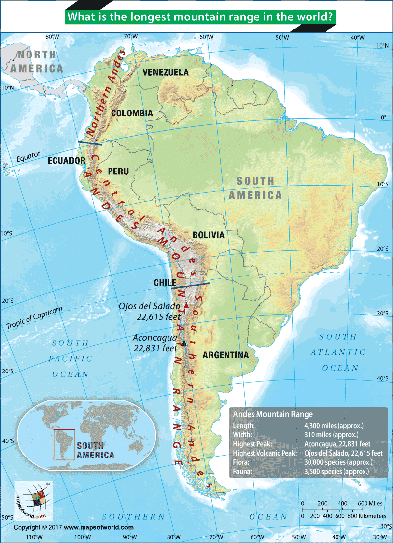
The Andes Mountains
100
Which continent do the Andes line the west coast of?
South America
100
Identify two physical characteristics of the Tierra Caliente.
broadleaf evergreen forests cover the eastern slopes of the Andes
natural vegetation on the western slopes ranges from lush rainforest to tropical grassland
Peru’s coast gets little rainfall and is a desert.
100
Why are flowers such as carnations, daisies, and roses grown in the Tierra template?
The mild weather provides the perfect climate for growing flowers
100
How does vertical trade benefit the people of the Andes?
It gives people in one zone access to a variety of food grown in other zones.
100
All of the Tierra Helada is above the ______ line and near the ______ line.

tree, snow
100
Which three countries does the Central Andes pass through?
Ecuador, Peru, and Bolivia
200
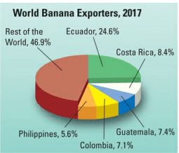
What percentage of the world’s bananas come from Ecuador, Costa Rica, Colombia, and Guatemala?
47.5%
200
True/False: The Tierra Caliente is more populated than the Tierra Templada.
False
200
True or False: The Tierra Templada is more populated than the Tierra Caliente

True
200
What are three physical features found in the Tierra Fria?

Steep and rugged mountains
Flat basins and plateaus
Lake Titicaca
200
What type of vegetation is rare in the Tierra Helada?
trees
200
More than ____ mountain peaks within the Andes reach elevations of more than 20,000 feet
50
300
Which factor explains why low elevations have denser air than high elevations?
gravity
300
How have people adapted to life in the Tierra Caliente? List two
People dress in light clothing
Farmers grow bananas, rice, and sugarcane.
People have built houses that are open to catch cooling breezes.
300
One nickname for the Tierra Templada is the...

“Land of Eternal Spring.”
300
What types of homes have people built in the Tierra Fria?
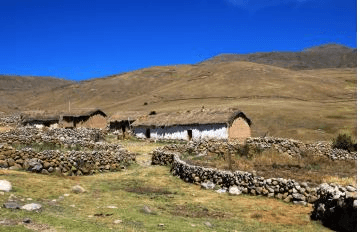
Thick-walled houses out of stone or adobe brick
300
What is one of the only types of crops that can be grown in the Tierra Helada?

Quinoa
300
How many countries in South America does the Andes pass through?
7
400
The city of Quito is located at 9,250 feet above sea level. According to the diagram below Quito is in which elevation zone?
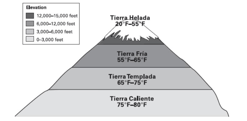
tierra fría
400
According to TCI, there are three main crops grown in the Tierra Caliente. What are the three?

bananas, rice, and sugarcane
400
Identify three types of crops grown in the higher elevations of the Tierra Templada.

coffee, corn, beans, and other vegetables, as well as flowers
400
What is found in the Tierra Fria, the tree line or the snow line?
treeline
400
What is found in the Tierra Helada, the tree line or the snow line?
snow line
400
Approximately, how long are the Andes Mountains?
4,500 miles from north to south
500
the division of land into zones based on elevation, which in turn helps determine climate and vegetation
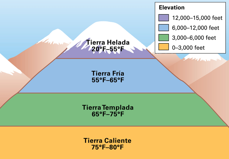
Altitudinal Zonation
500
What types of houses have been built in the Tierra Caliente?

Bamboo houses that are open to catch cooling breezes.
500
More well-off residents in the Templada may live on large estates called...
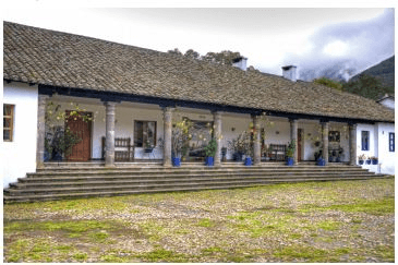
haciendas
500
What type of farming method do you notice in the image below?
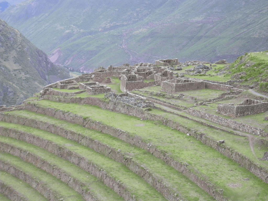
Terracing
500
What type of economic activity will you mostly find in the tierra helada?
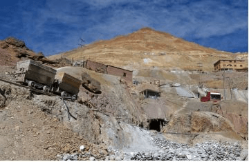
mining
500
The Andes consist of several mountain ranges that are known in Spanish as...
cordilleras