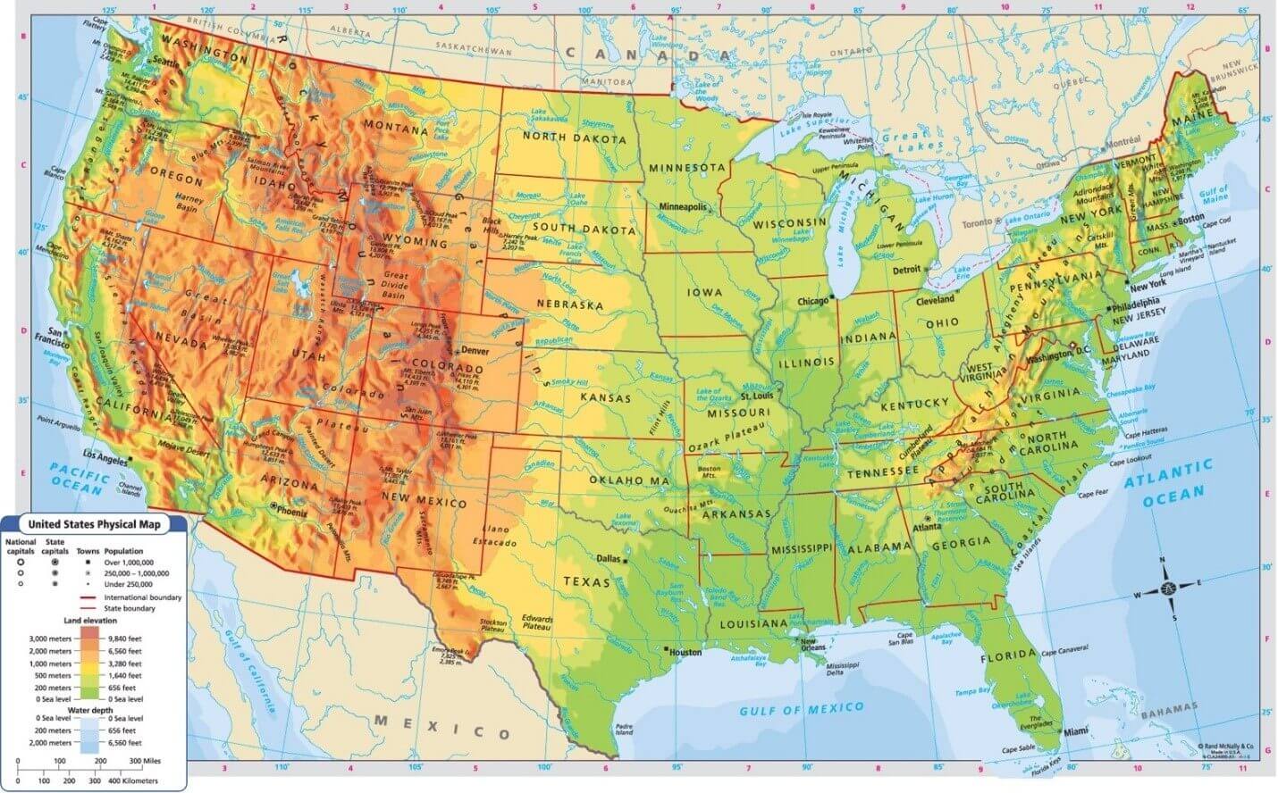
What type of map shows you the reader different landforms like mountains, rivers, and forests?
Physical
What part of the map (todals) tells you what direction you are going?
compass
Using map 1 on Google Classroom: What years are shown on the map by the color purple?
500 BCE
Using map 3 in Google Classroom: what coast of the U.S is the Appalachian Mountains on?
East
True or False: map authors can be a person or an institution/company?
true
What type of map shows you man made things such as roads, cities, and borders?
Political
Title
Using map 1 on Google Classroom: What parts of TODALS does this map not have?
Compass, Author, scale, and date.
Using map 3 in Google Classroom: which way does the mississippi river flow?
South
True or False: maps do not change over time
What type of map shows the reader information about a specific theme or event?
Thematic
What part of the map (todals) tells you when a map was made?
Using map 1 on Google Classroom: is this map a political or physical map and what is your evidence?
political because it shows you city names and borders.
Using map 3 in Google Classroom: on what coast of the U.S are the Sierra Nevada mountains located?
west
True or False: Wars and conflicts between countries can change how a map looks?
true

Physical
What part of the map (todals) uses symbols, colors, and words to describe what's on the map?
Legend or key
Using map 2 on Google Classroom: explain different labels like colors, symbols, fonts, and bolded letters are used to show you different things on this map?
blue letters and coloring = rivers and oceans
CAPITALIZED letters = countries
Bolded and CAPITALIZED letters = Important Italian cities
Using map 3 in Google Classroom: the state of Minnesota has what 2 types of geographical landforms and what color represent each?
Yellow - Grassland
Green - Woodland
True or false: there are two types of physical maps? if so, what are they called?
true, elevation and relief

Thematic (population)
What part of the map (todals) is used to see many miles apart places on the map are?
Scale
Using map 2 on Google Classroom: how many miles would it take for you to go from Rome to San Marino? (remember to use the scale and the ruler in your planner)
about 100 miles
Using map 3 in Google Classroom: How many miles would it take for you to travel from Mt. Rainer to Mt. Whitney? (use the scale and the ruler in your planner)
about 750 miles
true or false: Elevation maps show you height by using shading and coloring to make it look 3D?
false