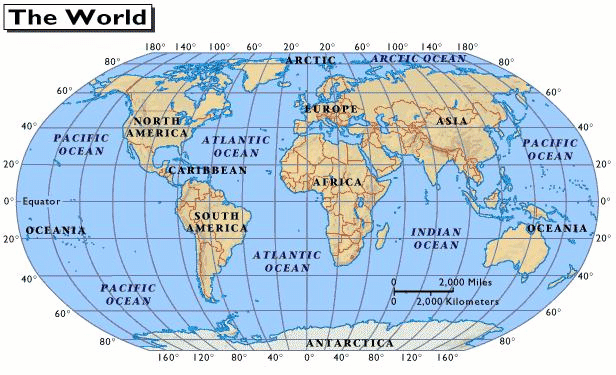
This is a 3D, accurate presentation of the entire world that shows accurate areas, distances, and relative shapes and sizes.
What is a globe?
 This ocean is between Antarctica and 60 degrees longitude.
What is the Southern Ocean?
This shows the cardinal directions on a map.
What is the compass rose?
This kind of map shows human activities and typically has a specific topic it is covering.
What is a thematic map?
This continent is located 20oW and 50oE.
Where is Africa?
Northeast, Southeast, Northwest, Southwest
What are intermediate directions?
This type of map shows the boundaries of a country as well as major cities or capitals.
What is a political map?
The line of latitude that runs at 0o and splits the Earth into northern and southern hemispheres is known as this.
What is the Equator?
This is the thing a mapmaker uses to show distance on a map.
What is a scale?
This continent is southeast of Africa.
What is the Australia?
What is relative location?
This type of map shows natural features of an area, such as rivers, lakes or mountains.
What is a physical map?
This ocean is the ocean that connects to the Chesapeake Bay and Eastern Virginia.
What is the Atlantic?
Almost always distorted in size or shape somehow.
What are all flat maps?
The line of latitude that is 0o and splits the Earth into eastern and western hemispheres is known as this.
What is Prime Meridian?
Someone who makes a map is known as this.
What is a cartographer?