All About Maps
Different Types of Maps
Geography
Where Am I?
Reading Maps (Practical)
100
A ____________________ is a scale model of the Earth.
A: Globe
B: Map
A globe is a scale model of the Earth, whereas a printed map is a symbolic representation of all or part of the planet. Unlike globes, maps can show small areas in great detail.
100
The map shown would be an example of which type of map?
Physical map. This map shows the topography and physical landforms of the continent Africa.
100
What is the line that divides the globe into northern and southern hemispheres called?
The Equator
100
What hemispheres is Australia located in?
The Southern and Eastern Hemispheres
100
On the Missouri map, what river connects the cities St. Louis and Kansas City?
The Missouri River
200
Another word for the map key would be _________________.
Legend
200
The map shown is an example of which type of map?

This is a political map. It shows the political divisions of the states in the U.S. and also capitals, cities and major highways/roadways in the country. Political maps usually show man-made features of a given area.
200
What is the line that divides the globe into eastern and western hemispheres called?
The Prime Meridian
200
What continents does the Equator cross?
South America, Africa and some Asian Islands
200
Which city in Missouri is bigger, Springfield or Kansas City? How do you know?
Kansas City is bigger. You know because the dot representing Kansas City is bigger than the dot representing Springfield.
300
These people make maps.
Cartographers
300
The given map is an example of which type of map?
This is an example of a flow-line map. This map shows arrows connecting different areas to relay specific information. This map shows immigration to the U.S. in the year 2007.
300
Which lines, latitude or longitude, run parallel to the Equator and measure distance to the north and south of the Equator?
A: Latitude
B: Longitude
Latitude
300
Which country does the absolute location 50 degrees N and 20 degrees E fall within?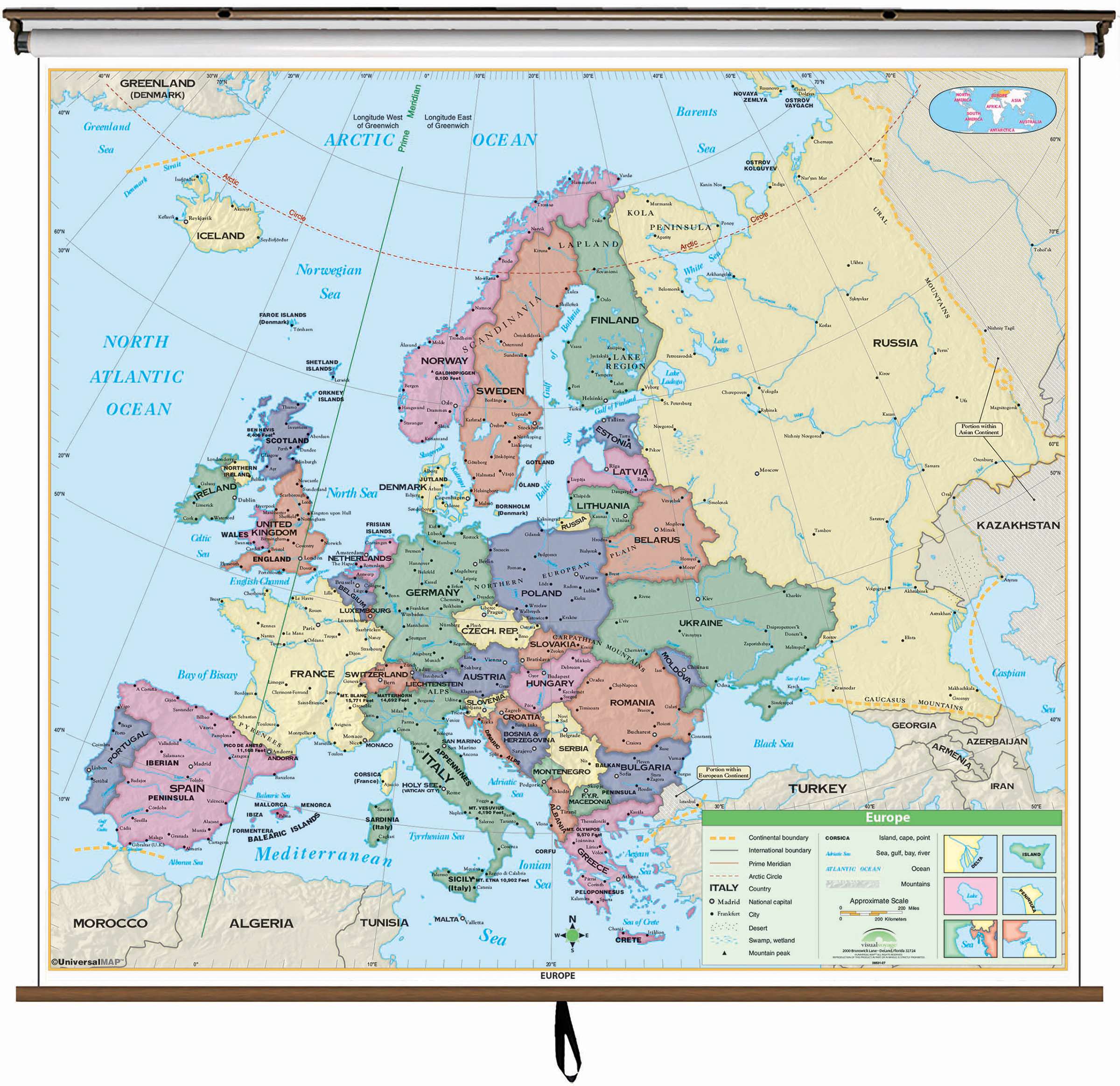
Poland
300
What cities in Missouri border the Mississippi River? (There are three identified on the given map)
Hannibal, St. Louis, Cape Girardeau
400
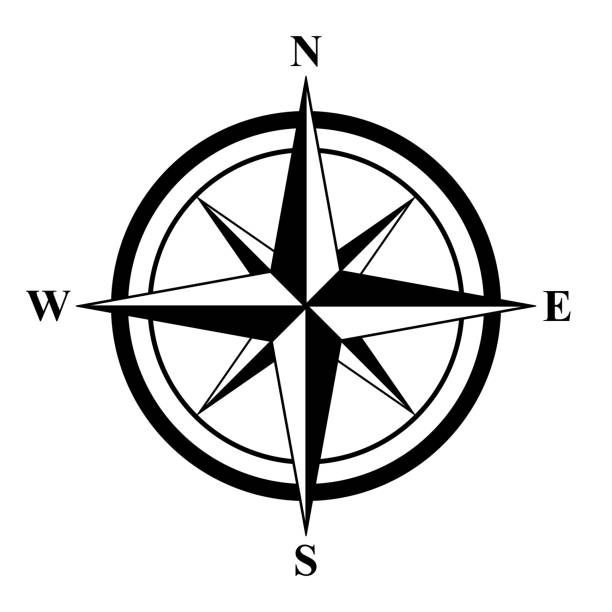
Compass Rose, or Compass, it is used to identify direction on a given map.
400
The map shown is an example of which type of map?

This is an example of a thematic map. Thematic maps show information relating to one specific area of information, in this case "United States Resources".
400
Which lines, latitude or longitude, run perpendicular to the Equator and measure distance to the east and west of the Prime Meridian?
A: Latitude
B: Longitude
Longitude
400
Which European capital city lies directly on the Prime Meridian line?
London, England
400
On the map of South Dakota, identify two National Parks. What color is used to identify National Parks on this map?
Badlands National Park and Wind Cave National Park. National Parks are identified with a dark green area.
500
What is the given tool used for? What is it called?
It is used to measure distance on a map. It is called a scale bar.
500
The given image is an example of which type of map?
This is an example of a qualitative map. These types of maps use colors, symbols lines or dots to show specific information related to a specific idea.
500
Every place has a "global address", also known as its _______________ _________________.
Absolute Location
500
The absolute location 50 degrees N, 0 degrees E/W falls within which body of water?
The English Channel
500
On the map of South Dakota, what U.S. Highway runs through Rosebud Indian Reservation?
U.S. Highway 18