Continents
Oceans
Random
Types of Maps & Landfroms
Landforms
100
What continent is shown in purple?
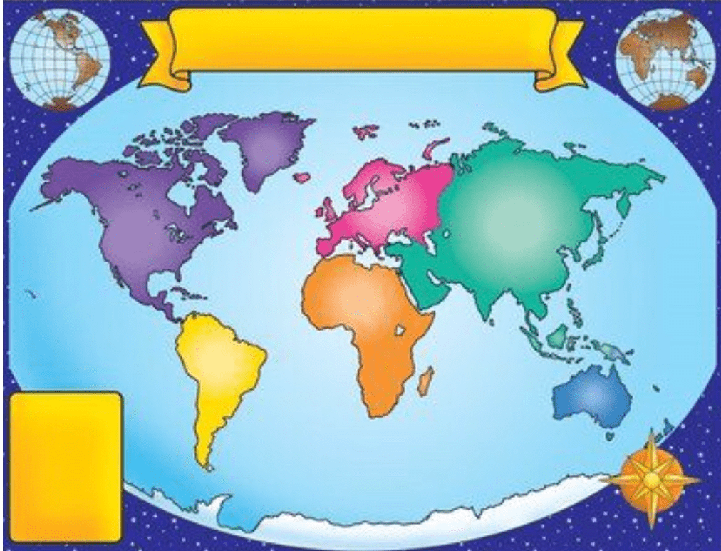
North America
100
What ocean is 9? 
Atlantic Ocean
100
What continent is shown in blue?

Australia
100
A dry area of land with very little rainfall.
desert
100
A low area of land between hills or mountains.
Valley
200
What continent is shown in yellow?

South America
200
What ocean is 8 & 11?
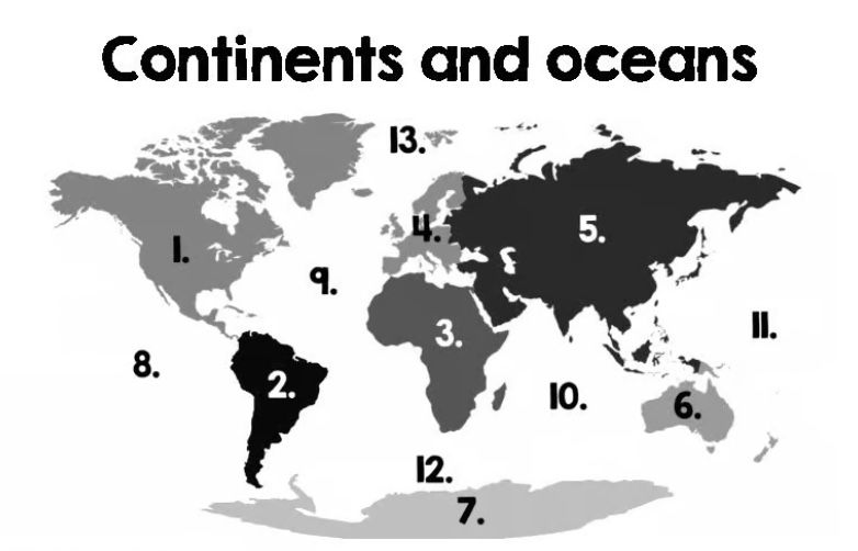
Pacific Ocean
200
What are the 4 Cardinal Directions?
North
South
East
West
200
_____ Map-Shows transportation routes and roads in a particular area.
Road Map
200
A raised, flat area of land.
Plateau
300
What continent is shown in pink?

Europe
300
What Ocean is 10?

Indian Ocean
300
What are the 4 intermediate directions?
Northeast
Northwest
Southeast
Southwest
300
_____ Map- SHows climate and weather coditions, such as temperature, rain and snow.
Weather Map
300
A piece of land that is surrounded by water on three sides.
Peninsula
400
What continent is shown in white?

Antartica
400
What ocean is 12?
Southern Ocean
400
A naturally raised area of land (rounded).
Hill
400
____ Map -Shows naturally made landmarks, such as rivers, lakes, and mountains.
Physical Map
400
A small body of water completely surrounded by land.
Lake
500
What continent is shown in Green?

Asia
500
What Ocean is 13?
Arctic Ocean
500
A deep, narrow, valely, usually with a river flowing through it.
Canyon
500
______ Map- Shows the boundaries of countries, states, and counties.
Political Map
500
A large, steep area of raised land, which usually rises more than 1,000 feet.
Mountain