Map Elements
GIS
Directions
Map Projections
Vocabulary
100
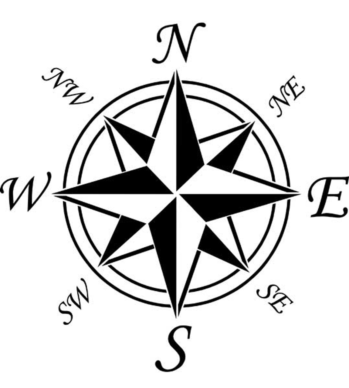 What is this image called?
Cardinal Directions
100
What does GIS stand for?
Geographical Information System
100
Name the cardinal directions
North, South, East, West
100
True or False. Map projections are chosen based on the cartographer's PURPOSE.
True
100
Airmen and Sailors use maps that are properly called ________.
charts
200
What box has symbols used on a map?
Map Legend or Key
200
What 3 components come together to make GIS possible?
1) Data
2) People
3) Computers
200
Through what ocean does the international date line pass?
The Pacific Ocean at 180 degrees longitude.
200
Map projections are based on location and geometric shape. What is the name of the map projections that focuses on the United States?
Oblique Map Projection
200
What is a person who makes maps called?
A cartographer.
300
What is this called? 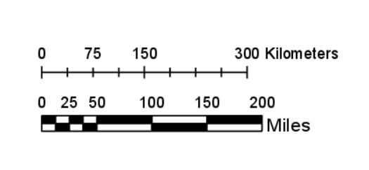
The map scale
300
What 3 data types are used to display objects in GIS?
1) point
2) line
3) polygon
300
Time zones around the world are so many hours ahead or behind of Greenwich time because the Prime Meridian (0 degrees longitude) passes through here. In what country does Greenwich reside?
England
300
Map projections are based on location and geometric shape. What is the name of the map projections that centers on the north pole?
Polar projection.
300
What technology was invented in 1761 that allowed sailors to accurately map their longitude?
Accurate seagoing clocks!
These were used to calculate the time difference from local noon at their current position and local noon at the port they left.
400
What does a scale measure on a map?
Distance on the map compared to distance on the earth.
400
Name 2 different types of data collection used for GIS.
1) Surveying
2) Remote Sensing
400
Degrees latitude are circles drawn on the earth parallel to the equator. What degrees and cardinal directions do they use?
0-90 degrees north.
0-90 degrees south.
400
Map projections are based on location and geometric shape. What is the name of the map projection that focuses on South America and centers on the equator?
Equatorial Projection
400
What global map was specifically made for the classroom?
The Robinson false cylindrical map
500
A map that covers a LARGE area of the earth has a ______ scale, while a map that covers a small area of the earth has a _________ scale.
small; large
500
What are 3 different types of remote sensing incorporated into GIS maps?
1) Acoustic (sonar)
2) Radio waves (Radar)
3) Light waves (Lidar)
500
Longitude are semi circles drawn on the globe originating and ending at the north and south poles. In what degrees and cardinal directions are they measured?
0-180 degrees east.
0-180 degrees west.
500
Why are maps distorted?
Maps attempt to transcribe the earth's round surface onto a flat 2D surface, which causes distortion.
500
What 3 different geometric shapes are used to project maps onto a flat surface and minimize distortion?
1) Gnomic (which is a plane)
2) Cylindrical
3) Conic