Map Features
Lat. and Long.
Continents and Oceans
Projections, please
Types of Maps
100
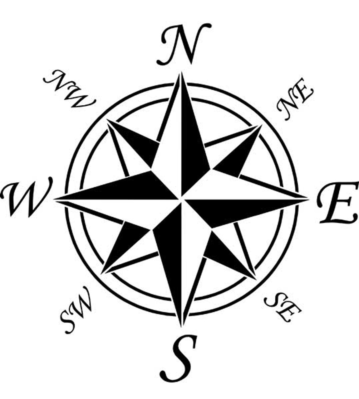
What is a compass rose?
100
This line runs at 0° Latitude, cutting the earth in half.
What is the Equator?
100
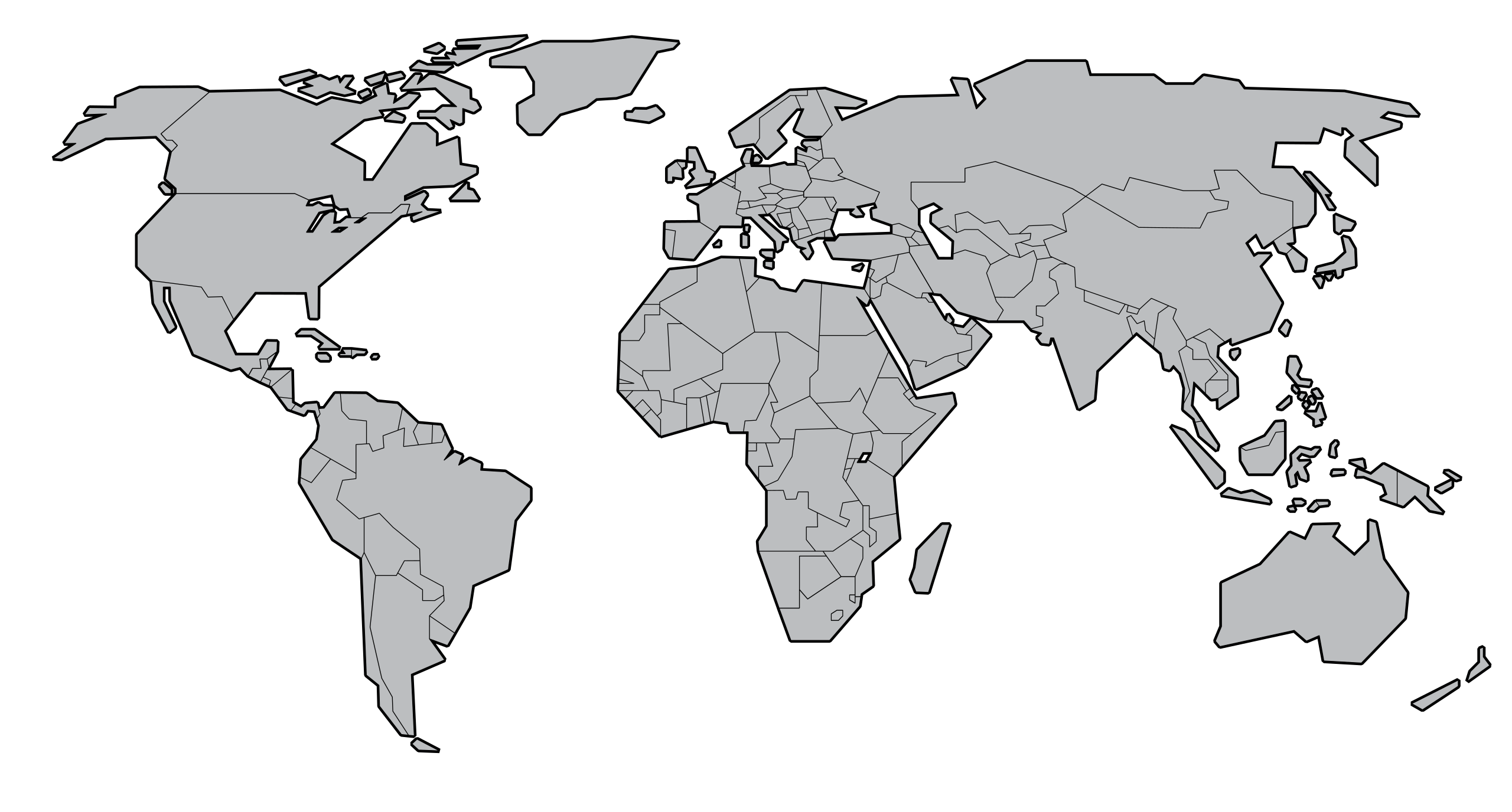 These two continents are completely in the northern hemisphere.
What are Europe and North America?
100
This map is also known as the orange peel map.
What is the Goode-homolosine?
100
This map shows national boundaries.
What is a political map?
200
The box or chart that explains symbols on a map.
What is a legend or key?
200
These lines represent east-west distances from an imagined zero.
What are lines of longitude?
200
This continent is located completely within the Pacific Ocean.
What is Australia?
200
This projection preserves distances from a central point but cannot present the whole globe.
What is an Azimuthal projection?
200
This map provides a general overview of an area by providing geographical information.
What is a reference map?
300
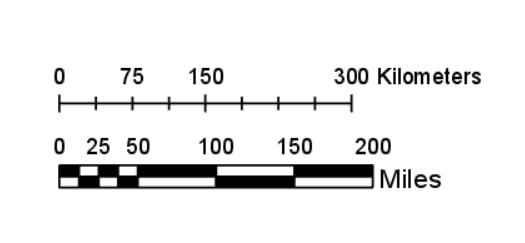
The ratio between distances on a map and distances on the Earth’s surface are represented using this feature.
What is a scale?
300
This line runs at 0° Longitude, cutting the earth in half vertically.
What is the prime meridian?
300
This ocean surrounds Antarctica.
What is the Southern Ocean?
300
The Mercator map has been increasingly critiqued for this reason.
What is the size distortion at the poles which perpetuate racist ideologies?
300
This type of map uses contour lines to show the shape of Earth’s surface.
What is a topographic map?
400
This feature informs the reader of what the map represents.
What is the title?
400
This line shows the most northerly latitude of the tropical region.
What is the Tropic of Cancer?
400
This continent can fit the three most populous countries (India, China, and the US) within its land area.
What is Africa?
400
The further north and south on most map projections, the greater the...
What is distortion?
400
This map describes the climate, animal life, and vegetation in an area.
What is a biome map?
500
The ratio for the below scale.
What is four inches equals 200 miles?
500
The Antarctic Circle is located at this latitude.
What is 60 degrees south?
500
This continent is the most distorted on a Mercator map.
What is Antarctica?
500
The Robinson map is a kind of compromise projection. Two advantages are...
What are (1) it intentionally balances distortion and (2) it is an aesthetically pleasing representation of the whole globe?
500
This type of map literally “measures the deep.”
What is a bathymetric map?