Directions
Reading Maps
Maps
Types of Map
100
What is this called?
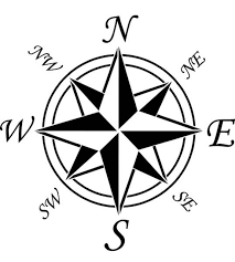
What is a Compass Rose
100
This city is east of Stafford Springs.

What is Putnam?
100
These imaginary lines run east and west on a globe.
What is lines of latitude?
100
What type of map is this and what does it show?

Road map used to show roads, streets, and highways?
200
Name 8 directional points on a compass rose.
What are North, South, East, West, Northeast, Southeast, Northwest, and Southwest.
200
Lincoln is the capital of this state.

What is Nebraska?
200
These imaginary lines run north and south on a globe.
What is lines of longitude?
200
What type of map is this and what does it show?

Political map that show state and country names, borders, and capitals.
300
If you are facing north, this direction is to your left.
What is west?
300
This state has oil, gold and forest resources.

What is California?
300
This helps us measure distance on a map.
What is a scale?
300
What type of map is this and what does it show?

Resource map that show natural resources in different areas.
400
This is a way of representing your location based on where you are in relation to something else.
What is relative location?
400
Based on this map, what's the difference between Eastern United State and Western United States in terms of temperature?

The Eastern United States is mostly below normal temperature and the Western United States is mostly above normal temperature.
400
The equator is at this degree latitude.
What is 0 degrees?
400
Name this map and what it shows.

Climatic map that shows the type of weather conditions in an area.
500
This is a way of representing your location based on lines of longitude and latitude.
What is absolute location?
500
What is the difference between the Gulf Coast Plain and the Great Plains?

The Gulf Coast Plain is closer to see level than the Great Plains.
500
This imaginary line is at 0 degrees longitude.
What is the Prime Meridian?
500
Name these maps and how they are used.


Physical and topographic maps used to show physical features of a place such as elevation, rivers, forests, and mountains?