Vocabulary/Directions
All Maps #1
Random Unit ?'s
All Maps #2
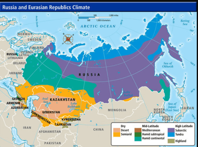
Climates and Climate Zones
100
What is a map key/legend?
The key explains the symbols, colors, and other information about the given map
100
What type of map is this??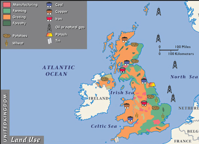
Natural Resource Map
100
What is the major line of longitude that we have studied. This line is 0 degrees longitude line and runs up and down and cuts through England?
The prime meridian
100
What type of map does this look like?
Physical map
100
What major "parallel" passes right through the middle of the lower climate zone (tropics)?
The equator
200
Tell me all 7 major continents and all 5 major oceans?
Continents - asia, africa, north america
200
Which continent is located east of north America, south of Europe, and west of Australia?
Africa
200
What three continents does the Equator pass through?
South america, Africa and Asia
200
What information is this map trying to show us? What type of map might this be?
Climate map, shows up the climate in each region of the USA
200
Which of the three climate zones is going to be cold and frozen for the majority of the year?
Higher Climate zones (polar zones)
300
What does the term absolute location mean?
The exact point where a place is located
300
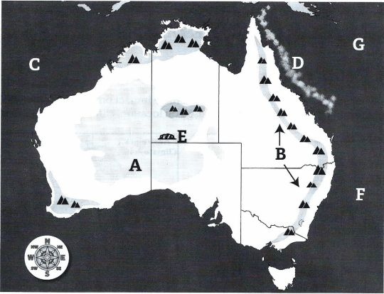
What Cordiant is located at 40 degrees N and 80 degrees E?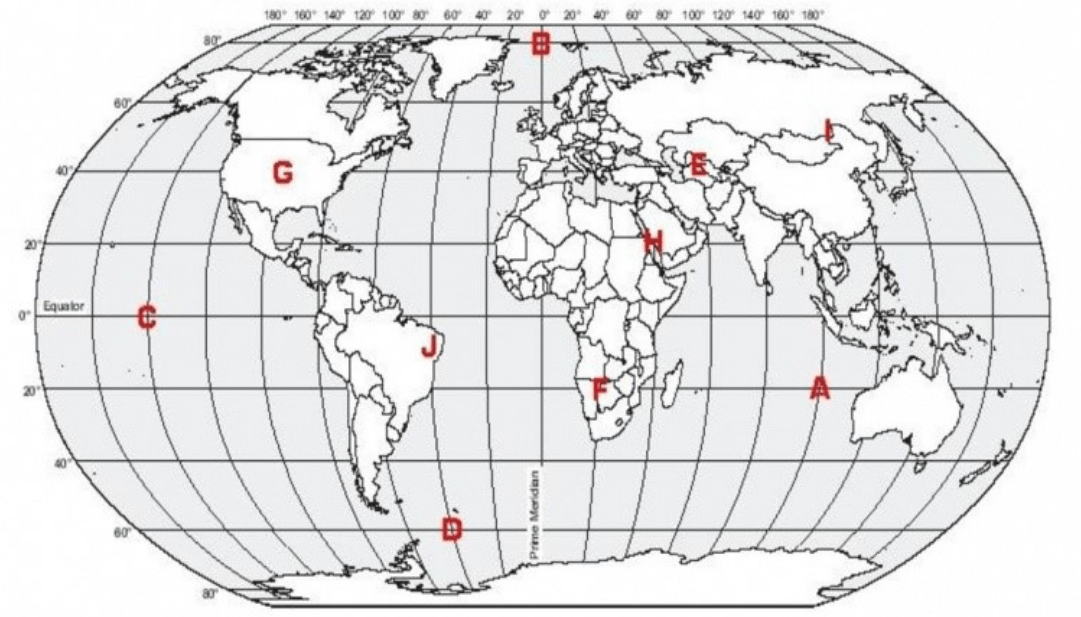
Letter E
300
latitude is referred to as parallels, as longitude is referred to as___________.
Meridians
300
On a physical map of the World, Which ocean is considered to be the 2nd largest ocean on our planet?
Atlantic ocean
300
What is the difference between weather and climate?
weather changes day to day hour to hour over a short period of time, climate doesn't change much and is measured over a longer period of time like a season or a year.
400
Tell me the four cardinal directions?
Tell me the four intermediate directions?
cardinal - north, south, east ,west
Intermediate - Northwest, Northeast, Southwest, Southeast
400
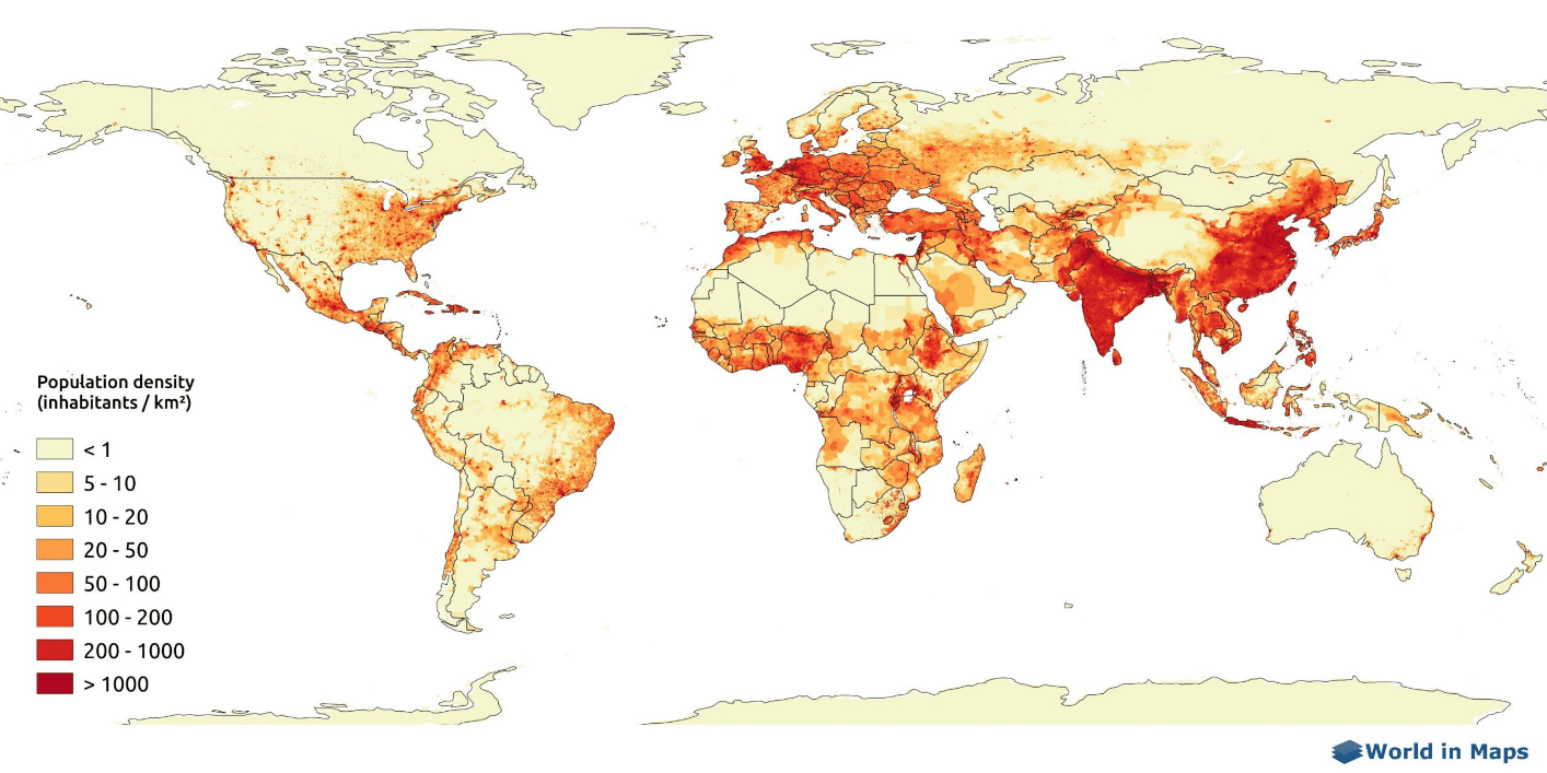 This is an example of what type of map?
Population density map
400
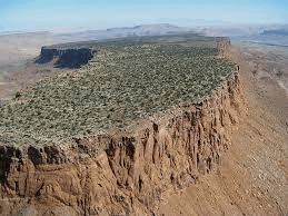
What landform is in this picture?
PLATEAU
400

What is identified on the map in the red square? and what can it tell us?
need identification and definition for any points>>
Map scale - Shows how much distance on earth is represented by distance on a map.
400
The lower latitude zones sit between which two parallels?
the tropic of cancer
and
the tropic of Capricorn
500
What are the 5 Themes of geography?
Movement
Human Environment interaction
Place
Location
Region
500
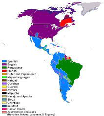
Based off the given information from this map, what type of map might this be??
Hint: Look at the map key!!
Thematic Map or language map
500

Please selected the two correct statements out of the four below. Must have both for all points!!
People are spread out more or less evenly throughout the United States
More people live in urban areas (cities) than in rural areas
Alaska and Wyoming have larger populations than California and New Jersey
Many of the largest population areas tend to be near coastal areas
Correct Selections
2 More people live in urban areas (cities) than in rural areas
4 Many of the largest population areas tend to be near coastal areas
500
What is a region? What might that term mean?
A group of places with common traits like culture and climate
500
What is the degree of measurement for the Antarctic circle? (What line of latitude?)
66 1/2 degrees S