BASIC INFORMATION
N. AFRICA & S.W ASIA GEOGRAPHY
TYPES OF MAPS
THINGS ON A MAP
N. AFRICA & S.W ASIA PHYSICAL FEATURES
FEATURES ON A MAP
GENERAL KNOWLEDGE
100
WHAT IS A MAP
A PICTURE THAT SHOWS ALL OR PART OF THE EARTHS SURFACE
100
What body of water is located directly North of N. Africa?
Mediterranean Sea
100
A MAP DISPLAYED ON A ROUND SURFACE IS CALLED
GLOBE
100
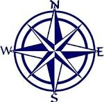
LABEL THE CARDINAL DIRECTIONS ON THE BACK BOARD. YOU HAVE 10 SECONDS
NORTH, EAST, SOUTH, WEST
100
N. Africa's key physical feature, the ______________, expands across the countries
Sahara Desert
100
THIS SEPARATES THE NORTHERN HEMISPHERE FROM THE SOUTHERN HEMISPHERE
EQUATOR
100
True or False
Nonrenewable resources take a long time to form in the earth, which means when we run out, they can be replenished at a local grocery store
FALSE: which means when we run out, they are gone!
200
TRUE OR FALSE: MAPS ONLY REPRESENT SMALL AREAS LIKE CITIES AND BUILDINGS
FALSE
200
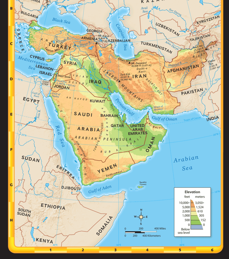
This image depicts: 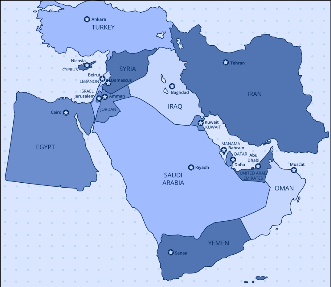
SW Asia or Middle East
200
WHAT TYPE OF MAP IS THIS?
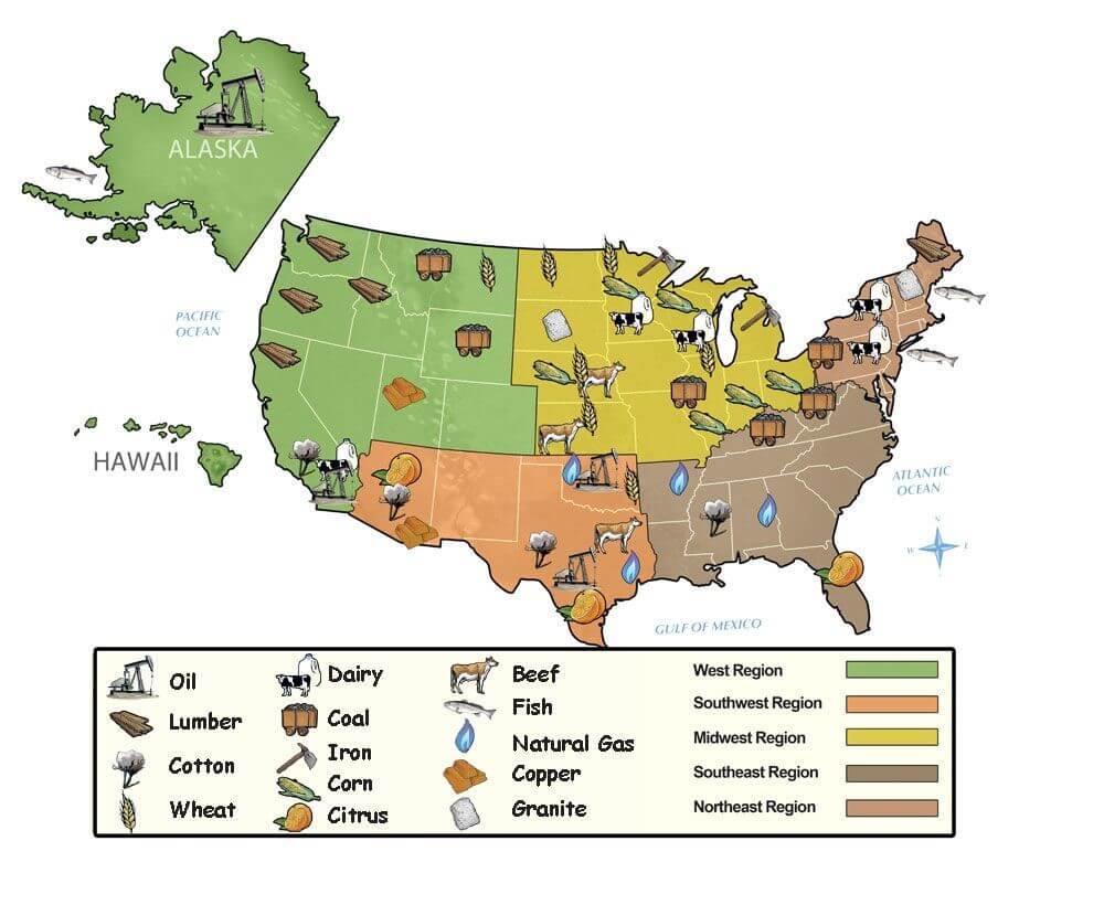
RESOURCE
200
NORTHWEST, SOUTHWEST, NORTHEAST & SOUTHEAST ARE KNOWN AS WHAT?
INTERMEDIATE DIRECTIONS
***FOR AN EXTRA 200 POINTS: BOTH CARDINAL DIRECTIONS AND INTERMEDIATE DIRECTIONS ARE FOUND ON WHAT???*****
200
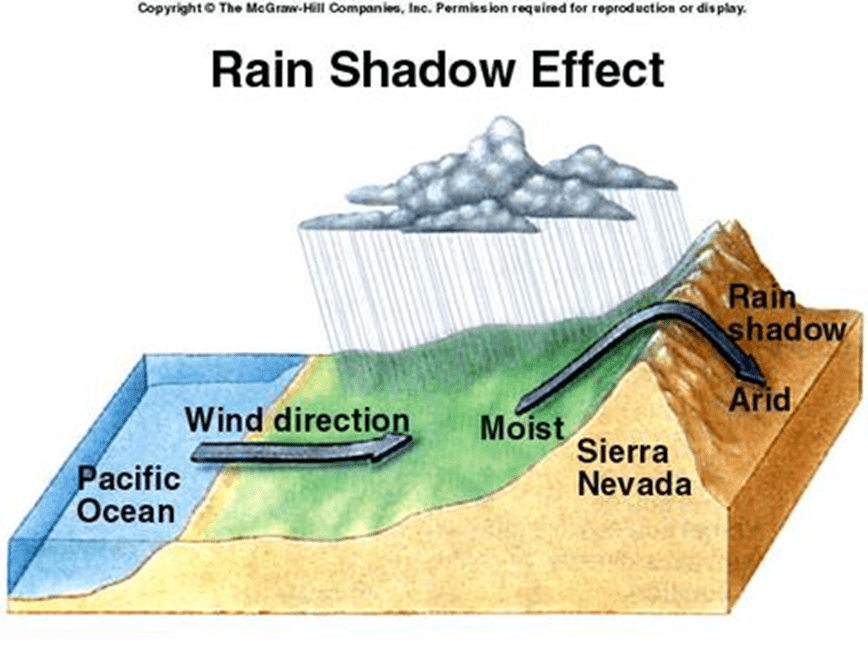
The High Mountains help create a___________
It’s a dry area on one side of the mountain
Rain Shadow
200
*****DAILY DOUBLE THIS QUESTION IS WORTH 400 POINTS********
1. WHAT TYPE OF MAP IS THIS
2. WHAT IS THE WEATHER LIKE IN SOUTH DAKOTA

1. CLIMATE MAP
2. COLD
200
WHAT IS THE NAME OF THE LARGEST OCEAN
PACIFIC
300
WHAT BODY OF WATER IS SE OF SOUTH CAROLINA?
ATLANTIC OCEAN
300
What country is located in both SW Asia & N Africa
Egypt
300
THIS IS THE MOST WIDELY USED MAP IN THE WORLD
ROAD
300
If all the names were removed from a political map, what could a person look at to determine if there were mountains in the area?
KEY OR LEGEND
300
Name the 3 most prominent mountains in SW Asia & Africa.
Atlas Mountains
Zagros Mountains
Taurus Mountains
300
WHAT DOES THE PRIME MERIDIAN DO?
IT DIVIDES THE EASTERN HEMISPHERE FROM THE WESTERN HEMISPHERE
300
The climate is like in SW Asia and N Africa?
Arid desert.
400
1. What system is depicted in the image below?
2. When is this system implemented
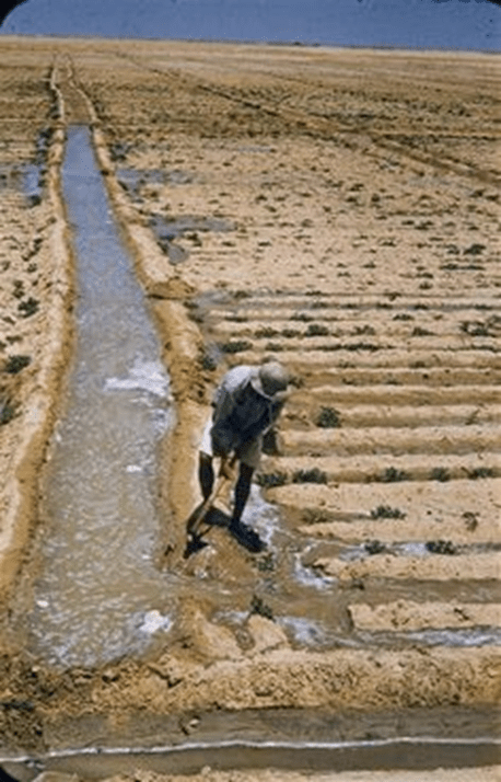
1. irrigation
2. when it doesn’t flood farmers must use irrigation
400
List the 5 countries located in N. Africa
Morocco, Algeria, Tunisia, Libya, and Egypt
400
THIS TYPE OF MAP SHOWS WEATHER PATTERNS THAT HAVE BEEN OBSERVED OVER A LONG PERIOD OF TIME
CLIMATE MAP
400
THIS SHOWS YOU HOW DISTANCES ON A MAP ARE RELATED TO DISTANCES IN REAL LIFE
SCALE
400
South West Asia is more commonly referred to as...
The Middle East
400
 WHAT TYPE OF LINES ARE DEPICTED IN THIS IMAGE
LATITUDE
400
The _______________________ is mostly desert and provides a large percentage of the world’s petroleum
Arabian Peninsula
500
When the rivers flood it deposits __________ which makes the soil rich in ___________
When the rivers flood it deposits silt which makes the soil rich in nutrients
500
List 5 countries located in SW Asia
Afghanistan, Egypt, Bahrain, Iraq, Israel, Jordan, Kuwait, Lebanon, Oman, Qatar, Saudi Arabia, Syria, United Arab Emirates (U.A.E.), Yemen, Cyprus, Iran, Turkey.
500
NAME THE FIVE TYPES OF MAPS
POLITICAL, PHYSICAL, CLIMATE, RESOURCE, & ROAD
500
HOW MANY RESTROOMS ARE LOCATED AT DIZZEELAND?
1
500
•____________(underground tunnels) brought mountain water down to the plains
1. What are they
2. Who invented them?
*****DAILY DOUBLE THIS QUESTION IS WORTH 1000 POINTS******
1. Qanats
2. Iran
500
SARAH MEASURED WITH A RULER, 1 INCH ON A MAP WAS APPROXIMATELY 50 MILES. IT WILL TAKE SARAH 7 INCHES TO REACH HER LOCATION. HOW MANY MILES WILL SHE END UP DRIVING?
350 MILES
500
LIST THE 7 CONTINENTS FROM SMALLEST TO LARGEST
AUSTRALIA, EUROPE, ANTARCTICA, SOUTH AMERICA, NORTH AMERICA, AFRICA, ASIA