Landforms
Political Maps
Physical Maps
More
100
A dry, barren area of land, usually covered with sand
Desert
100
Political maps show names, locations, and boundaries of political entities. True or False?
True
100
Name one landform you may find on a political map.
Mountains, desert, plateau, basin, etc.
200
A deep gorge, typically with water flowing through it
Canyon
200
How are capital cities identified on a political map?
With a star
200
Name one water form you would find on a physical map.
River, lake, gulf, etc.
300
land that is surrounded by water on 3 sides
Peninsula
300
Name one example of a political feature for transportation that you may find on a political map.
Roads, highways, railroads, airports, etc.
300
What colors do you typically see on physical maps?
Greens, browns, blues, etc.
400
Land that rises sharply and is flat on top
Plateau
400
Name one example of a political feature for safety and health that you may find on a political map.
Hospitals, police stations, army bases, etc.
400
What 2 things must a thematic map have?
Title and key
500
A flat area of land formed by deposits of sand and silt at the mouth of a river, causing the river to split into many small streams that flow through it
Delta
500
Name one example of a political feature for conservation that you may find on a political map.
Community, state, and national parks, water treatment plants, etc.
500
What type of map is this? What is the title?
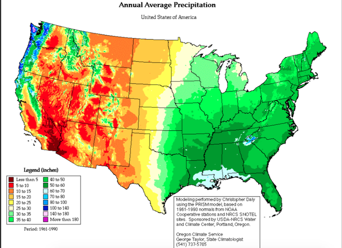
Thematic - Annual Average Precipitation