Maps
Mountains/Volcanoes
Earthquakes
Waves
100
What kind of map is this? 
Topographic Map
100
The tallest Mountain in the world?
Mount Everest
100
When tectonic plates slide past each other suddenly, a large release of energy occurs. This is creates an __________.
Earthquake
100
The highest point of a wave.
The crest
200
Even though makes have different purposes, most maps have a _______ to help represent symbols on the map.
Map Key
200
The volcano that erupted in Washington State in the 1800s.
Mount Saint Helens
200
What is the name of the drawing that is made to measure an earthquake?
Seismogram
200
The distance between each wave.
Wavelength
300
A topographic map has _______, which show the elevation of the land.
contour lines
300
Looking at the map, where are most mountain ranges located?
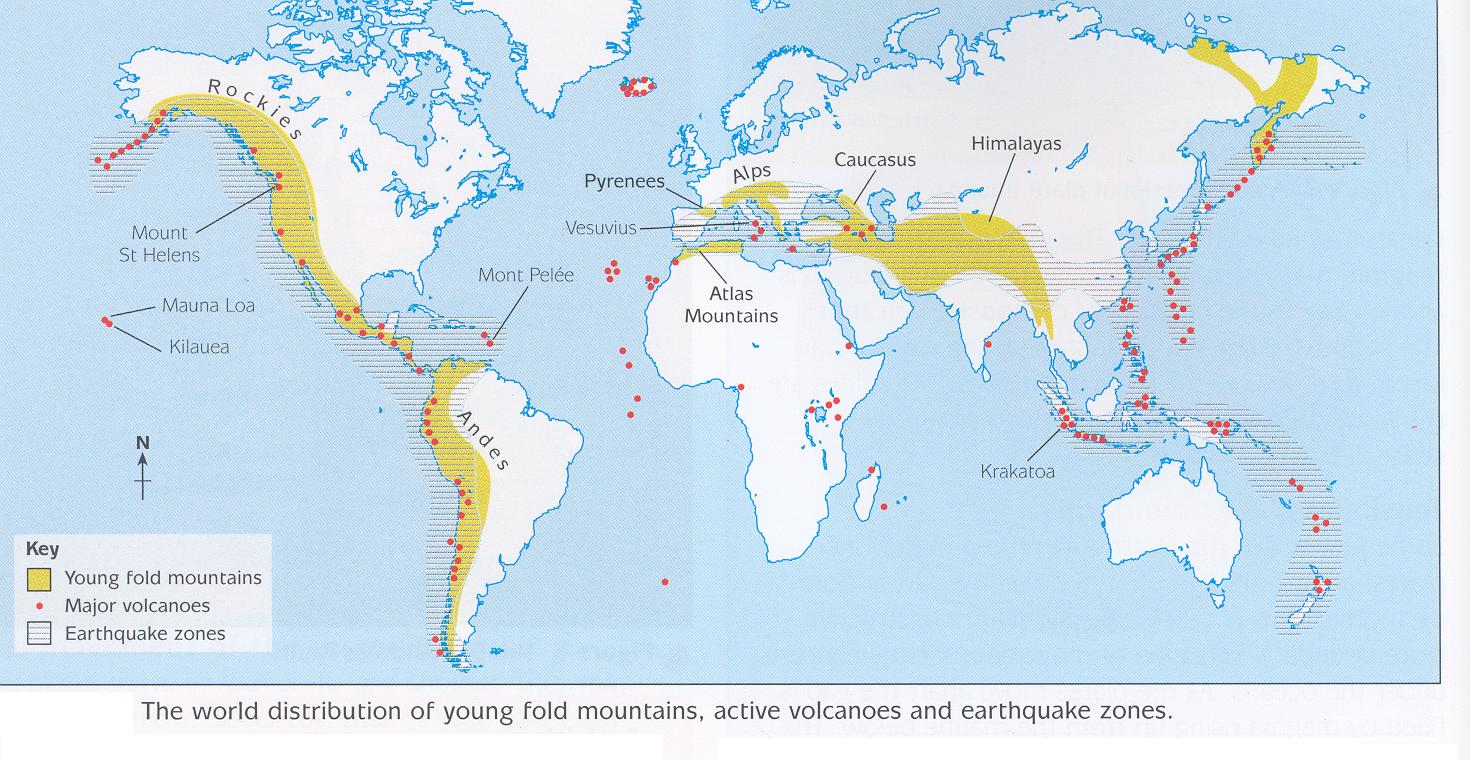
On the edge of the land, near the water
300
How many tectonic plates are there on earth?
Seven
300
The high of a wave measured from the baseline to the crest or the baseline to the trough.
amplitude
400
These types of maps so roads, cities, buildings, etc.
Political Map
400
Looking at the map, what do you notice about the location of volcanoes? 
Located where the mountain ranges are located
400
Name of the wave that goes through the earth surface and creates an earthquake.
seismic wave
400
This wave has a ______ amplitude and _____ wavelength. 
high amplitude and short wavelength