Map Features
Continents and Oceans
Land and Water
Types of Maps
Projections of the Earth
100
This feature is used to describe what the map is about
The Title
100
Which continent do we live on?
North America
100
Name the city and the country you live in.
Washington, D.C., United States of America
100
What type of map is this?

A political map
100
Why is it impossible to make a perfect map of the earth?
Because the earth is a sphere and maps are rectangular, so maps always distort the size and/or shape of the earth.
200
This map feature shows the ratio of distance on the map to the distance in the real world.
Map Scale
200
What is the largest Continent?
Asia
200
Which is larger, a city or a state?
A state
200
What type of Map is this?

A Physical Map
200
How does the Mercator Projection distort the image of the earth?

The Martcator Projection shows the accurate shape of the continents, but it distorts their size making places closes to the poles appear larger and places closer to the equator appear smaller.
300
This map features defines what the symbols and colors on the map represent.
Key or Legend
300
What is the largest Ocean?
The Pacific Ocean?
300
What is the largest country in the world?
Russia
300
What type of map is this?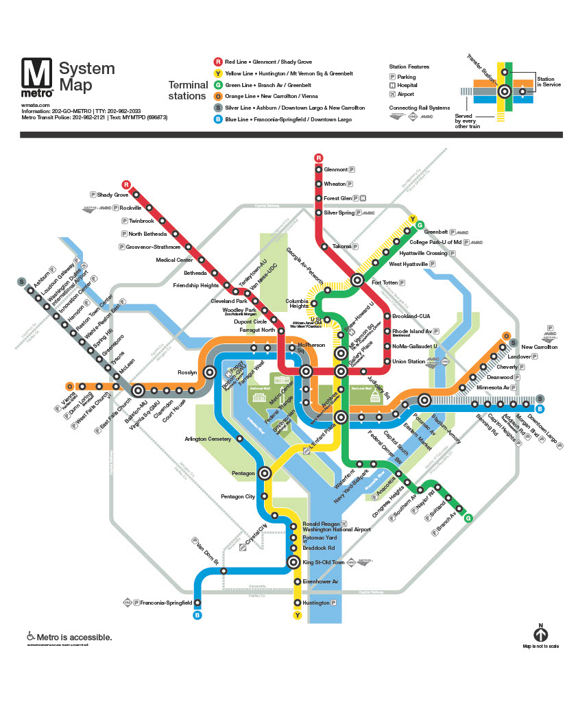
A Thematic Map
300
How does the Galls-Peter's Projection distort the way we see the earth.

The Galls-Peter's Projection shows the accurate size of each continent, but it distorts the shape.
400
A set of vertical and horizontal lines that are used to give each point on the map an identifier
Map Grid
400
Name all 5 Oceans.
Pacific Ocean, Atlantic Ocean, Southern Ocean, Indian Ocean and the Arctic Ocean
400
Philadelphia is a...
City
400
What type of map is this?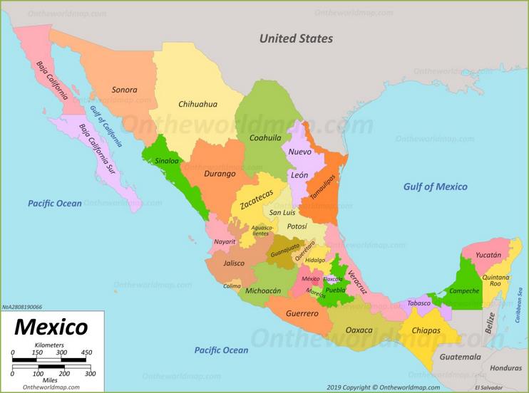
A political map
400
Why is the Winkel Tripel Projection considered the most balanced projection of the earth?

The Winkel Tripel Projection shows countries and oceans closer to their true size and shape, although both size and shape are minorly distorted.
500
Name the cardinal directions on this compass rose in clockwise order.
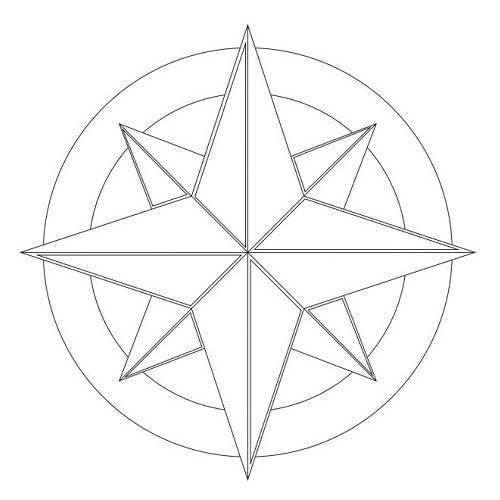
North, East, South, and West
500
Name all 7 continents.
North America, South America, Africa, Europe, Asia, Australia and Antarctica
500
What land mass is both a continent and a country?
Australia
500
What type of map is this? What do the colors on the map represent?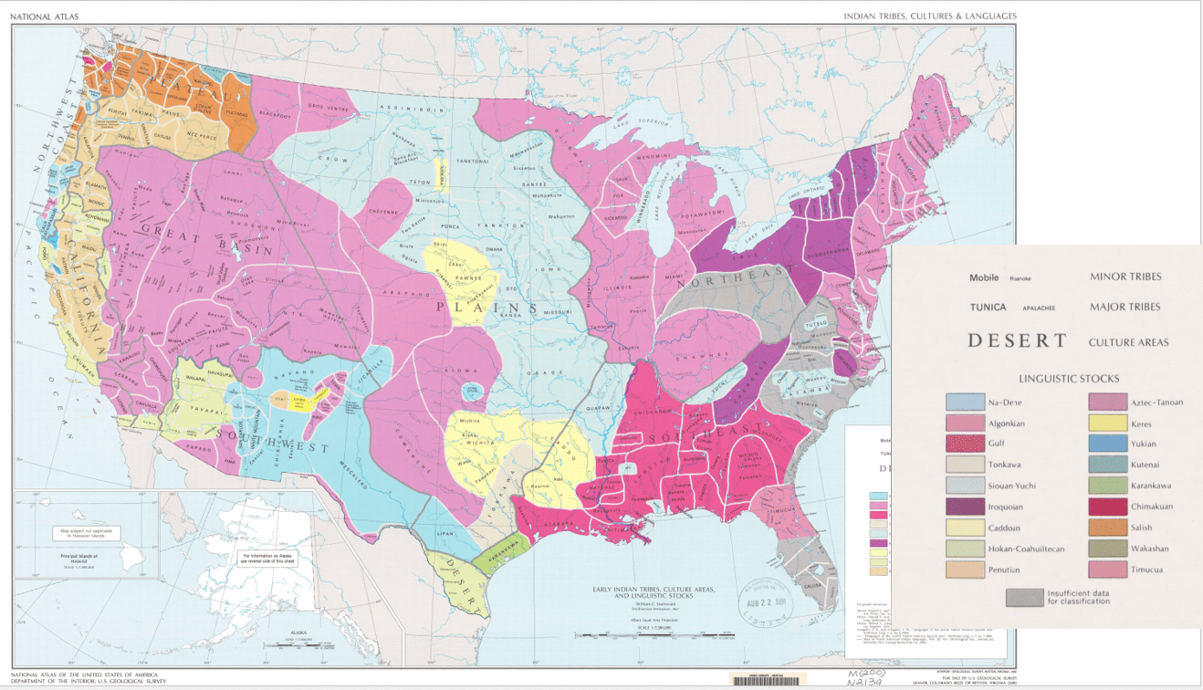
This is thematic map. The colors represent languages spoken by different Native American groups.
500
Why did sailors use the Mercator projection to navigate around the world?
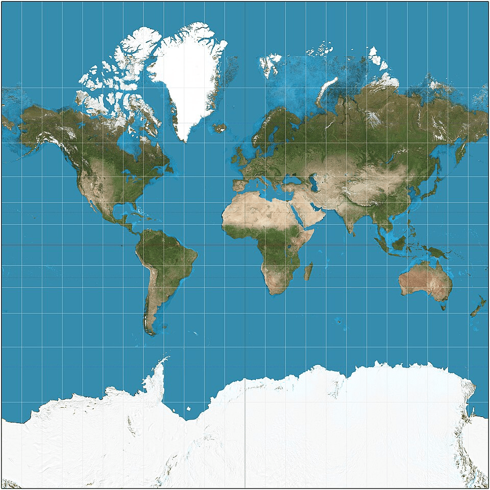
Because if you draw a straight line from one place to another and follow it, you can arrive at that destination.