5 Themes of Geo
Key Terms
Physical Geography
Miscellaneous 1
Miscellaneous 2
100
An area with a high density of people and businesses
example: Chicago or Austin
Urban
100
A special part of a map
that explains what
symbols and colors on
the map represent,
like cities, rivers, or
mountains.
legend
100
Physical Region of the United States known for swamp or marshy land, a hot, humid climate, and economic activities like shrimping and fishing.
Gulf Coastal Plains
100
Farmers in desert regions often use this method to water their crops.
irrigation
100
Which is a Political Map?
Go to link below:
https://www.fla-shop.com/resources/us-regions/
A -
( Map of Standard Federal Regions in the US)
or
B-
( Map of Cultural and Geographical Regions in the US)
A
200
An area outside a city; many people who live there work in the city.
Example: Round Rock
Suburban
200
The
study of the natural
features of the Earth
like mountains, rivers,
deserts, and oceans.
Physical geography
200
Longest River in the United States
Mississippi
200
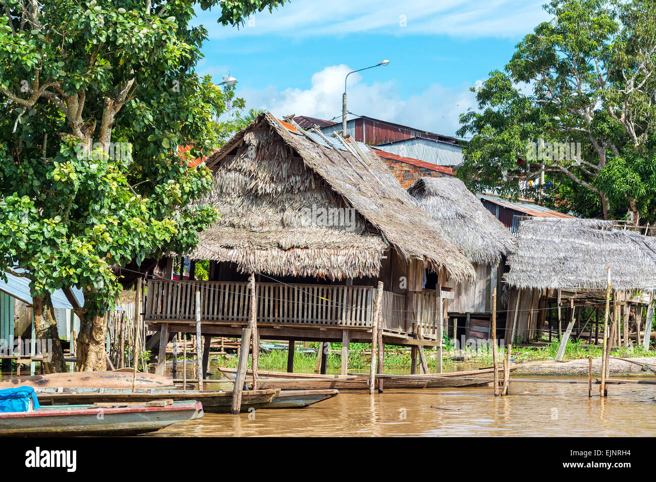
In tropical rainforests as well as coastal areas prone to flooding, homes are often built on_______________.
stilts
200
What type of Map is this?
Political
300
An area that has a low density of people and businesses
(the country)
Rural
300
This tells us how much
smaller the map is
compared to the real
world. It helps us
understand distances.
scale
300
Includes:Superior, Michigan, Huron, Erie, and Ontario
Great Lakes
300
Name a region(one of the 5 talked about in class that most geographers agree upon) that produces oranges.

Southeast or West
300
Urban area and the surrounding suburbs where people can easily commute to work in the city.

Metropolitan area
400
An area with common cultural traits or features(climate, language, resources)
region
400
A ______ is like a
giant graph that helps
us find exact places
on a map by using
lines that go up and
down (longitude) and
side to side (latitude).
grid system
400
Physical region that is good for farming and growing crops.
Great Plains/Central Plains
400
Name a state in the midwest that produces wood.'

Ohio, Wisconsin
400
2nd largest city in the United States, located in close proximity to the Pacific Ocean, population close to 4 million people.
Los Angeles
500
Exchanging goods or ideas(a speech)
movement
500
Largest Mountain Range in the eastern United States. These are older mountains, that often resemble large rolling hills.
Appalachians
500
Large desert region that includes portions of Utah, California, Nevada, Idaho, and Oregon.
Great Basin
500
Maps that show government boundaries.

Political Maps
500
The purposeful cutting or clearing of a vast area of trees or vegetation for human development.

Deforestation