Topographic Maps 1
Topographic Map Features
Topographic Map Features 2
Topographic Map Features 3
Topographic Map Rules
Topographic Map Practice
100
A map that shows land features and elevation on a flat piece of paper
Topographic Map
100
What is a contour line?
A line joining points of equal elevation on a surface
100
What is a contour interval?
The distance or difference in elevation between contour lines
100
What symbol indicates a river or river valley on a topographic map?
V-shaped contour lines
100
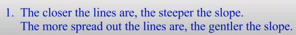
What is rule #1 when reading a topographic map?
100
What is the Contour Interval for this map?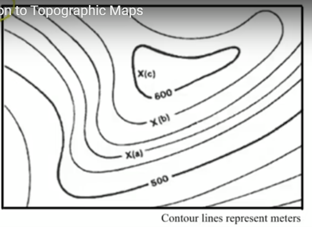
20 meters
200
Elevations are usually measured in
feet or meters
200
Define elevation?
distance above sea level
200
How do you determine the contour interval on a topographic map?
1. Find two consecutive index contours
2. Subtract them
3. Divide by 5
200
The V always points
upstream or toward the source or the river
200
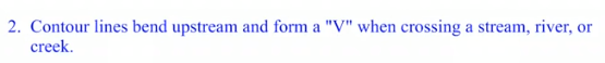
What is rule #2 when reading a topographic map?
200
What is the elevation of point a?
540m
300
Who would normally use a topographic map?
Hikers, campers, military, survivalists, land developers, erosion specialists
300
What is an Index Contour Line?
are thicker contour lines that appear at every fifth contour line
300
Topographic maps show_________ and _________ by using _________ _________.
elevation, shape, contour lines
300
What is a depression?
a sunken area
300
What is rule #3 when reading a topographic map?

300
 What is the elevation of point b?
580m
400
Knowing that a topographic map shows the elevation (steepness) of the land, how could it help any of these people?
by showing elevation it could show a hiker how high a mountain is before they climb, erosion specialist: what areas are most likely to erode fastest or has already eroded.
400
On a topographic map what color lines represent land?
brown
400
The smallest, inner irregularly shaped, successively concentric circles or ovals represent
the highest elevation of a hill or mountain
400
How is a depression represented on a topographic map? Give two examples.
it is indicated with small lines called hachure marks inside a circle or oval
ex: volcanic craters, meteor impact craters
400
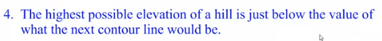
What is rule #4 when reading a topographic map?
400
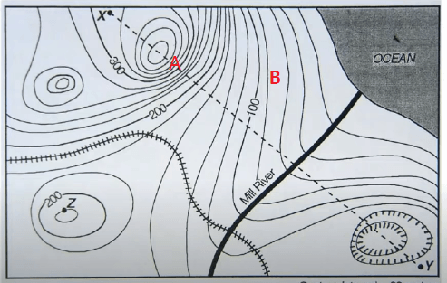 How many hills and depressions can you locate on this topographic map?
3 hills, 1 depression
500
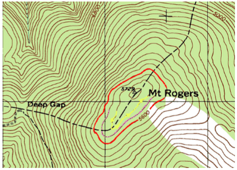 What is the highest elevation on this topographic map?
5729 ft
500
On a topographic map what color lines represent water?
Blue
500
What is the contour interval for this map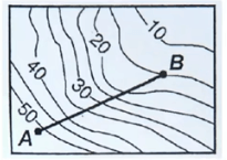 topographic map?
5ft
500
Hills and mountains appear as
a series of irregularly shaped, successively smaller concentric circles or ovals
500
What is rule #5 when reading a topographic map?

500
 Is "A" a steep slope or gradual slope? Why?
Is "B" a steep slope or gradual slope? Why?
A is a steep slope because the contour lines are close together.
B is a gradual slope because the contour lines are further apart.