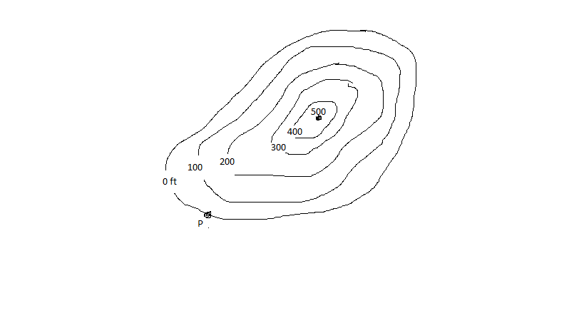
What is a mountain?
The air we breathe is part of this 'sphere'
What is the atmosphere?
This is the outermost layer of the Earth
What is the crust?
An area of land that is surrounded on all sides by water
What is an island?
A landform with a wide base and narrow summit that is at least 2,000 feet tall
What is a mountain?
The lines in a topographic map measure this
What is height? or What is elevation?
Lake Superior is part of this 'sphere'
What is the hydrosphere?
This is the only layer of the Earth that is liquid
What is the outer mantle?
A landform with a wide base and a narrow summit that is under 2,000 feet tall
What is a hill?
A lowland in between mountains and hills that can be V-shaped or U-shaped
What is a valley?

What is a hill?
Sequoia Forests are part of this 'sphere'
What is the biosphere?
This is the layer of the Earth where tectonic plates are
What is the mantle?
A deep, narrow area of land with steep sides that extend upward
What is a canyon?
A large flat area of land with at least one very tall and very steep side
What is a plateau?
Some topographic maps show different colors for the biosphere, hydrosphere, and lithosphere. This is a color that is used to represent the lithosphere in one of these maps
What is red, brown, gray, or white?
Smith Rock is part of this 'sphere'
What is the lithosphere?
This is the thickest layer of the Earth
What is the mantle?
A low piece of land that juts into a body of water
What is a peninsula?
A small, isolated hill with steep sides and a flat top
What is a butte?
The lines in topographic maps called are called these
What are contour lines?
These are the four 'spheres' of the Earth
What are the atmosphere, hydrosphere, biosphere, and lithosphere?
The core of the Earth is mostly made of this
What is iron? or What are iron and nickel?
An area of land enclosed by higher lands surrounding it
What is a basin?
A tall piece of land that extends into a body of water
What is a cape?