Latitude & Longitude
Parts of Earth
Topographic Maps
Contour Maps
Other Mapping Stuff
100
This is the 0 degree latitude line
What is the equator?
100
This is the part of Earth made up of water
What is the hydrosphere?
100
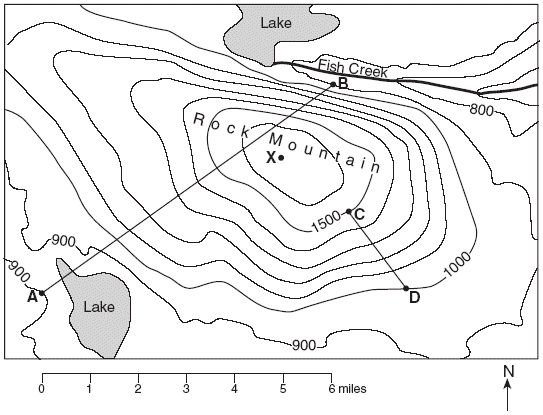 Contour interval C to D __________________
100
100
This is the distance between each contour line.
What is a contour interval?
100
The altitude of Polaris is 45 degrees above the horizion. This is the latitude you are standing at.
What is 45 degrees north?
200
This is the 0 degrees longitude line.
What is the prime meridian?
200
The part of Earth made up of gases.
What is the atmosphere?
200
This is a side view of the topographic map.
What is a topographic profile?
200
The steepness or slope on a contour map.
What is the gradient?
200
A hiker would use this type of map in order to see how difficult there hike would be.
What is a topographic map?
300
These types of lines are labelled east and west of the 0 degrees.
What are longitude lines?
300
This is the solid part that we walk on.
What is the lithosphere?
300
This is the height above sea level.
What is the elevation?
300
Isobars
What are lines of equal pressure called?
300
This page of the reference table can be used to find the latitude and longitude of Albany, NY.
What is page 3?
400
These lines are labelled north and south of the 0 degrees line.
What are latitude lines?
400
This page has information regarding Earth’s atmosphere.
What is page 14?
400
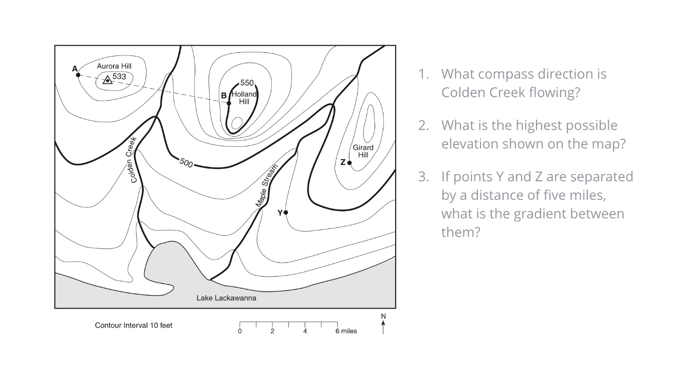
Calculate the gradient between points Y and Z on the map.
3
400
Connect points of equal elevation.
What is a contour line?
400
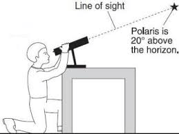
What is the
20 degrees North Latitude
500
This number of degrees of latitude is equal to 1 hour time.
What is 15 degrees?
500
Information regarding Earth’s interior can be found on this page of the ESRT.
What is page 10?
500
This is the formula for calculating gradient.
What is the change in elevation divided by distance?
500
What do contour lines on a topographic map indicate?
lines of equal elevation
500
An observer in NYS measure the altitude of the Polaris to be 44 degrees. According to the Earth Science Reference Table, the location of the observer is nearest to
Watertown