Latitude/Longitude
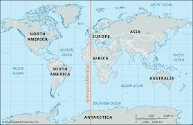
Maps and Regions
Charts and Graphs
Geography
100
The imaginary horizontal lines that run East to West across the Earth. (They determine distance from the Equator)
What is Latitude?
100

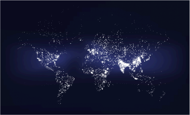
The type of map shown above.
What is a Population Density Map?
100
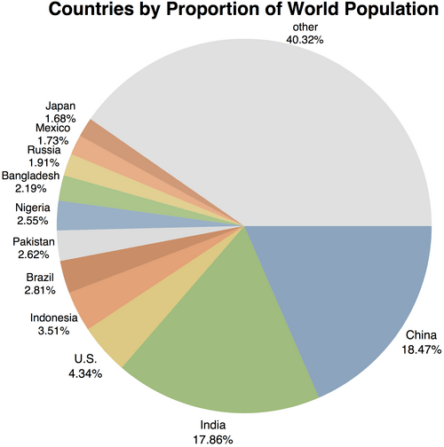 The country with the largest population?
What is China?
100
Civilizations and Cities most often develop near this geographic feature.
What is Water?
200
The imaginary vertical lines that run North to South across the globe. (They determine distance from the Prime Meridian)
What is Longitude?
200
The Prime Meridian divides the globe into these two Hemispheres.
Eastern Hemisphere and Western Hemisphere.
200
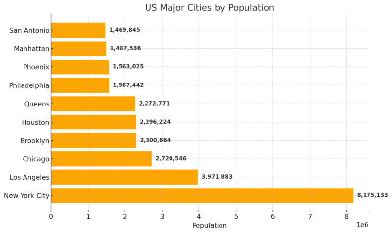 The largest U.S. Major City in population?
What is New York City?
200
The geographic factor related to weather.
What is Climate?
300
Lines of Longitude determine distance from this line that runs North to South.
What is the Prime Meridian?
300
The two hemispheres that the equator divides the globe into.
Northern Hemisphere and Southern Hemisphere.
300
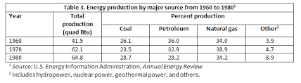
The year that had the lowest production of natural gas?
What is the 1960s?
300
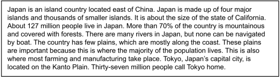
The geographic area where the majority of people live in Japan.
What are the plains?
400
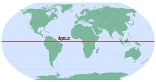
Lines of Latitude determine distance from this line that runs East to West.
What is the Equator?
400
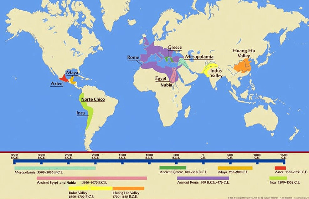
The geographic feature that all of the ancient civilizations are located next to.
What is bodies of water?
400
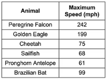
The animal that is faster than a Cheetah but slower than a Golden Eagle.
What is a Brazilian Bat?
400
The most densely populated continent.
What is Asia?
500
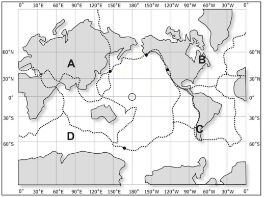
The letter representing the coordinates 48 degrees North and 85 degrees East.
What is A?
500
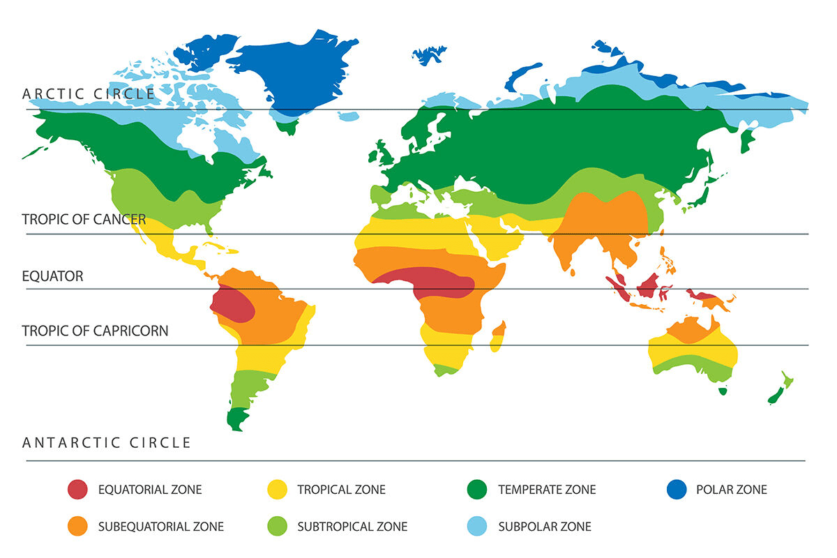 The two climate zones that do NOT exist in South America.
What is Polar and Subpolar?
500
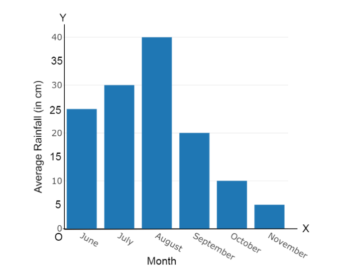
The average amount of rainfall in August.
What is 40 centimeters?
500
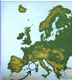 The body of water circled in the picture
What is the Mediterranean Sea?