Geography
Studying History
Early Peoples
Early Civilizations
100
These lines measure how far east or west is on a globe.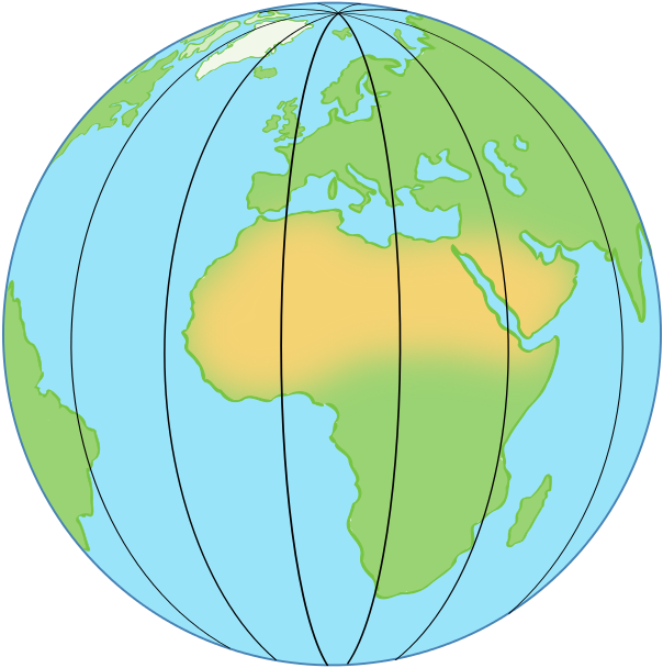
What is longitude?
100
This is a period of 10 years.
What is a decade?
100
This was the main source of food for hunter-gatherers.
What is they hunted animals and gathered plants?
100
What is a food surplus?
An excess amount of food over what was needed or wanted
200
These lines measure how far north or south something is on the Earth.

What is latitude?
200
This is a source that comes from a person who experienced an event or is from the time period you are studying.
What is a primary source?
200
This is the process of changing the growth of plants or behavior of animals to be useful for humans.
A. Domestication
B. Adaptation
C. Technology
D. Hunting
What is domestication?
200
Provide an example of a geographical feature that humans would choose to settle by.
What is...
A river or fertile soil?
300
In this elevation map of the western USA, what do the darker brown areas indicate?
A. The tops of mountains
B. The valleys
C. The rivers and lakes
D. The cities
A. The tops of mountains
300
This is a source that comes from someone who did not experience an event or time period.
What is a secondary source?
300
Which of these is NOT an agricultural advancement people used to adapt to their physical landscape?
A. Crop terracing
B. Crop rotation
C. soil erosion
D. fertilizer
300
This is the lowest position in the social structure of many ancient civilizations.
A. Farmer
B. Merchant
C. Slave
D. Government official
C. Slave
400
"In Tennessee, rivers are used with hydroelectric dams to create electricity."
What element of geography is this?
A. How the Earth's surface is shaped by physical events
B. How humans use Earth's natural resources
C. Using maps to study the relationships between people, places, and environments
D. Understanding the effect of places and regions on the people living in them
B. How humans use Earth's natural resources
400
This year goes best in the "B" spot on the timeline.
A. 8000 BCE
B. 6500 BCE
C. 450 BCE
D. 1500 BCE
What is 8000 BCE?
400
Provide one example of how hunter-gatherers may be affected by geography.
What is...
the types of animals they hunted, types of plants they gathered, access to resources like water
400
This was the effect of a food surplus.
What is population growth?
500
These coordinates correspond to a body of water.

A. 10° S latitude, 20° E longitude
B. 30° S latitude, 10° E longitude
C. 20° S latitude, 20° E longitude
D. 10° S latitude, 20° E longitude
B. 30° S latitude, 10° E longitude
500
This year goes best in the C spot on the timeline.
A. 9000 BCE
B. 7500 BCE
C. 6000 BCE
D. 8000 BCE
What is 6000 BCE?
500
Based on this map, this is likely the last continent early humans would have migrated to.

What is South America?
500
Name 4 of the 7 characteristics of civilizations.
what are...
Cities, Technology, Government, Language, Social Structure, Job Specialization, or Religion?