Terms
Parallels & Meridians
Basic Map Skills
Reading a map
Reading Latitude & Longitude
Map Scale
100
The seven largest areas of land on Earth.
What are continents?
100
This imaginary line is located at 0° latitude.
What is the equator?
100
This map component tells you which direction is north.
What is the compass rose?
100
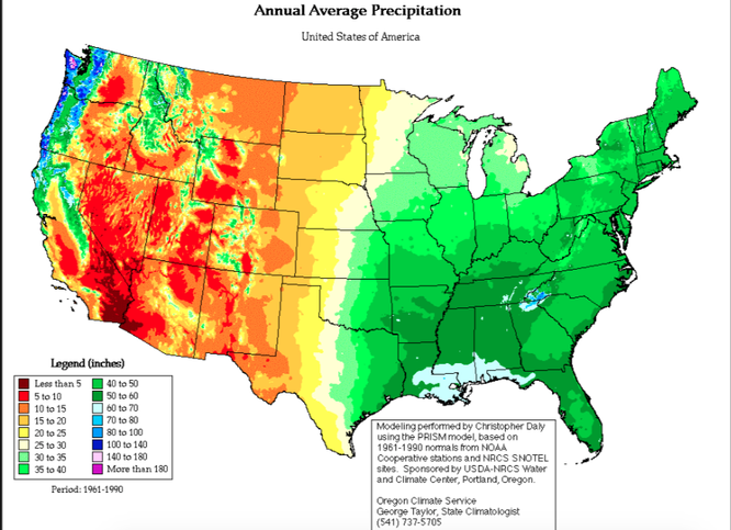
This is a _____ type of map.
What is a Thematic Map?
100
This state is located at 45°N, 100°W?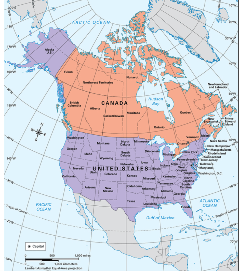
What is South Dakota?
100
This shows the relationship between a distance on a map and the corresponding distance on the ground.
What is map scale?
200
It is where a place is located in relation to another place.
What is relative location?
200
This imaginary line marks 0° longitude and runs through Greenwich Observatory in London, England.
What is the Prime Meridian?
200
Consisting of a series of horizontal and vertical lines, this map component helps a reader find absolute locations.
What is the map grid?
200
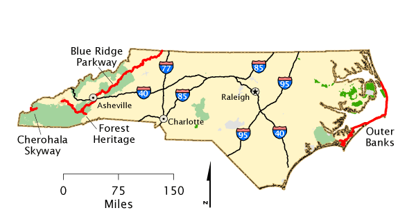
This interstate is used to drive from Asheville to Raleigh.
What is interstate 40?
200
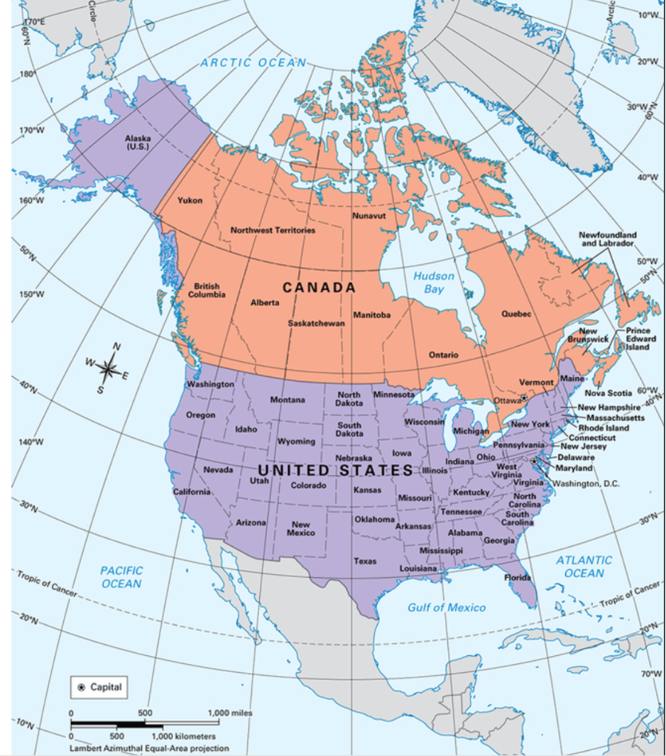 This country is located at 60°N, 120°W?
What is Canada?
200
- Map Scale: 1 inch = 10 miles
- The distance between two cities on a map is 3 inches, so this is the actual distance between the cities in miles.
What is 30 miles?
300
This is a person who studies the physical features of the Earth, and how humans interact with their environment.
What is a geographer?
300
This imaginary line is located at about 66.5° south latitude and marks the northern edge of the southern polar zone.
What is the Antarctic Circle?
300
This map component shows what symbols and colors on a map are meant to represent.
What is a map legend, or key?
300
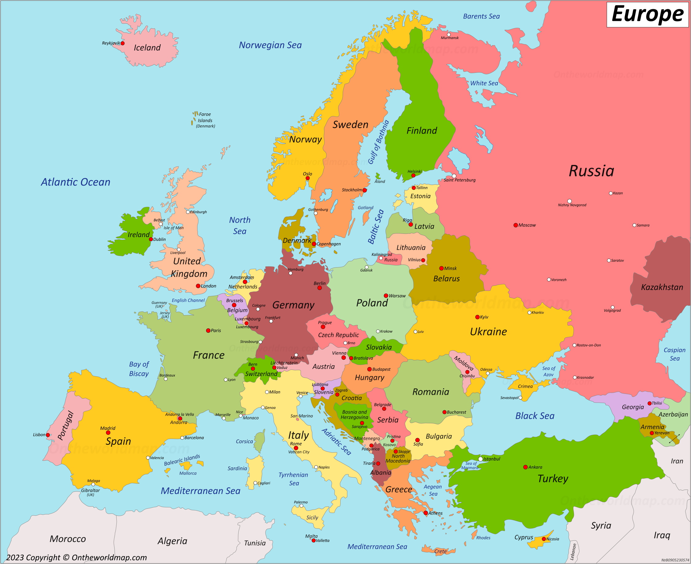
This country is south of Switzerland.
What is Italy?
300
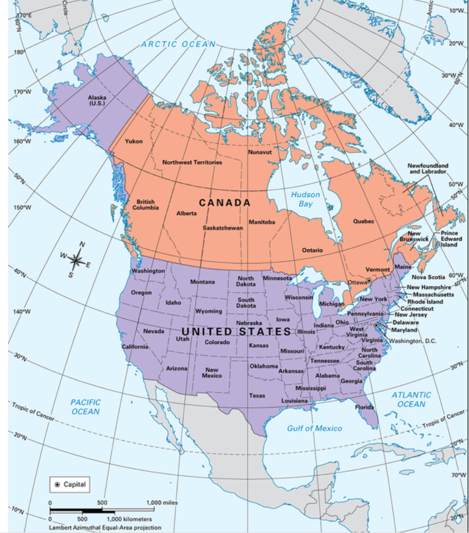 This country is located at 20°, -100°?
What is Mexico?
300
- Map Scale: 1 inch = 5 miles
- The distance between two landmarks on a map is 4.5 inches, so this is the actual distance between the landmarks in miles.
What is 22.5 miles?
400
A map that shows borders.
What is a Political Map?
400
This imaginary line is located at about 23.5° north latitude and marks the southern edge of the northern temperate zone.
What is the Tropic of Cancer?
400
These are the seven continents.
What are North America, South America, Europe, Asia, Antarctica, Africa, and Australia?
400
These mountains are along the north west coast of Africa.
What are the Atlas Mountains?
400
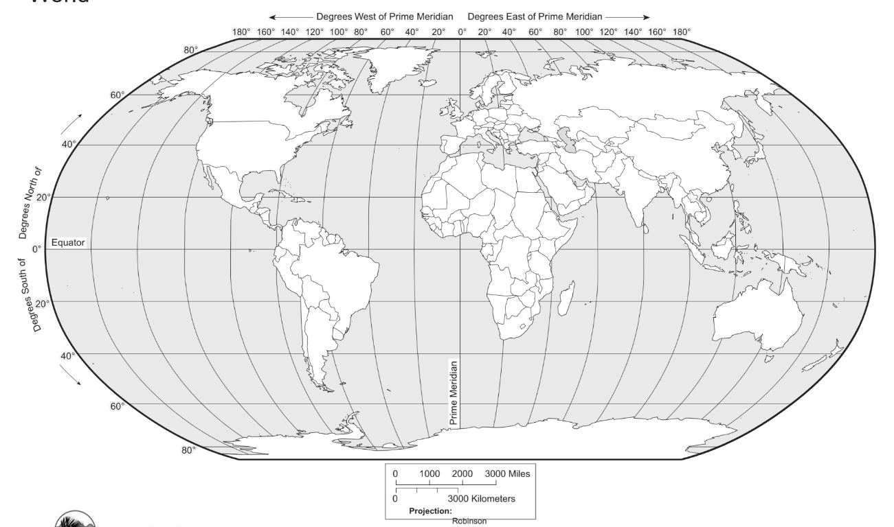 This continent is located at -10, -50?
What is South America?
400
Map Scale: 1 inch = 30 miles
The distance between two cities on a map is .5 inches, so, this is the actual distance between the cities in miles.
What is 15 miles?
500
A map that shows the natural features of an area.
What is a Physical Map?
500
This imaginary line is located at 180° longitude. Travelers who cross over it will find that the date on their phones has changed.
What is the International Date Line?
500
These are the five oceans of the world.
What is the Souther, Indian, Artic, Pacific, and Atlantic Oceans?
500
The Korean War Memorial is in a ________ area on the map.
What is a secured area?
500
Asia is located in these hemispheres.
What are the northern and Eastern hemispheres?
500
A map has a scale of 1 inch = 10 miles. The actual distance between two cities is 50 miles. This is how far apart are the cities are on the map.
What is 5 inches?